
If you’re looking to go on an adventure in the great outdoors, the variety of landscapes in the Pacific Northwest — from temperate rainforest and brilliant geological formations to expansive sand dunes and stunning river-carved canyons — are awe-inspiring for even the seasoned traveler.
Hoh Rainforest, Olympic National Park, Washington State

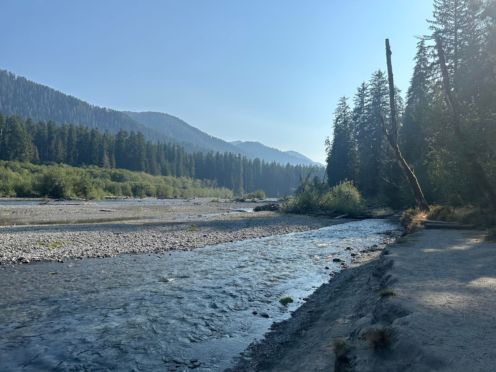
Named for the Hoh River that runs from Mount Olympus to the Pacific Coast, the Hoh Rainforest is one of the largest temperate rainforests in the United States. This magical ecosystem is one of the wettest places in the country, with an annual average rainfall of 140 inches per year. All that rain creates a dense canopy of deciduous and coniferous trees, and the forest floor is blanketed with ferns, fungi and mosses.
A gigantic rainforest once stretched from southeastern Alaska all the way to central California along the Pacific Coast — the Hoh Rainforest is what remains of that ancient forest.
Located around an hour drive from the city of Forks, Washington, and a two-hour drive or so from Port Angeles, the Hoh Rainforest is in the western portion of Olympic National Park. To get there take Highway 101 to Upper Hoh Road.
The old-growth forest has a year-round campground with 72 sites along the Hoh River. Reservations can be made six months in advance at recreation.gov.
Stop in at the Hoh Rain Forest Visitor Center — closed from January through early March — for tips on making the most of your visit.
From the visitor center there are two loop trails: the 0.8-mile Hall of Mosses Trail — which features old-growth forest, including a maple tree grove and club moss springing from the forest floor — and the 1.2-mile Spruce Nature Trail, which leads you along the Hoh River and Taft Creek through new- and old-growth forest.
The main hiking trail in the Hoh Rainforest is the out-and-back Hoh River Trail. You can take this trail as far as you feel comfortable, up to its endpoint 18.5 miles in. Along the way the trail takes you past multiple campsites, the farthest of which is Glacier Meadows at 17.3 miles in. The trail ends with a view of Mt. Olympus at Blue Glacier moraine.
“I love the Hoh Rainforest! The Hoh River trail parallels the Hoh River and is relatively easy. At the end of August, the river is low enough that you can wade across it near Tom Creek,” adventurer Sarah Strock told EcoWatch.
The Hoh Rainforest. Sarah Strock
Just past the ranger station on the Hoh River Trail is the Hoh Lake Trail, which goes up to Bogachiel Peak between the Sol Duc Valley and the rainforest. Turn-around day hikes in this area include Mineral Creek Falls 2.7 miles in; First River access 0.9 miles in; Cedar Grove four miles in; and Five-Mile Island, which is five miles one way.
More information on hiking and permits for the Hoh River Trail and Olympic National Park can be found on the Wilderness Backpacking Reservations page. Pets are not permitted on Hoh Rainforest trails.
With the Hoh’s plentiful rainfall comes a rich ecosystem of flora and fauna. Average summer temperatures stay in the pleasant mid-70 degrees Fahrenheit, and the dense forest canopy and thick undergrowth provide ample shade for the rainforest’s many species.
Mammals like black bears, Roosevelt elk and river otters are common. Mountain lions and bobcats can be harder to spot, but at night you may hear or feel them roaming about their mystical home. Making their way along the forest floor are snails, banana slugs, salamanders, snakes and rodents. Songs, screeches and hoots from barred owls, American robins and Canada grey jay can frequently be heard, along with sightings of these majestic creatures. The endangered northern spotted owl also graces the old-growth trees of the forest.
Among the mammoth trees you will spot in the Hoh Rainforest are red cedar, sitka spruce, douglas fir and big leaf maple. As you explore the rainforest, you will see many fallen trees. When one of these giants topples, it allows sunlight onto the floor of the forest and provides nutrients for many new plants, animals and fungi.
There is truly no place like the ancient, hushed wonderland of the Hoh Rainforest — living evidence of the height of our planet’s balance and beauty.
Painted Hills, Central Oregon

The red and gold Painted Hills of Central Oregon sit like colorful camel humps in the foreground of the Cascade Mountain Range. The soft, rolling hills were formed 32 to 35 million years ago by sedimented clay and cooled and oxidized ash from the nearby mountains.
“If you drive north past the Painted Hills, the road will become thin and rutted. It passes through the John Day river canyon, with views normally available only to the ranchers and farmers who line its banks. It comes out on the crest of the Ochoco Mountains near Antelope, in a location where you can watch the sun set behind the Cascades – spanning from Rainier to South Sister,” lifelong Oregon resident Zach Spier told EcoWatch.
The climate east and west of the Cascades is vastly different. The western part of Oregon is temperate and rainy, while in the east lies the dry and cooler high desert.
To the east of the mountains is the John Day Fossil Beds National Monument. The monument is made up of three units — including the Painted Hills — each from one to two hours apart by car. The formation of the varying strata of the fossil beds began approximately 100 million years ago; it continues to this day.
Located about 10 miles from the town of Mitchell, the Painted Hills are located within the John Day River Basin. The ash that gives the hills some of their layers blew east from the mountains, and combined with shale and clay deposits to give the hills their colorful stripes.
“The reddish and yellowish layers consist of laterites, soils rich in iron and aluminum that were created in tropical climates with a distinct wet and dry season. Red soils come from a more tropical period, while the yellows are from a drier and cooler time. Dark black dots and streaks in the hills are stains from manganese nodules, likely the work of plants that fixed the mineral or from salts that became concentrated as pools of water rich in the mineral dried up,” the Geology In website explains.
There are five hiking trails in the Painted Hills unit, each with its own parking area along Bear Creek Road. They include the 0.5-mile Painted Hills Overlook Trail, the 1.6-mile Carroll Rim Trail, the 0.25-mile Painted Cove Trail, the 0.25-mile Red Scar Knoll Trail and the 0.25-mile Leaf Hill Trail.
Learn more about the region’s geological history at the Thomas Condon Visitor Center, located in the Sheep Rock unit of the John Day Fossil Beds National Monument. The visitor center has a paleontology lab, fossil gallery and displays with information on the more than 40-million-year-old fossil record of the area. The center also offers a short film, Layers of Life: Stories of Ancient Oregon.
Oregon Dunes National Recreation Area

While exploring the Pacific Northwest, the rugged and dynamic Oregon Coast is a place you won’t want to miss! Among its wonders is the Oregon Dunes National Recreation Area — one of the most extensive temperate coastal sand dunes on Earth. Looking out upon the expanse of undulating golden sand, you might feel as though you’ve traveled to the Sahara Desert.
Part of the Siuslaw National Forest, the 31,500-acre Oregon Dunes were designated as a National Recreation Area in 1972. The sand in the dunes comes from sedimentary rock, uplifted and blown over from the Oregon Coast Mountain Range 12 million years ago. The rock moved downstream in rivers, eroding into sand. The shoreline as it stands now stabilized 6,000 years ago, but wind and water shape the dunes into various formations that change throughout the year.
The unique ecosystem of ocean, forest and dunes is home to many animal and plant species, including the western snowy plover — tiny shore birds who lay their eggs on the open sand; black-tailed deer — a subspecies of mule deer who sometimes graze on foredune grasses near the beach; bald eagles, raptors and golden eagles, who can be seen soaring above the dunes in the warm summer months; bobcats who roam the dunes at night, hunting birds and small mammals living in small stands of trees; the rare Humboldt marten, who usually lives in old-growth forests along the coast, but ecosystem changes have caused to take up residence in sand dune forests; sand verbena — a sweet-smelling succulent with bright yellow and pink flowers; tiny coastal strawberries that ripen into a rare and delicious treat in late June; and European beachgrass — an invasive species introduced in the early 1900s to keep the dunes from overtaking railroads, roads and ports, but which now covers more than half the landscape and threatens all of it.
There are several trails to guide you through the varied landscapes of the Oregon Dunes. One of them is the Tahkenitch Dunes Trail near Gardiner, Oregon. This six-mile loop takes about two-and-a-half hours, offers opportunities for birdwatching and does not allow dogs.
“The Tahkenitch Dunes trail is a quiet respite, taking hikers in a loop through multiple ecosystems, including areas in the process of becoming forested,” Spier told EcoWatch.
A shorter hike that you can take with your canine best pal is the 1.4-mile Tahkenitch Creek Trail, which is also a loop that takes about half an hour to complete.
Another possibility is the Oregon Dunes Loop Trail — a four-mile, moderately challenging hike near Westlake, Oregon. It takes about an hour and 17 minutes and does not allow dogs.
If you’re looking to gain some elevation and see a body of water other than the magnificent Pacific Ocean, the Threemile Lake Trail might be for you. This out-and-back hike is a total of 6.1 miles and takes you 997 feet above sea level to Threemile Lake. Starting out near Gardiner, the moderately challenging route takes about two hours and 47 minutes and is best tackled from March through October.
The distinctive colors, textures, animals and plants of the wind-blown Oregon Sand Dunes pretty much guarantee that whatever you choose to do while visiting this one-of-a-kind landscape, your experience will be unforgettable.
Columbia River Gorge National Scenic Area, Border of Washington and Oregon

A trip to the Pacific Northwest would not be complete without a visit to the Columbia River Gorge. The gorge is an 80-mile-long, meandering spectacle of ridges, overlooks, cliffs and waterfalls. At 1,243 miles long, the Columbia River is the biggest river in the Pacific Northwest and forms the border of Oregon and Washington.
“I have ridden my motorcycle many times through the Columbia River Gorge area on both sides of the river, Highway 84 in Oregon or 14 in Washington, and both offer spectacular views going both directions of the marvelous geology and wondrous architecture of Mother Nature,” Harley rider and nature enthusiast Patrick Roat told EcoWatch.
The country’s largest national scenic area was formed approximately 18,000 years ago when an ice dam broke and Lake Missoula flooded the region on its way to the sea, forming gorges in its path.
Long before pioneers settled the gorge, the Klickitat Tribe thrived on the river’s plentiful salmon from both the Klickitat and Columbia Rivers.
The Columbia Gorge boasts the most waterfalls in the U.S., including the famous Multnomah Falls, Oregon’s tallest waterfall at 620 feet.
Hiking and camping are both popular pastimes here, as are picking your own fresh fruit at local orchards, enjoying fresh produce from nearby farms and visiting regional wineries.
Hundreds of wildlife species grace the Columbia Basin Watershed, including beavers, bobcats, black bears, the Pacific tree frog, yellow-bellied marmots, chipmunks, the western tanager, the greater roadrunner, the California ground squirrel, steelhead, walleye and small and largemouth bass.
One of the many trails you can follow through this glorious landscape is the 2.3-mile Oneonta Gorge Trail that leads you through a canyon past waterfalls and scenic views. The best time to hike this trail may be in late summer, as the canyon is at risk for flash floods in the spring. Also, stay clear of log jams.
Other hikes include the 13.1-mile out and back Eagle Creek Trail — 25.8 total miles — to Wahtum Lake; the six-mile Munra Point Trail with an elevation gain of 2,300 feet and spectacular views; and the 12-mile Tunnel Falls hike that will take you past multiple waterfalls.
Head to the Bridge of the Gods trailhead to join the Pacific Crest Trail, Section G of which leads to Timberline Lodge.
Another fun option is the Hood River Fruit Loop, a 35-mile drive through the Hood River Valley, where you will be greeted by fruit stands, u-pick farms and wineries. Depending on the season, you may find cherries, berries, lavender, apricots, flowers, pumpkins or wine and beer tastings.
“I absolutely love it in the summertime, it’s like a mini Grand Canyon in places, and it feels sort of hidden because it’s not on major highways per se like I-90 or I-5,” Roat said.
For those who love to be out on the water, the gorge provides opportunities for boating, canoeing, windsurfing and swimming, as well as kayak tours.
The Columbia River Gorge has something for everyone — each season offers new ways to appreciate this testament to the untamed splendor of the Pacific Northwest.
“The canyons, spires, cliffs, and river basin all afford breathtaking views and leave you with a sense of reverence about the area that will draw you back for more,” Roat added.
The post 4 Natural Wonders of the Pacific Northwest appeared first on EcoWatch.
https://www.ecowatch.com/natural-wonders-pacific-northwest-ecowatch.html
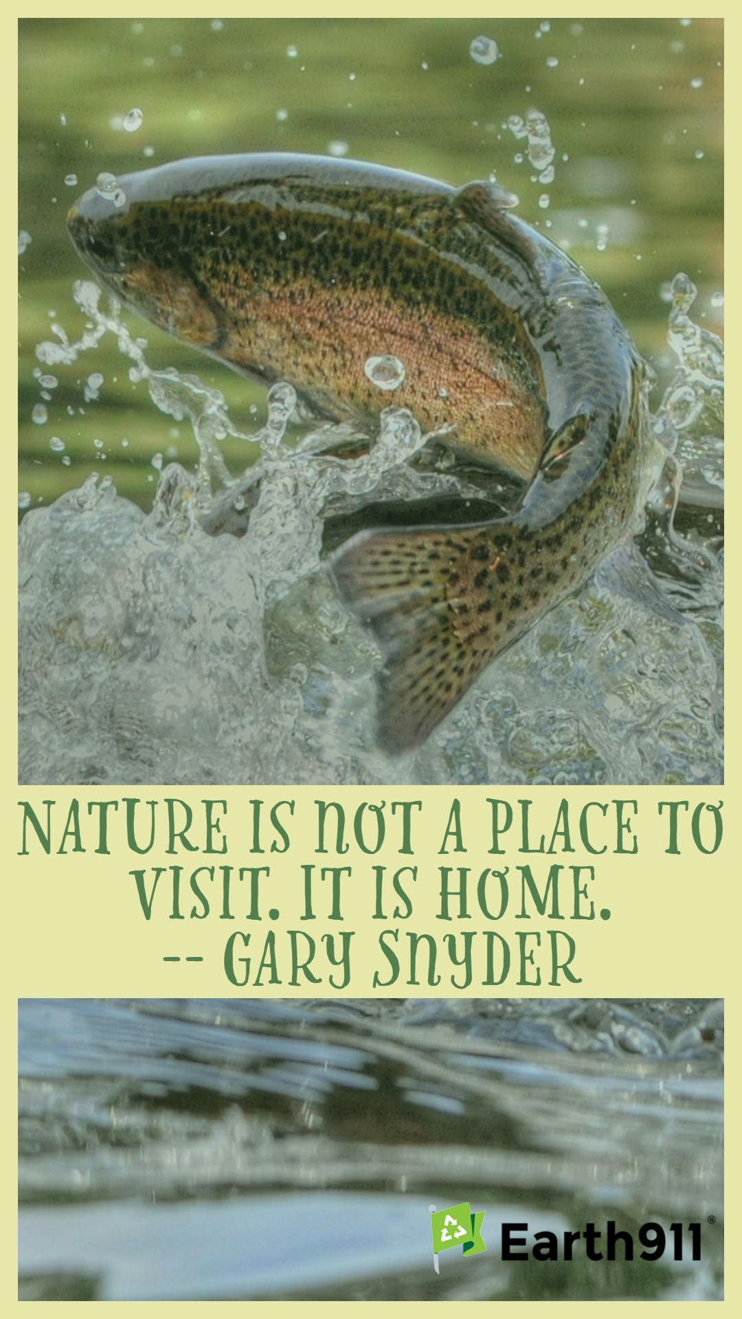
This week’s quote is from poet Gary Snyder: “Nature is not a place to visit. It is home.”
Earth911 inspirations. Post them, share your desire to help people think of the planet first, every day. Click to get a larger image.
The post Earth911 Inspiration: Nature Is Not a Place To Visit. It Is Home. appeared first on Earth911.
https://earth911.com/inspire/earth911-inspiration-nature-is-not-a-place-to-visit/
Green Living
Best of Sustainability In Your Ear: Colorado’s First-Of-Its-Kind EPR Oil Recycling Program With David Lawes
Subscribe to receive transcripts by email. Read along with this episode.
Americans dispose of approximately 1.3 billion gallons of used motor oil annually, but only about 800 million gallons get recycled, and most of that is burned as fuel rather than re-refined into new oil. The plastic packaging oil comes in is more problematic: most curbside programs won’t accept them because residual oil contaminates other recyclables. What happens when the companies that make motor oil embrace extended producer responsibility (EPR) laws that require recycling the oil and the containers it comes in? David Lawes, CEO of the Lubricants Packaging Management Association (LPMA), is leading what could become a national model for extended producer responsibility. Colorado just became the testing ground. In September 2024, five major oil companies—BP Lubricants, Chevron, ExxonMobil, Shell, and Valvoline—founded LPMA as an independent producer responsibility organization.
Colorado gave producers a choice: join the Circular Action Alliance, which manages all packaging and printed paper recycling in the state, or develop their own sector-specific program that demonstrates better outcomes. LPMA chose the independent path, arguing that petroleum packaging requires specialized handling that general-purpose programs can’t provide efficiently. Lawes brings two decades of EPR policy experience to the role, including a decade regulating EPR programs in Canada. The program he ran in British Columbia achieves a 96% recycling rate for oil containers—compared to less than 1% in most U.S. states. “This is not about skirting the law or finding an easier pathway,” Lawes explains. “It is about meeting the same results in an industry-friendly way.”
If Colorado’s model works, it could reshape EPR programs nationwide. We discuss why petroleum packaging can’t be managed through curbside programs, what lessons from Canada’s more developed EPR system apply here, and whether the U.S. needs national recycling standards to harmonize the patchwork of state regulations. You can learn more about LPMA at interchange360.com.
- Subscribe to Sustainability In Your Ear on iTunes
- Follow Sustainability In Your Ear on Spreaker, iHeartRadio, or YouTube
Editor’s Note: This episode originally aired on December 1, 2025.
The post Best of Sustainability In Your Ear: Colorado’s First-Of-Its-Kind EPR Oil Recycling Program With David Lawes appeared first on Earth911.
https://earth911.com/podcast/sustainability-in-your-ear-colorados-first-of-its-kind-epr-oil-recycling-program-with-david-lawes/
Green Living
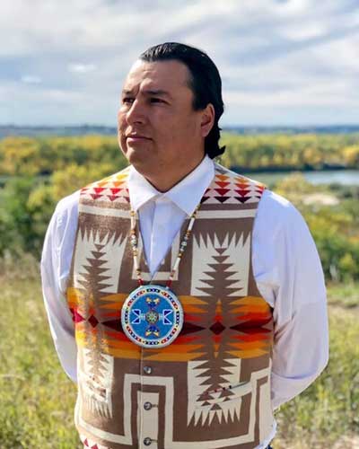
Sustainability In Your Ear: Cody Two Bears on Indigenized Energy’s Community-Centric Grid Strategy
Tribal households in the United States carry an energy burden 28% above the national average and endure 6.5 times more power outages a year, and roughly 17,000 tribal homes — housing at least 54,000 people — have no electricity at all, according to the Department of Energy. Those are the communities now first in line to absorb the next surge in demand, because Energy Information Administration concluded data center load will be the dominant driver of long-term U.S. electricity growth. Our guest this week is Cody Two Bears, founder and CEO of Indigenized Energy, and his answer to that arithmetic is tribal energy sovereignty: build it yourself, on your own terms, at your own pace. A member of the Standing Rock Sioux Tribe and once the youngest person elected to its tribal council, Cody founded the organization in 2017 after the NoDAPL protests and went on to develop North Dakota’s largest solar farm. It recently became an independent 501(c)(3) this spring and now runs energy makeover projects in four tribal communities and food sovereignty work in two more. A household that signs on returns a share of what it saves — a flat fee on one reservation, a 50-50 split on another, a sliding scale elsewhere that asks 70% from a family with a job and 10% or 20% from an elder on a fixed income. The revolving fund covers maintenance, sustains jobs, and eventually becomes collateral in places where conventional lending has never worked, because sovereign land doesn’t fit a repossession-based credit model. Cody puts it plainly: tribes are asking for a hand up, and the point of the first dollar is that nobody has to come back for a second.
The Tribal Renewable Energy Coalition that Indigenized Energy helped form won $136 million through the EPA’s $7 billion Solar for All program, and Cody’s team completed some of the earliest builds in the country before EPA terminated the program in August 2025. The reimbursements never arrived. Cody also declines to treat any of this as partisan, and he’s persuasive about why: North Dakota is a firm red state, and its farmers run the math on solar the way they’d run it on a truck loan. Ann Arbor and Portland are now standing up residential programs that resemble what tribes have operated for years, which makes Indian Country something closer to an R&D lab for community-scale energy than a charity case. The conversation gets most interesting where energy stops being about electricity. Indigenized Energy’s off-grid array at the Northern Cheyenne buffalo facility in Montana — too remote for a grid connection — runs the electric fences, water stations, and freezers, and feeds both the tribe and local food banks; Solar Builder named it 2025 Project of the Year under 100 kW. A similar system is going up at Wozu on Standing Rock to support a returning buffalo herd, doubling as shade during handling. Grass-fed buffalo raised on regenerated grassland commands a premium, so healing the land lands on the balance sheet. The energy decision, the food decision, and the land decision are one decision, because the systems were never separate to begin with.
To learn more about Indigenized Energy’s projects, programs, and workforce training, visit 4Indigenized.energy. September 16–18, 2026 brings People of the Sun to the Standing Rock Reservation, a three-day gathering of tribal leaders, energy practitioners, artists, and musicians marking ten years since NoDAPL; tickets are at PeopleoftheSun.live.
- Subscribe to Sustainability In Your Ear on iTunes
- Follow Sustainability In Your Ear on Spreaker, iHeartRadio, or YouTube
Interview Transcript
Mitch Ratcliffe 0:11
Hello. Good morning. Good afternoon. Or good evening, wherever you are on this beautiful planet of ours. Welcome to Sustainability In Your Ear. This is the podcast conversation about accelerating the transition to a sustainable, carbon-neutral society, and I’m your host, Mitch Ratcliffe. Thanks for joining the conversation today.
We’re going to be talking energy independence for the nation’s Indigenous communities, which could be a model for the distributed, community-centered electrical grid of the future. The national conversation about the clean energy transition has a geography problem. It tends to center on the places where capital flows most easily: coastal cities, utility-scale solar farms in the Sun Belt, offshore wind corridors in the Northeast. But the communities bearing the highest energy burdens in the country, many of them rural and tribal, are treated as footnotes in a story that’s mostly being written somewhere else, and that gap is getting harder to ignore.
Electricity demand is accelerating, driven by AI infrastructure buildout, data centers, and an aging grid straining to modernize, and the pressure continues to land unevenly. Native American families pay disproportionately high utility rates for disproportionately unreliable service, and they’re facing the next wave of demand pressure while the federal policy environment that was supposed to support tribal energy development has become, let’s just say, significantly less reliable. The clean energy transition, as currently structured, risks leaving behind the communities that most need it.
And my guest today has been working on the other version of this story, one in which tribes don’t wait for transitions to arrive, but build their electric infrastructure themselves, on their own terms, at their own pace. Cody Two Bears is the co-founder and CEO of Indigenized Energy, an organization that works alongside tribal nations to advance energy sovereignty. He’s a member of the Standing Rock Sioux Tribe, and what makes Indigenized Energy structurally different from most organizations in this market is the thing it refuses to be — an outside group bringing solutions to Native communities. Instead, Indigenized Energy is of these communities, staffed by Native leaders and practitioners, accountable to tribal governance, and built to stay present long after a grant cycle or a solar installation is complete.
Indigenized Energy is running energy makeover projects in four tribal communities, integrating solar, battery storage, and efficiency upgrades in a model designed to be replicable. Alongside that work, food sovereignty projects in two communities are connecting clean energy directly to land regeneration, water conservation, and community food systems, because Cody’s position is that energy is never just about electricity. And in April of this year, Indigenized Energy became an independent 501(c)(3) nonprofit, a milestone that positions the organization to steward resources directly and build the long-term partnerships its three-year strategic plan depends upon.
The strategic plan itself is worth understanding. It’s built around a vision of Native-led energy futures that support thriving communities for the next seven generations — a planning horizon that puts it in a different category than most organizations in this sector. Where others build for grant cycles, Indigenized Energy is building for continuity across leadership transitions, funding volatility, and the long arc of what it actually takes to shift who holds power in an energy system.
So we’re going to talk with Cody about what the energy burdens actually look like in the communities where he works; how AI demand growth is shaping the stakes for rural and tribal communities; why distributed solar and microgrids are tools for sovereignty and not just cost savings; how energy connects to food and land and water in ways the mainstream conversation misses; as well as what it means to build an organization from the inside out rather than delivering solutions from the outside in. The clean energy transition will either be built with Indigenous communities or it will be built around them. Let’s explore Cody Two Bears’ clear view of the difference right after this quick commercial break.
Welcome to Sustainability In Your Ear, Cody Two Bears. How you doing today?
Cody Two Bears 4:21
Good, good. Could be better, I guess. We know there’s a lot of energy crisis out there, a lot of things happening in the world. But you know, we’re doing the best we can with some of the circumstances.
Mitch Ratcliffe 4:35
What we’re going to talk about on this show — the circumstances are truly unusual. But Indigenized Energy’s vision is for a Native-led energy future that supports generations of thriving communities for the next seven generations, and that’s a very different planning horizon than, you know, say, the typical three- or five-year corporate strategy or any federal funding cycle. How does that thinking in generations change the decisions you’re making about energy today?
Cody Two Bears 4:55
I think the biggest thing — what it looks like for, you know, energy is our people. Native American people never really thought about the energy crisis like we do today. You know, 150 years ago, 200 years ago, we were always just focused on, you know, food sovereignty, our traditional medicines, our culture, our language, things that are really important to us. But now, as we fast forward and we live in this energy era, and with really climate change kind of causing catastrophic events around the world, you’re starting to see how energy can really play a role into life-and-death situations.
So because of that, Native American people now have really looked toward energy sovereignty as another pillar, just like all those other things like food sovereignty and traditional medicines. Now, as we move forward, it’s really important to really understand how energy can really heal the land, but also making sure that energy can also make us sovereign and less reliant on outside resources.
Mitch Ratcliffe 5:57
We’re going to talk a lot about the idea of sovereignty over the course of the conversation, but let me ask you about what the day-to-day experience of energy dependence feels like. What’s it actually look like in a family’s daily life?
Cody Two Bears 6:10
I think, you know, being on the reservation — I grew up on the reservation my whole life. I grew up in one of the top 10 poorest counties in the country, Sioux County, North Dakota, on the Standing Rock Reservation. Standing Rock borders two states, North Dakota and South Dakota, and is the fifth largest landmass tribe in the country. So we have a lot of land out there, rich land.
But most importantly, when I grew up, I never understood why we always had frequent power outages, why some of our utility rates were some of the highest compared to other places around us in the region especially. But I think the biggest thing I’ve learned is we always had to pay more for energy, which I would call less reliable energy. But yet we had to pay more, which was kind of ironic in itself.
But most communities, we are what I always say at the end of the line, you know, and it is something that, as infrastructure at the end of the lines are always aging, outages can be more frequent and even last longer toward the end of those utility lines. You know, that really hits our families on reservations pretty hard. The energy burden of us having to try to keep the lights on and keep our homes warm in the winter — and you can only imagine, in the northern plains where I grew up, we experience, I would say, sometimes below negative 70 wind chill factor, and we have to keep our homes warm. And could you imagine not having energy during those times, or having a power outage during those times? And now we’re even experiencing, you know, 100-plus-degree weather more frequent in the South. Could you imagine not having cool air, energy, in the South?
So, you know, those are the things that have really struck hard to a lot of people now. You know, in reservations where I come from, we’ve been experiencing those for a long time. Now we’re just seeing the rest of the world starting to experience that and start to ask questions. But I think that makes our work at Indigenized Energy even more important now, and why our energy projects have really powerful impacts, is because lowering energy costs puts real money back into our families’ pockets, especially places where I come from. But it also creates more resilient homes, which is really important. Local jobs, and of course, everlasting economic value for our community, which is really, really important. So the work that I do here at Indigenized Energy is that much more impactful because of all the reasons I just discussed, and you can walk out your front door and see the results.
Mitch Ratcliffe 8:43
And that must be a really powerful experience, not just for you, but for everybody in the community.
Cody Two Bears 8:49
Absolutely. And I think the biggest thing is taking it right off the top of the meter, having those significant savings in real time, just right there at our disposal, right off the meter. Distributed energy projects, for me, in Indian Country are really important. You know, I know just having a reliable grid is really important as well, of creating solar farms and different things like that. But you can’t create a higher, more impact than actual distributed energy in Native communities.
Mitch Ratcliffe 9:18
Let’s talk a little about sovereignty, and this is a concept that’s breaking out all over the place. On the net, for instance, it means raising walls around data and infrastructure that were previously open. It sounds like some previous historical eras — the enclosure movement in the U.K., for instance, and of course the seizing of lands from Native tribes in the United States. Can you unpack how tribal sovereignty supports your community’s relationship with place and resources? What does that mean to your community?
Cody Two Bears 9:51
I think, you know, just look at it in this aspect of it. For many generations, Native tribes have contributed a lot to the greater good of the United States, this country that we live in today. You know, we were the ones that had to give up a lot of our land, a lot of our resources, to be able to allow this country to flourish. Well, now a lot of Native lands have shrunken now because of the taking of our lands and what has happened historically in the last couple hundred years.
But I think the biggest thing that we’re learning from that is whatever little lands we have left now — because before then they threw us on lands that were some of the most ugliest, desolate lands in the country. But now they’re some of the most beautiful lands in the world, you know, because we’re able to preserve those lands that we’re on. But because of that, there’s not a lot of development happening on those lands.
So what we look at that is, you know, number one, our energy infrastructure is very outdated. Number two, we’re using more energy more and more every day. The Western world, where we live in the United States, we use energy probably 10 times more than the other side of the world, and it’s just continuously, rapidly growing. You know, our energy needs are always growing. So we as Native tribes, because we have a lot of land, we have a lot of resources, we want to be able to contribute to the energy grid in a way that we see fit, in a way of what energy sovereignty means to us. So not only do we want to take care of our own people and our own needs, so we don’t have to always outsource our needs anymore — we want to always insource our needs.
I think the creative thing that we’re doing here can teach a lot of municipalities, can teach a lot of communities out there, states, on actually how to be sovereign themselves and not have to rely on the greater good. Because one example: when we all know the catastrophic events that happened in Texas a few years ago, where they got cold down there and their grid shut down, and they had no power for like a week or a week and a half or something — and then we had to shut down up in the north for like four hours out of the day to send power down their way, you know. So those are just some of those examples why I say energy resiliency is really important, because we have to start to protect our communities and where we live, and our states and where we come from, even more so.
And that’s what energy sovereignty and what Indigenized Energy is doing for tribes. We’re starting to work with tribes to help them become their own tribal utility, help them generate their own energy in their own communities, and help dictate those rates, because we know that with all the things that are going on in the world right now — and we’ll get into a lot of the AI data center stuff here in a minute — but because of all the energy needs and what’s happening in the world right now, those energy costs are continuously rising. So it’s really important to be able to generate our own energy moving forward, and that’s what energy sovereignty means to Native Americans.
But what I will say is, energy is different for every tribe. There’s 575 federally recognized tribes, and they might do it a little bit different compared to the next tribe, and that’s okay. But the most important part is looking out for their future generations to come and making sure that those energy costs stay within those communities, but most importantly, they’re more resilient than ever. As you know, solar is becoming cheaper every single year. It’s becoming cheaper, it’s more efficient. So tribes are really looking at a way in to figure out how can we become more energy sovereign as we move forward.
Mitch Ratcliffe 13:20
As you say, distributed energy and microgrids can offer real energy independence, but there’s a lot of upfront costs and technical complexity. What’s the model for making these projects work financially for communities that have been systematically under-resourced?
Cody Two Bears 13:36
And that’s a great question there, Mitch, because, you know, Indigenized Energy — I really thought hard about this. We all know that in the world today we can put up an energy project in a community like mine and turn around and leave. But if you don’t build the skill sets or capacity internally to make them understand what you’re putting there, it’s probably going to fail. It’s probably going to crumble in the next two or three years, right?
So what I do is, we create projects at Indigenized Energy, but we also are really focused on creating programs. And within those programs — what I’ve learned, and Indigenized Energy has been doing this for the last seven years now, Mitch, which is pretty exciting — so what we do is, when we create a program, a distributed residential solar program for a tribe, usually we need some upfront capital or philanthropic dollars to help kickstart a program, but knowing that these programs are going to be self-sufficient on their own.
So what I mean by that, Mitch: if you had a home on the reservation and you wanted solar, and you wanted to sign up for a program, you could sign up for that program. Every program that we create is different from each reservation that we work with. One reservation would have a flat rate fee that you would pay to be a part of the program. Another one saves 50% across the board on what you generate in your home and what you save in your home in that month — 50% of that goes back into the program, the other 50 you get to save within your own pocket. Or another one is like a sliding scale, right? Where if you work, which is, you know, very rare on reservations, not a whole lot of jobs, but if you do work, you might be able to pay up to 70% back into the program. You keep 30% because you have a job, while there’s other elders that are on fixed incomes that may only pay 10 or 20% back. So it’s like a sliding scale program.
And what we’re seeing with these programs — and that’s what we got awarded Solar for All, the $7 billion through the EPA, Mitch. When we did our proposal for that, we created that model, and we were held in high regard. Indigenized Energy, through our coalition of tribes and other Plains tribes, we were held in high regard on: this is exactly the model we need to make solar flourish in the world.
So what that means is, as we create these programs, we’re actually kickstarting that. We’re just going to kickstart that with that $136 million we got, and that was going to put like 400 of these things on every reservation. And could you imagine the income it would generate being a part of a program for every tribe and where I come from? And what that will do is, it would unlock and unleash us as Native American people to finally be investable.
You know, because a lot of times Native American tribes, we have our own laws and our own sovereignty. So a lot of times we can’t get home loans on a tribe. They can’t go and just repo a home on our reservation, or a car loan, or different types of things. So it’s very tough to do and create loans within reservations. But whenever you create a program, a sustainable program that generates money within places of some of the highest poverty places and tribal nations in the country — you generate money. Well, that’s a fund that sustains jobs. That’s a fund that takes care of the O&M, and it also creates a fund that, once you start creating that fund, you can go out and take a loan and leverage all the money that’s out there for us for low-income communities to take advantage of. So that’s what we were going to do to kickstart Indigenized Energy to take us to the next level.
And what we’ve learned in the last six months, Mitch, is there’s places like Ann Arbor, Michigan — you can look up — and Portland, they’re actually creating distributed residential programs within their own communities now, and that’s something that tribal nations have been doing for quite some time. So I just wanted to give you the kind of nuts and bolts of why our work was really important, is because we do a lot of projects too, but programs was really the big thing that Indigenized created that would really help green economies flourish within reservation boundaries.
Mitch Ratcliffe 17:39
A lot of people see the process of financialization as just bad, but what you’re saying is that it can be used to move from human exploitation to human enablement.
Cody Two Bears 17:49
Right. And I think that’s the biggest thing at Indigenized Energy. We don’t always ask for handouts; we ask for a hand up. And I think that’s the biggest thing: as we’re continuously raising money, we’re continuously saying, “Hey, help a tribe start a residential program, and once they start that, then you won’t need to keep going back and asking for more money anymore. It’s going to be self-sustainable.”
And I think that was why, you know, when Biden saw our vision and actually held our proposal in high regard — there was 60 awardees that got awarded the Solar for All program, and we were one of two that was held up as an example of that. And you know, I really wish we could have continued on with that project. You know, of course, this new administration here pulled those federal fundings. We were actually through the planning stages, ready to deploy the projects and start to build things before it got pulled. But the crazy thing about that, Mitch, is even though the money got pulled, a lot of our money we never really got reimbursed fully the way we should have. So Indigenized Energy, we lost quite a few dollars and resources of not being able to get reimbursed, because it was cut off so fast.
But most importantly, I think our tribes are more ready than ever to be able to take in funds because of that, and we’re kind of ready to deploy. We’re just looking for alternative resources and support and help to make that happen.
Mitch Ratcliffe 19:10
So you just completed a transition to becoming an independent 501(c)(3) nonprofit, and that’s significant. But you’re doing it in a genuinely difficult funding environment. What does organizational resilience look like for somebody in a mission-driven organization who’s navigating that strife-driven national dialogue you just described?
Cody Two Bears 19:31
I think the biggest thing is, as nonprofits do the work, funders always ask, “Well, what is your sustainability plan to keep you guys going?” And I think the model that I just shared is exactly that sustainability plan. That, you know, any funder that would understand this financialization model, they would want to give to that. They would want to say, “Wow, I want to be a part of something like that.” So for us, it’s just getting the word out there. The model now is actually working. It makes sense. We just need to deploy in other tribal communities that we service and work with.
But you know, as far as becoming our own 501(c)(3), we can really now lock in and do this work even more at a higher level for our tribal communities. Because sometimes when you use federal funds, well, there’s always like some red tape that you go through. There’s needs within tribal communities that won’t be met, because you can only do so much with federal dollars. Or if you’re, you know, fiscally sponsored, well, the policies that they create through fiscal sponsors don’t align with tribal values. So a lot of times we always hit roadblocks because of that. So becoming a Native-led organization and our own 501(c)(3) now has really propelled us to even cut all that red tape and to really help tribal nations the way they really need it. And I think that’s the exciting part about doing this energy work, being Native-led, but most importantly, being our own 501(c)(3).
Mitch Ratcliffe 21:01
You mentioned this before, that the national conversation these days about energy demand is increasingly being driven by AI expansion and data centers, just generally. And most of that conversation focuses on grid capacity at the macro level. What gets lost or left out when frontline and rural communities aren’t part of the conversation? What do we need to know about the interdependence we need to build?
Cody Two Bears 21:24
Yeah, look. You know, there’s no avoiding it. These AI data centers are going to be coming. They’re going to be built. A lot of times it’s going to affect communities around them. A lot of times it’s going to drive up the energy costs, you know, a lot more, and it’s going to utilize a lot of their natural resources around them, right? So there’s no way of avoiding it. But I think the concern is what that means for families that are already struggling with high energy costs — is that it’s going to be so difficult.
Like, just on a reservation, there’s AI data centers going up around reservations, and we already pay high energy costs. We already have to take the burden of looking at what that would look like when power goes low. It’s going to go to these data centers, and then I just told you we’re always at the end of the line. So we’re going to get that less energy. It’s going to go somewhere else because we’re at the end of the line, which is going to cause more frequent power outages, then those energy costs to rise. So that’s why our work now even makes more sense. The work that we’re doing now is needed much more than ever, because of that fact.
And we know that as tribal communities, of the demands out there, we also know that we have to do something within our tribal reservations to utilize our sovereignty around energy as we move forward. So I think that’s the biggest thing right now. We’re kind of seeing these AI data centers starting to play out, the types of resources it’s creating, the type of energy costs rising around us. I think is really, really disturbing in my mind. So I just want to make sure that we continue to move the needle within our tribal communities, to make sure we are continuing our work, to making sure we are providing our own energy resources within our tribal nations. Because, you know, those are just more examples for us to keep pressing forward and moving the needle, to making sure we’re taking care of our own needs.
Mitch Ratcliffe 23:15
As we think about a new technology like artificial intelligence, we have to drive it to do the right things for the planet and the people who live on it, but the infrastructure buildout is accelerating demand for natural resources, critical minerals, and so forth, as well as water, in addition to electricity. How do you address the contradiction between those things when you think about whether AI data centers, or data centers generally, might even be part of tribal economic development strategies in the future?
Cody Two Bears 23:44
So I think, you know, as every tribe — and I just said that earlier on this podcast — every tribe has different agendas. Every tribe utilizes things in an economic way. Some tribes don’t. Some tribes want to keep their internal natural resources and not allow things like that to happen within their tribal boundaries. So every tribe has different priorities, different needs.
But what I will say, though, is, as we do this just transition away from fossil fuels — like, you know, I think fossil fuels are the determining factor of why we are the way we are today, right? But there isn’t going to be a perfect technology today. We’re just slowly making that transition, and I think that’s one thing that a lot of my tribal elders or people in my community always ask me. Well, there’s always some type of form of extraction, right? You’re never going to get away from that. But what is less impactful? You know, what can we do to minimize our footprint within the Earth and the land and the waters and the environment around us?
And I think that just transition that we talked about is really important to me, because if I can lessen my footprint just that much more, you know, we’re gonna do that. And when the technology gets better, where we don’t need to do extraction as much anymore in the future, we’ll slowly adjust those. But right now I think it’s just that transition that we’re making away from not having to rely on one source of energy that really is destructing the lands, and understanding and knowing that, yes, there’s other forms of things that are happening out there that are being extracted, but nothing at a major level compared to what we’ve been doing in the past. So there is some movement there, and I know technology will get better. And us as Native Americans, we’re always paying attention to what is the next best thing we should be focused on to continue protecting the environment.
Mitch Ratcliffe 25:31
I think we’ve got a good lay of the land, but there’s a lot more to talk about here, folks. We’re going to take a quick commercial break and be right back to continue talking with Cody Two Bears.
Mitch Ratcliffe 25:45
Welcome back to Sustainability In Your Ear. Let’s return to my conversation with Cody Two Bears, who’s co-founder and CEO of Indigenized Energy, which is a nonprofit developer of distributed electrical infrastructure that’s working to connect Native communities across the continent.
Cody, Indigenized Energy is advancing energy makeover projects in four tribal communities right now. You know, you’re integrating solar, battery storage, and various forms of efficiency. How do you think about designing resilience at the community scale? What do you describe to people when you work with them to develop an infrastructure that supports their way of life?
Cody Two Bears 26:24
Well, that’s kind of why I created Indigenized Energy, Mitch. You know, I always thought, well, what type of good technologies are out there in the world? You know, there’s all good technologies, there’s bad technologies, but there’s also technologies — you have to use them in the right way. If you don’t use them in the right way, then we’re no better than, you know, the oil companies or people that are extracting the lands in a negative way. So my aim was always collaborating Western science and technology with Indigenous ways of life and traditional customs as Native people. And how do you collaborate that to allow Native American communities to make it make sense? And I knew that was going to be the biggest challenge as I created Indigenized Energy, bringing a certain type of technology in to create energy sovereignty within our tribal communities, which is really important.
But these whole makeover projects have been significantly something that’s really true to, you know, understanding that even solar energy in itself isn’t just the answer. You know, I’ll give you an example. A lot of tribal nations live in federal HUD homes, like cookie-cutter type homes that are issued by the federal government through treaties — our treaty laws, where the federal government is supposed to build homes and provide federal funding for homes within our communities, but it’s very, very minimal. They’re cookie-cutter type homes, like I talked about. The walls ain’t very well insulated, and then, of course, Grandma’s got her old freezer that she’s had that she loves for the last 20 to 30 years, that just won’t give up, but she loves it. All these factors play in to creating, you know, what an energy bill looks like in your home, and those energy bills are sometimes eight to nine times higher than the national average, because our homes ain’t well insulated. Our homes still use old technology, and home efficiency is really becoming a big thing for tribal communities as well. So we can save a lot of money just on top of the meter with solar, but could you imagine how much we would save by making even our homes more efficient?
So these home makeover programs and distributed energy projects that we do really are game changers in our communities. As we learn from what tribal communities’ needs are, we’re starting to learn that, number one, tribal communities are very distant. They’re in the middle of nowhere. A lot of our homes are just kind of put out there. There’s not really anything out there, and what that means is whenever we get disconnected from energy — especially our elders, especially our medical-needs people — they could be out without energy for a few days, which could be catastrophic.
So what we’re learning from our tribal communities, and why these home makeover projects are really important, is the tribal communities really want to focus on their elderly. They want to focus on the people in these remote areas. So then, when the power does go out, there’s battery backup there. There’s huge savings, and because we’re always at the end of the line, like I talked about, they can’t get more resilient than that. And one thing that I’ve learned from the few projects that we’ve done is there was one home that we did in the Oglala Sioux Tribe there, by Pine Ridge. When the power went out on their reservation, the home that we did there a few years ago — they were the only ones with power. This elderly group was the only ones with power, and didn’t even know that the rest of everybody was out for a whole day. They still had that resilience of having power in their home. So those are the types of things we see that are really impactful. We know that the work that we do is impactful from day one, from the time we turn that system on, the energy system on, and provide that energy resiliency.
Another one that’s really impactful there, Mitch, is we won Project of the Year through Solar Builder magazine last year, in 2025. We did a food sovereignty project that was initiated with energy sovereignty through a buffalo program out there in Northern Cheyenne. Their buffalo program is in the middle of nowhere. There’s no utility lines that reach out there to that buffalo program, because — I told you — we’re always at the end of the line. But there, there was no power lines going out there, so we had to bring the power to them. We created a small little off-grid system that powered their buffalo facility, and their buffalo facility processes buffalo meat to the community.
So not only did that have battery backup in there to make sure that we’re running in real time, but most importantly, it powered their electric fences. It powered their water stations. It powered their freezers for their buffalo meat. And now, because of that, you know, they’re able to really feed not just their own community, but they’ve been feeding local food banks in the local area because of our efforts there within that project.
So those are some powerful, powerful things that I talk about, Mitch, about why our work at Indigenized Energy is important, because, you know, we just don’t create something to save money. We actually create something that creates a way of life for our people, and I think that’s really the biggest thing that we see and why our work is so impactful. But those are just a couple examples of these home makeover projects and resiliency within communities that are really important and powerful, that we really want people to understand and know, because there’s a lot of great work that is happening out there. Even though the federal government wiped out all of our funding, that didn’t stop us from continuing to know what’s important. And our tribal communities are working hard every day to continue to strive toward that.
Mitch Ratcliffe 31:58
I can, to whatever degree it’s possible, really relate to being at the end of the road. I live in a very remote rural community. The federal broadband subsidy program installation stopped a half mile down the road. You know, so thankfully I have Starlink and I can talk with you. But I’m thinking, as I talk about this: is this a model for any community? And what’s your advice to a small town or a county that’s contemplating its energy independence?
Cody Two Bears 32:25
Well, I think there already is. You know, Texas is a red state, but we see a couple communities in Texas that are 100% renewable, and it’s a red state. I don’t know why renewable energy has to be under a political agenda. I don’t understand why solar has to be a political agenda. Because if you really look at it, even in where I come from in North Dakota, you know, we’re a very firm red state as well. But the farmers and ranchers are looking at solar as an economic thing. Like, it pencils out. It makes sense. Like, you’re going to save money. It’s like a car loan, right? Like, I make a loan on a solar system, and I pay that off within, you know, six, seven years, whatever it’s going to be, and then you have this power for the next 20 years free. So I mean, you know, it’s just economics. It makes sense. And so, like I said, solar energy is becoming cheaper more and more every day.
So those are the types of things that I look at. I don’t like to go on the political landscape. I show real examples of impacts of what this really does in places where we’ve worked, and I think that’s what the stories people need to hear. They don’t need to hear the propaganda of what this does, what that does, how it affects this, how it affects that. You know, I just look at real-world impacts that we’ve created.
But I think, you know, for communities outside the reservation, I would really encourage them to even look at what Ann Arbor is doing, what Portland is doing, you know, what tribal nations are doing, because we’re our own sovereign nation. Let’s learn together to figure out what an actual microgrid would look like for a community, what a tribal utility — or what a utility — would look like in your community, and how can you start programs that make sense where you come from. Because these energy costs ain’t going to wait. They’re always going to continuously rise, and we’re going to use more energy more and more every day. So I really encourage, you know, states, like I said, municipalities and cities, to really take a look at the energy crisis, because whether they know it or not, they’re going to be affected with outdated systems, and we need to figure out creative ways on how to create that within. And I think that’s the most important part of what we’re teaching here at Indigenized Energy around what energy sovereignty looks like on Native reservations, but how could that be expanded in other parts off the reservation?
Mitch Ratcliffe 34:45
This comes back to sovereignty and the idea that we will negotiate as equals. And one of your core principles is tribal direction comes first. And as you pointed out, there’s a diverse approach to tribal direction, a lot of different flavors. Many of the philanthropic and policy-driven funding opportunities that are available come with a lot of agenda. And again, thinking about any small community, not just tribal communities, how do you negotiate from a place of equality based on setting your own local standards and standing by them?
Cody Two Bears 35:20
Yeah, and I think the biggest thing that I would say is, how does funding fit in? And this is a great question, Mitch, because this is something that I know, as growing up as a Native American my whole life — you know, our people always being the original environmentalists in the Western Hemisphere — and I always look at this as energy is not just energy savings. It’s not just creating jobs. When you create good energy, it’s going to trickle down to everything else, because everything is all connected, right? So if you’re using less fossil fuels and using other alternative resources of energy, what you’re doing is you’re helping the air, you’re helping the land, you’re helping the water, you’re improving resources around us that really make sense.
So then, as you go after these federal dollars and these funds, I even use renewable energy as an economic value, of economic development. So we can attack it in all kinds of avenues and ways to how energy can make sense tied to funding, even though it’s not directly funded toward an energy project. We can relate to energy and what we do here in our work at Indigenized Energy and connect that with food sovereignty. We can connect that with jobs, with workforce — workforce development money is out there. So, you know, the things are endless on how you can connect philanthropy, federal dollars, and grants to the work that we do. You know, there’s always a path forward on what that connection looks like.
But I’ve done energy work now for the last 10 years — I’m coming on 10 years through Indigenized Energy’s existence. What I’ve learned is, you know, the work that we do helps all other areas and not just energy. And I think that’s what makes this work so attractive. That’s what makes this work so successful, and why I feel like, you know, energy projects should be funded even more than ever, because it helps the whole ecosystem around us.
Mitch Ratcliffe 37:19
It’s really interesting how you describe unlocking land regeneration through this integrated approach to energy and food sovereignty. What does it look like when those two things reinforce one another? You began to describe the ripple effects, but can you point to a couple of examples where the economy of a community and the options available to it expanded because of food and energy sovereignty investments?
Cody Two Bears 37:44
Yeah. So we actually are doing a project right now on my home reservation on Standing Rock. There’s an organization called Wozu, and they do a lot of land regeneration right now. But they also are bringing back more of the buffalo herd as well, and it’s quite remarkable, the work that they’re doing. But we’re doing an off-grid system there for that buffalo program within theirs, and it’s right outside their buffalo handling facility. It’s actually bolted really high, and it’s an array there that provides shade for the buffalo, right? Which is pretty cool. So whenever they sort the buffalo there, they have a shade that’s powered by the solar array through their whole facility there, which is pretty cool. And we’re just now putting out the press release on that and what that looks like.
But we’re pretty excited about that, because now that particular program — to keep themselves sustainable, they have to be able to provide buffalo meat for their community, but they also want to, in the future, sell buffalo meat, especially, you know, with the land regeneration of the buffalo. The buffalo now are feeding off of natural grasslands, healed lands, so that grass-fed buffalo meat is at a premium right now throughout the world. So the biggest thing is that’s what’s going to keep our tribe economically stable — this program and this community — because not only are they able to help feed our own people, while using energy sovereignty and power to be able to do that, that’s going to create a ripple effect for economy-based programs that help them not only save money, not only preserve their buffalo meat, not only take the health and well-being of their buffalo as a whole as they use that for their facility, but what that does is it creates economic impacts in our communities. It also helps us be self-sustaining and self-generating.
So that’s the powerfulness of this work that we do. Because when you tie in food sovereignty, energy sovereignty, or whatever it may be, it’s always connected. You know, you can never go wrong, because those are the types of things that are really going to help flourish and take communities like ours to the next level, and we have several examples of that now. So that’s why it’s always good to not just say, let’s just throw up an energy project — and it’s good to do that and save money — but when you can tie it into other things of your ways of life, not just on reservations, but anywhere in the world, you know that really makes sense, because now that economy that you’re trying to build is speeding up a little bit more, faster, because you’re collaborating the both into something great.
Mitch Ratcliffe 40:29
I’ve asked several Native guests over the years to describe what it’s like to be indigenous to a place, which I think is a skill all of us need to open our eyes to, to recognize our relationship with the systems in which we live. And I think you just described what the world would look like if we are really successful in localizing power generation. But as you think about where you’re going as an organization, where the Native communities of America are going as a collective identity, how important is the role of economic development and cultural preservation to the strategies that you’re designing for Indigenized Energy?
Cody Two Bears 41:12
All right, so let me tie this, Mitch. The word indigenized. There’s a reason why I called it Indigenized Energy, and let’s not even think about this as Indigenous people, even though that’s who I work for, that’s the work that I do for my nonprofit, and that’s my mission. But let’s just think back for a second on the word indigenized. Yeah, everybody came from somewhere. Everybody had a way of life. Everybody had a way of sustainability, you know, before the Western world kind of took over and did what they did.
Now here we are having all these issues and these problems. Now we’re starting to ask questions: Well, what do we do now to kind of reverse what we’ve done? Or what do we do now to kind of learn how to give back to the land? Because every day, Mitch, we’re taking, taking, taking, but nobody was ever taught how to give back, or give back in a way to help regenerate what we’ve been doing on this planet. And I think that’s what Indigenous people have been doing for so many generations. We’ve been taught how to do that. It’s in our way of life and our structure and what we do.
But I think the biggest thing that I want you guys to understand is that the word indigenized, and what that means is, as I go into a tribal community — like I told you, everybody’s going to do something a little bit different. So we’re going to have to indigenize what we do for the needs of what’s sustainable within your region, your climate, and what you do. There’s no one cookie-cutter way, Mitch, of doing this work everywhere. Every climate, every region has to do things differently. So we have to indigenize what we do to meet their needs, to make it make sense for them.
And I think that’s what we need to do for outside tribal communities, like in cities, municipalities. We need to indigenize their energy systems. We need to indigenize their food systems, because there’s certain things that they have to grow at certain times of the year. There’s certain medicines that are in their region that we need to keep sustainable and healthy.
So I think that’s why the word indigenized, to me, is really important, and that’s why that connects with outside communities, outside tribal reservations, because we have to learn about who we are and where we come from. And that’s something my grandma always taught me, Mitch. She told me that, and I was like, “Well, Grandma, what do you mean by that?” But you don’t know where you’re going unless you know where you’ve been. And I think that’s the biggest thing that I’ve learned: once you’ve learned where you’ve been, once you’ve learned your history of your lands and where your house is and where your city is, and how it evolved, then you’ll better understand and know: okay, this part of this land here that we live on, this is what this is good for. This is what we need to focus on. So you’re actually indigenizing what you create moving forward, by just understanding who you are and where you really come from.
Mitch Ratcliffe 43:58
Cody, that’s a spectacularly clear frame for this conversation. Thanks so much for all of the ideas you’ve shared. How can our listeners follow your work? And I know that you’ve got a big event coming up. Tell us about it.
Cody Two Bears 44:09
Yeah, so you can follow us at Indigenized — it’s actually 4Indigenized.energy, the number four — and you can find us there. You look at all our work, all our previous projects, all the awards and successes that we’ve had within our projects to date. And also, we’d like to invite everybody to come out to the People of the Sun event on Standing Rock. It’s September 16th through the 18th on our reservation there on Standing Rock, and this just isn’t another conference or festival. It’s an event centered on Indigenous leadership, innovation, culture, and community. We’re bringing together tribal leaders, industry experts, artists, musicians, changemakers — you name it. We’re bringing them in, and really having those honest conversations about what the future of energy looks like, what our food systems look like, and what sovereignty looks like in real time.
And I think this year especially, it’s meaningful, because it’s the 10-year anniversary of NoDAPL. If we remember, on my homelands there on Standing Rock, in the community of — why Indigenized Energy was created — it was created because of the NoDAPL protest that happened in my community, a pipeline that was put a half mile north in my community. That’s why we do this work. It’s a 10-year anniversary, so we want to celebrate the progress that we’ve made and the work that really we’re focused on.
So I think the biggest thing is that we’re going to give out a lot of awards to a lot of champions out there in the energy sector. We’re also going to make sure that, you know, we’re entertaining people culturally, bringing a lot of great high-end musicians. So I encourage you guys to really look at PeopleoftheSun.live. Tickets now actually have become available on that website now, so go out there and get a ticket. But this is an event you’re not going to want to miss. And because of what’s happening in this country and the direction we’re going, we want to be able to allow people to be excited about this work. And just because, you know, there’s a lot of federal cuts and they moved all the tax incentives and the IRA and all of that away from this work, that doesn’t necessarily mean we’re going to stop. We should be continuing to celebrate what is working out there, and by bringing people together, we can really accomplish that all together, as tribal people and non-tribal people. So I encourage you guys to look into PeopleoftheSun.live and see what we’re going on in September, and invite you all out to Standing Rock.
Mitch Ratcliffe 46:30
Well, Cody, the celebration of solutions is absolutely what we need to be focused on. Thanks so much for a really fascinating conversation.
Cody Two Bears 46:38
Thank you for your time, Mitch, and super excited about the work that you’re doing and putting out the word on why this work is important. So thank you so much.
Mitch Ratcliffe 46:50
Hey, welcome back to Sustainability In Your Ear. You’ve been listening to my conversation with Cody Two Bears, co-founder and CEO of Indigenized Energy, a Native-led nonprofit that helps tribal nations build their own distributed solar, storage, and efficiency technology designed around what each community actually needs. You can learn more about Cody and his team’s work at four — that’s the number four — Indigenized.energy, and there is no space or no dash between four and Indigenized. That’s 4Indigenized.energy. And you can also find tickets for the People of the Sun gathering at Standing Rock on September 16th through 18th at the site as well.
Let’s start with the word indigenized. That’s the concept Cody built his organization around, and when I asked him about being indigenous to a place, he shared a view that’s much wider than tribal energy policy. What does this mean? Everybody comes from somewhere, and everybody once had a way of living that worked where they lived. We’ve been moving an awful lot compared to previous generations the last few centuries. Every region has its own climate, its own growing season, its own medicines, its own history of how the land came to be what it is, and every place contains a community: human, animal, insect, fungal, and many more. Nature is a set of systems, and we are inside them. We’re not standing over them, as Western thinking has insisted for centuries, even as the systems that we depend upon collapse.
Native and Indigenous peoples have carried and transmitted the practical knowledge that we need about how to live as part of those systems rather than at their expense, and that is the inheritance available to all of us. But we have to learn to be of and for our place, not just prepared to take from it, whether we’re talking about mining the land, cultures, or personal data for profit. And there’s no cookie-cutter approach to designing a sustainable future that can succeed, which means the transferable asset in this case isn’t a solar project design, but the practice of knowing where you are well enough to know what to build.
Cody’s grandmother’s line lands harder than any policy paper that you’re ever going to read: you don’t know where you’re going unless you know where you’ve been. And you can see that principle at work in the Northern Cheyenne buffalo facility, an off-grid array that drew national attention to Indigenized Energy’s work in the tribal energy sector. The installation runs the electric fences, the water stations, the freezers, and it helps feed the community and local food banks. Energy sovereignty and food sovereignty aren’t parallel programs; they’re the same program, and a larger system than either one alone. Grass-fed buffalo raised on regenerated grassland commands a premium price, which adds the benefit of healing the land to the buffalo meat operation’s bottom line.
And that’s what balance looks like when it’s working. The energy decision, the food decision, the land decision, along with the economic decisions, are one decision, because the systems were never separate to begin with. But we’ve consistently oversimplified the economic thinking that we do. However, systems thinking is starting to unpack that misunderstanding.
Now compare all of that to the other thread in this conversation — the one I can’t shake. Cody did not romanticize the AI data center buildout. He said it’s coming, and there’s no avoiding it. He explained the mechanism driving higher energy prices plainly: rising regional demand, rising rates, and when load has to be curtailed so that you can feed those data centers, the end of the line is where the curtailment lands. Standing Rock is the fifth largest tribal landmass in the country, and also one of the poorest counties in America, and residents already pay premium prices for less reliable service. A 2023 Department of Energy report documented this pattern. Where the wire ends tells you who mattered when it was built. And the thing we have to recognize about building an infrastructure is it hardwires these power relationships over the long term — not just energy power, but political and social power.
But consider the sense of resignation in that statement, that there’s no avoiding it. A new set of systems arrives, sited by people far away, and the community absorbs the consequences without a seat at the table. And look, Cody’s people have lived that story before at a scale that most of us have never had to imagine, and here we are laying another vast layer of infrastructure on top of an industrial system that is already tearing nature apart, and we’re calling its arrival inevitable. It’s not just Native communities on the receiving end of these dictates that will shape their future — it’s all of us, and that’s the part we need to refuse. We need a voice at the table. A sense of inevitability, in the way that Cody expressed it, is the experience of a decision someone made and declined to explain to you. We can have a real conversation about what to adopt, what to discard, and what our choices mean, but only if we understand the whole system in which we are living, considering everyone and everything in the system — which is exactly the understanding indigenizing our thinking would provide.
“End of the line” speaks volumes. It suggests we’re on our own, although when you get there, you actually find that there are communities everywhere in need of new infrastructure. We’re all at the end of the line in the take, make, and waste centralized economy. We have to recognize that, which brings me to the practical answer that Cody would hand to any rural county commissioner in America.
Indigenized Energy doesn’t just install systems; it builds programs with communities that fund themselves. When a household signs on to get solar installation, it returns a share of what it saves — perhaps a flat fee here, a 50-50 split in the cost there, a sliding scale that asks for 70% from a working family and only 10% or 20% from an elder who’s living on a fixed income. The community is in it together, and that revolving fund pays for maintenance, sustains jobs, and eventually becomes collateral where conventional lending has never worked, because sovereign land doesn’t fit a repo-based credit model. It’s an acknowledgement that everyone in the community is in it together.
The Tribal Renewable Energy Coalition that Indigenized Energy helped form won 136 million dollars through the EPA’s Solar for All program on the strength of its community-centric design. Then the federal money was pulled mid-planning, and Cody’s organization ate unreimbursed costs on the way out. But the model didn’t fail, because the communities were bought into its benefits. It was the funding cycle that failed. It was the political system that failed.
Meanwhile, cities like Ann Arbor and Portland are building residential distributed programs that look a lot like what tribes have been running for years, and that’s your leading indicator. Indian Country is the R&D lab for community-scale energy, and it still needs philanthropic or public capital to kickstart — capital that’s scarcer than it was 18 months ago.
We can learn a lot from Indigenized Energy. The communities that were never at the center of the grid may be the ones who figure out how to live well without depending on it, because they never lost the habit of asking what a place can actually support. Think local, act local, and understand our roles — and there are many roles — in the larger world that we owe our children and grandchildren, down to the seventh generation.
September at Standing Rock marks 10 years since the NoDAPL protests. A decade has turned that protest into a renewable energy infrastructure. Indigenize what you build where you are. That’s the plan. We’ll be tracking what gets built next, and the growing awareness that becoming small-i indigenous is the challenge of our times. So get to know nature and the human systems that shape your reality.
Hey, look, if this conversation gave you something worth passing along, please send it to one person who needs to hear it, or leave a review where you listen. Folks, you’re the amplifiers that can spread more ideas to create less waste, and our archive has more than 560 episodes, and it’s waiting for you on Apple Podcasts, Spotify, iHeartRadio, Audible, or whatever purveyor of podcast goodness you prefer. Thanks for your support.
I’m Mitch Ratcliffe. This is Sustainability In Your Ear, and we will be back with another Innovator interview soon. In the meantime, folks, take care of yourself, take care of one another, and let’s all take care of this beautiful planet of ours. Have a green day.
The post Sustainability In Your Ear: Cody Two Bears on Indigenized Energy’s Community-Centric Grid Strategy appeared first on Earth911.
https://earth911.com/business-policy/sustainability-in-your-ear-cody-two-bears-on-indigenized-energys-community-centric-grid-strategy/


-
Greenhouse Gases12 months ago
Guest post: Why China is still building new coal – and when it might stop
-
Climate Change12 months ago
Guest post: Why China is still building new coal – and when it might stop
-

 Greenhouse Gases2 years ago
嘉宾来稿:满足中国增长的用电需求 光伏加储能“比新建煤电更实惠”
-

 Climate Change2 years ago
嘉宾来稿:满足中国增长的用电需求 光伏加储能“比新建煤电更实惠”
-
Climate Change2 years ago
Bill Discounting Climate Change in Florida’s Energy Policy Awaits DeSantis’ Approval
-

 Renewable Energy9 months ago
Sending Progressive Philanthropist George Soros to Prison?
-

 Carbon Footprint2 years ago
US SEC’s Climate Disclosure Rules Spur Renewed Interest in Carbon Credits
-
Greenhouse Gases1 year ago
嘉宾来稿:探究火山喷发如何影响气候预测