

A forest area equivalent to the size of the Isle of Wight has not been planted because UK governments have failed to meet tree-planting goals since 2020, according to Carbon Brief analysis.
The latest figures from Forest Research show that only 15,700 hectares of trees were planted across England, Scotland, Wales and Northern Ireland over the past year.
This is roughly half the annual target of 30,000 hectares by 2025 that was set by the previous Conservative government.
After the 2019 general election, the Department for Environment, Food and Rural Affairs (Defra) laid out a planned trajectory for England from 2020 up to 2025.
Tree-planting is a devolved issue, so Scotland, Wales and Northern Ireland have had their own annual targets.
The chart below shows how, collectively, the nations have repeatedly missed these goals.
The cumulative impact of missed tree-planting targets over the past five years adds up to 36,429 hectares of unplanted forest, equal to nearly the size of the Isle of Wight.
This gap has grown since last year, when Carbon Brief analysis showed that the missed targets equated to a 22,129-hectare – or “Birmingham-sized” – forest.

As the location of most UK tree-planting, Scotland has also been the biggest contributor to the shortfall.
Shortly before the latest figures were released, government advisors at the Climate Change Committee (CCC) pointed to the UK’s “highest planting rate in two decades” in 2023-24. However, it noted its “concerns that recent reductions in funding for woodland creation in Scotland could reverse this trend”.
As the CCC predicted, just 8,470 hectares of trees were planted in Scotland in 2024-25, down from 15,040 hectares the previous year.
The nation had been targeting 18,000 hectares of annual woodland creation that year, although this was scaled back to 10,000 at the end of 2024 following a 41% cut to forestry grants.
Tree-planting rates across the other nations have steadily increased, but they have still not been on track to achieve their internal goals.
While the 30,000-hectare goal has not been formally abandoned, Labour did not mention it ahead of their election win last year.
Instead, the new government only committed to “establish[ing] three new national forests in England, whilst planting millions of trees and creating new woodlands”.
(Since winning the election, Labour has announced a tree-planting “taskforce”, in part to help meet a legally binding target of raising England’s tree cover to 16.5% by 2050.)
This followed repeated warnings from industry sources and independent analysts, over the course of the previous government, that the 30,000-hectare target was slipping out of reach.
Nevertheless, the CCC urged the new Labour government last year to move quickly to meet the goal. Earlier in 2025, the committee said it remains “vital” that tree-planting more than doubles to 37,000 hectares per year by 2030 to remain on track for the UK’s net-zero target.
Such rates are necessary because trees are needed to absorb carbon dioxide (CO2) and balance out remaining emissions from sectors that are not able to completely decarbonise by the 2050 net-zero date, the CCC says.
Around two-thirds of the trees planted last year were broadleaves rather than conifers, which grow faster and, therefore, absorb more CO2 in the short term. This is likely due to the decline in tree-planting across Scotland, which is home to most of the UK’s commercial conifer plantations.
Methodology
This article is an update of Carbon Brief analysis published ahead of the general election last year, which assessed progress towards tree-planting goals in the UK and the devolved administrations.
During the 2019 election campaign, the Conservatives committed to a UK-wide goal of creating 30,000 hectares of new woodland a year by the end of parliament, which was pegged for 2024-25. (Annual tree-planting figures are reported for the period between 1 April in one year and 31 March in the following year.)
Within this, England had a planned trajectory set out by Defra, Scotland had annual tree-planting goals, Wales targeted “at least” 2,000 hectares a year from 2020 and Northern Ireland set out annual goals in its “forest service business plans”.
For the final year, Carbon Brief compared the 2024-25 tree-planting rates recorded in Forest Research data to the overall UK-wide target of 30,000 hectares. For the previous four years, the comparison is with the combined annual targets set by the devolved administrations.


The post Chart: UK misses tree-planting targets by forest the ‘size of Isle of Wight’ appeared first on Carbon Brief.
Chart: UK misses tree-planting targets by forest the ‘size of Isle of Wight’

Climate Change
“Sink or swim”: WA Gov hugely underestimating decline in regional gas demand while sleeping on green exports, new report finds
PERTH, Tuesday 13 October 2026 — A new report from Greenpeace Australia Pacific and Springmount Advisory reveals green commodity exports are an untapped economic opportunity for Western Australia in a declining Asian gas market, while offering a genuine solution for decarbonising Asia.
From Gas to Green: Building Western Australia’s Future State is a comprehensive analysis of the declining gas market in Asia, and the untapped economic opportunity for WA to become a global leader in green commodity exports while driving the regional shift away from fossil fuels.
The report offers key recommendations for the WA Government to support regional decarbonisation through an orderly phase out of gas exports in favour of green iron and other green exports. It comes as global climate leaders from across business, politics and advocacy prepare to meet for the Global Citizen Now: Perth event focused on decarbonising WA.
Key findings:
- Gas demand is falling across WA’s core markets in Asia: Gas demand fell in 2025 and is projected to continue to decline, driven by a combination of global geopolitical factors and domestic concerns.
- Policy shifts in key markets since the war on Iran now prioritise renewables and nuclear over gas: Japan, South Korea and China have legislated energy plans that prioritise renewables and nuclear over gas.
- New WA gas would arrive in a saturated, uncertain Asian market filled with cheaper gas: The US is now the world’s largest liquefied gas producer and plans to double its capacity as it also targets Asian markets.
- Green commodities offer a real solution to sustain WA’s economy: WA can lead Australia’s green commodity exports, which by 2060 could be worth almost a trillion dollars.
- Exporting more WA gas is likely to delay or impede Asia decarbonisation: Despite claims by the gas industry, there is no evidence that WA gas is displacing coal in Asia, and in fact diverts resources from genuine decarbonisation options.
Geoff Bice, WA Campaign Lead at Greenpeace Australia Pacific said: “As our export partners in Asia shift away from expensive and polluting gas, the WA Government has a golden opportunity to pivot our economy to green exports, like green iron, which is the most effective way to help our region to decarbonise.
“The writing is on the wall: gas is in decline, renewables are our future. In this context, it makes zero sense for the government to encourage high risk projects like Woodside’s reckless Browse gas proposal at Scott Reef.
“This report clearly shows that the WA Government faces a choice: sink or swim. They can either allow the gas industry to keep ripping off West Australians and continue propping up its decline, or choose the path that will deliver enormous benefits to the state and the world by becoming a leader in the rapidly expanding green economy.”
Tom Quinn, Managing Director of Springmount Advisory: “Western Australia prospers when it looks to the future and builds for future demand. Twenty years from now, what the world needs is green commodities made using WAs abundant renewable resources. Just like it did with iron ore in the 1950s and gas in the 1970s, WA should look to the future and build what the world will need, not sunsetting industries like gas that are already past their peak.”
-ENDS-
Media contact
Kate O’Callaghan on 0406 231 892 or kate.ocallaghan@greenpeace.org
Lucy Keller on 0491 135 308 or lucy.keller@greenpeace.org
A report from Greenpeace Australia Pacific and Springmount Advisory reveals the untapped green economic opportunity for Western Australia in a declining Asian gas market, which also offers a genuine solution for decarbonisation in Asia.
Is Western Australia clinging to a fading gas industry while a thriving green future passes it by? As major Asian trading partners rapidly pivot away from volatile gas imports toward cheap solar and battery storage, this report exposes a high-stakes choice: risk becoming stranded in an oversupplied fossil fuel market, or harness WA’s unmatched sun and wind to lead the global clean energy transition.
Summary
From Gas to Green: Building Western Australia’s Future State reveals that Western Australia (WA) faces a critical juncture as falling Asian gas demand, geopolitical gas supply volatility and accelerating renewable energy deployment undermine the long-term economic viability of gas exports. By harnessing its world-class wind and solar resources, the report demonstrates that WA can execute an orderly phase-out of gas and pioneer a green commodity export economy that could generate $987 billion in economic value by 2060, create 24,000 ongoing jobs, and drive a 9.6% reduction in global greenhouse gas emissions.
Key Findings
- Gas demand is falling in Asia – WA can no longer rely on gas exports: Gas demand in core Asian markets fell in 2025 and is projected to continue to decline in 2026. Legislated energy plans in Japan, South Korea, and China now prioritise renewables and nuclear over gas.
- Asia is increasing renewables, importing gas just gets in the way: Evidence from markets like Thailand suggests that gas imports are increasingly crowding out cheaper renewable energy investments and battery storage rather than displacing coal, locking in more emissions over time.
- Green commodities offer a real solution to decarbonise Asia – this is a major win for WA: With world-class renewables, WA can lead Australia’s green commodity exports, which by 2060 could be worth almost a trillion dollars ($987 billion) and support a genuine 9.6% reduction in global emissions.
Recommendations to WA government
Recommendation 1: Plan an orderly gas phase-out aligned with a trading partner pivot plan
Implement a managed, orderly phase-out of gas exports aligned with trading partners’ decarbonisation pathways, rather than waiting for demand to collapse, by:
- Developing and implementing a staged phase-out of gas facilities aligned with feedstock supply expiry or typical end of facility lifespans.
- Committing to no new gas development for gas expansion, including Browse and Kimberley fields.
- Developing new, reciprocal trade relationships with existing gas trade partners, structured to progressively replace gas exports with green commodities – integrated with recommendation 2.
Recommendation 2: Develop an integrated green commodity export strategy, positioning WA as a global green iron manufacturing hub
Establish an integrated green commodity export strategy that immediately prioritises green iron development, positioning WA as a global green iron manufacturing hub, by:
- Committing to green commodity export targets to give industry and investors a clear demand signal.
- Prioritising green iron as the lead sector within the broader green commodity strategy, given WA’s iron ore endowment and first-mover potential.
Recommendation 3: Reject false solutions such as carbon dumping (CCS) and blue hydrogen
Reject carbon dumping (also described as carbon capture and storage, or CCS) and blue hydrogen as viable decarbonisation technologies, and prioritise green hydrogen and proven renewables for clean energy and fuel production by:
- Excluding blue hydrogen projects (and CCS-dependent projects) from all government support programs.
- Requiring existing hydrogen-based production (including ammonia, methanol, synthetic fuels) to have clear, near-term transition timelines to switch to green hydrogen production.

What you can do
Together, we can push for a prosperous green future.
You can help by:
- Sending an email to Environment Minister Murray Watt and Prime Minister Anthony Albanese, calling on them to reject Browse.
- Sharing this story to help more Australians understand what’s at stake.
- Encouraging your friends and family to take action.
REPORT: “From Gas to Green” Building Western Australia’s Future State
Cleaner cooking projects in the UN carbon market will have to set aside a share of their credits to insure against the risk that the trees they save are lost to fire, drought or logging, after the market’s regulator rejected calls to exempt the sector.
The requirement is part of a new rulebook that the Paris Agreement carbon market regulator – the Article 6.4 Supervisory Body – approved last Friday for programmes that aim to cut emissions by distributing new and cleaner cookstoves in regions that still burn wood or charcoal for cooking.
These are the UN mechanism’s first rulebooks for cookstoves, one of the carbon market’s most popular credit types and also one of its most criticised for overstating climate benefits.
They consist of two methodologies: one for programmes that aim to cut greenhouse gas emissions by distributing more efficient cookstoves that burn less wood or charcoal, and a separate methodology for projects shifting households to lower-emissions cookers running on electricity or liquid petroleum gas (LPG).
Mkhuthazi Steleki, the South African chair of the Supervisory Body, said “this decision gives cleaner cooking projects a new pathway under the UN carbon market, with clear rules to ensure that each credit represents a real and credible emission reduction”.
Industry and NGOs lobby to weaken UN carbon credit rules in “coordinated” push
In copycat submissions and a private briefing to government officials, the groups have opposed a proposal to tighten safeguards for emissions offsetsLaunch of Africa Energy Bank delayed again in blow to oil and gas hopes
Repeated delays are raising questions about the bank’s momentum and whether it can mobilise investment to finance Africa’s oil and gas ambitions in an era of energy transition

Exemption push rejected
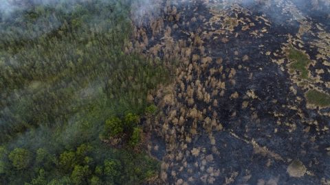
More efficient cookstove projects earn credits based on the amount of carbon they save by preserving trees that would have otherwise been cut down and burned for fuel. But if those trees later burn in a wildfire or are logged, the carbon stored would be released anyway, erasing the climate benefits of the credits.
Several carbon credit developers, conservation NGOs and the UN Environment Programme (UNEP) disputed that cookstove projects face this risk, in what critics described as a “coordinated lobbying campaign”.
They argued that, unlike forest protection schemes, this type of credit represents a “flow” of avoided emissions rather than a “stock” of stored carbon that can be released. They also warned that requiring a buffer would impose disproportionate costs and undermine the financial viability of these activities.
But the UN carbon market regulator was not persuaded by the argument. It decided that projects would have to protect against this reversal risk by handing over a percentage of credits to a so-called “buffer pool” instead of selling them.
‘New paradigm’
The amount of credits to be given up is calculated by applying different methods for natural risks, like wildfires, droughts or hurricanes, and human-caused ones, such as logging or land clearing.
For natural risks, project developers will need to apply local risk values derived from new modelling published by a group of independent scientists.
Campaigners have broadly welcomed the decision. Federica Dossi, an expert at Brussels-based advocacy group Carbon Market Watch, said it sets a new paradigm for calculating reversal risk based on empirical data. “This approach is grounded in science and we hope to see this now being adopted by other carbon crediting mechanisms in the voluntary market,” she added.
Backers claim this method is more rigorous than current practice in the voluntary carbon market, which largely