
English version below
Die letzte Woche unserer Expedition ist angebrochen und wir haben die Labradorsee in Richtung Osten verlassen. Die verbleibenden Tage werden wir mit Messungen der CTD-Rosette verbringen. Sie besteht aus einem Kranz von Flaschen, mit denen wir Wasserproben nehmen können und zusätzlichen Messgeräten, die darunter angebracht sind. Die eigentliche CTD (die Abkürzung steht für: Conductivity = Leitfähigkeit, Temperature = Temperatur, Depth = Tiefe) ist ein Messgerät an der Unterseite der Rosette. Zusätzlich gibt es noch eine kleine Kamera, die Bilder aufnehmen kann und ein Messgerät, das Fluoreszenz misst. An bestimmten Positionen müssen wir dann das Schiff anhalten und lassen die Rosette an einem Kabel bis zum Boden hinab. Bei Wassertiefen, die teilweise über 3000m betragen, kann es bis zu 2 Stunden dauern, bis die CTD-Rosette nach unten und wieder nach oben gefahren ist.
Die geplanten CTD-Stationen sollten uns Stück für Stück Richtung Grönländischer Küste führen. Die küstennahen Messungen sind dabei besonders interessant, um ähnlich wie in der Labradorsee den tiefen Randstrom zu untersuchen. Doch bei diesem Plan machte uns das Eis einen Strich durch die Rechnung. Auf der einen Seite freuten wir uns über die Schönheit der zahlreichen Eisschollen um uns herum, auf der anderen Seite verhinderten sie leider auch unser Vorankommen zu den küstennahen CTD-Stationen.

Aus dem Film Titanic haben wir alle gelernt: So ein Eisberg kann zum fatalen Problem für ein Schiff werden. Aber ist das eigentlich noch aktuell? Laut Kapitän Björn Maaß, können Eisberge heutzutage durchaus noch Schiffe versenken. Wir haben allerdings einen Vorteil, gegenüber der Titanic: das Radar, auf dem man Eisberge sehr gut erkennen kann. Nicht so gut erkennbar sind allerdings die von Eisbergen abgebrochene kleinere Eisstücke, Growler genannt. Growler (wortwörtlich übersetzt Brummer) sind nach dem Geräusch benannt, das sie beim Aus- und Abtauchen in der See verursachen. Teilweise sind sie schon mehrere Jahre unterwegs, weshalb sie häufig aus härterem Eis bestehen und nicht so weit aus dem Wasser schauen, da sie schon rundgewaschen sind. Um auch die Growler im Blick zu behalten, ist es deshalb wichtig zusätzlich zur Radarbeobachtung auch aus dem Fenster zu schauen, um alles im Blick zu behalten.
Damit kommen wir zu dem Problem, das unsere CTD-Messungen verhinderte. Es ist nämlich nicht nur das Eis, sondern die Kombination aus Eis und schlechten Sichtverhältnissen, die zur Gefahr wird. Zu Beginn der Stationsarbeit hatten wir Nebel aber nur wenig Eis. Später klarte es auf und das Eis wurde mehr. Solange die Sicht gut ist, sind bis zu 70-80% Bedeckung der Wasseroberfläche mit Eis noch in Ordnung, so der Kapitän. Doch der erneut aufziehende Nebel verringerte die Sicht drastisch. Solange die CTD-Rosette im Wasser ist, ist das Schiff in der Manövrierfähigkeit eingeschränkt und könnte damit einem auf das Schiff zutreibenden Eisberg schlecht ausweichen. Selbst nah am Schiff vorbei treibende Eisberge können zur Gefahr werden. Wie allgemein bekannt, befindet sich der Großteil eines Eisberges unter Wasser. Durch Abtauen des Eises kann es zur Verlagerung der Gewichtsverteilung und damit zum Drehen oder Kippen des Eisberges führen. Sollte das in der Nähe des Schiffes passieren, kann es zu einer Kollision kommen.

Vielleicht fragt sich an diesem Punkt der ein oder andere: ist die Maria S. Merian nicht ein Eisbrecher? Wieso ist das Eis dann überhaupt ein Problem? In der Nord- und Ostsee, wo man es nur mit einjährigem Eis zu tun hat, kann sie tatsächlich bis zu 80cm Eis brechen. In dem Gebiet, in dem wir uns jetzt befinden, kann es aber durchaus sein, dass sich eingeschlossen im einjährigen Eis auch ältere Stücke befinden. Diese haben bereits einen oder mehrere Sommer überstanden und sind dadurch schon mehr verdichtet und damit härter. Versucht man dieses dann zu brechen, kann das Schiff beschädigt werden. Das führte mutmaßlich zum Untergang des Kreuzfahrtschiff Explorer 2007 in der Antarktis. Die Besatzung des Schiffes war auf der Nord- und Ostsee ausgebildet und damit nur im Umgang mit einjährigem Eis geschult.
Fassen wir also kurz zusammen: Eisberge sind auch heutzutage noch eine Gefahr für die Seefahrt. Dank Radar kann man das Eis zwar sehr gut beobachten, doch die Sichtverhältnisse sollten trotzdem möglichst gut sein, wenn man sich in einem Eisfeld befindet. Außerdem ist nicht jedes Eis gleich und muss auf Grund des Alters, der Form und der Größe differenziert betrachtet werden.

Bleibt nur noch die Frage, was passieren würde, sollte unser Schiff die Maria S. Merian doch einmal mit einem Eisberg zusammenstoßen. Das kann auch der Kapitän nicht so leicht beantworten. Zuerst einmal ist die Geschwindigkeit des Schiffes ein wichtiger Faktor. Bei einer Kollision mit 2 Knoten Fahrt, würden die Eisstücke höchstwahrscheinlich nur zur Seite geschoben werden, während ein Zusammenstoß bei 10 Knoten Geschwindigkeit gefährlicher wäre. Außerdem hängen die Auswirkungen eines Zusammenstoßes noch von einigen weiteren Kriterien ab, zum Beispiel wie groß der Schaden ist und wo sich das Loch befindet. Da das Schiff in mehrere Sektionen unterteilt ist, die sie sich wasserdicht voneinander abschotten lassen, kommt es darauf an wie viele und welche Abteilungen volllaufen. Solange nicht Maschinenraum und Windenraum oder nur zwei Sektionen geflutet werden, bleibt die Maria S. Merian schwimmfähig. Für uns bleibt das eine hypothetische Überlegung. Am Ende hatten wir einen atemberaubenden Ausblick, der uns über die verpassten CTD-Stationen hinweggetröstet hat und wurden von der Brücke sicher wieder aus dem Eis herausmanövriert.
The downside of icebergs
The last week of our expedition has dawned and we have left the Labrador Sea towards the east. The remaining days will be spent with measurements of the CTD rosette. It consists of a wreath of bottles with which we can take water samples and additional measuring instruments attached underneath. The actual CTD (abbreviation stands for Conductivity, Temperature, Depth) is a measuring device on the underside of the rosette. In addition, there is a small camera that can take pictures and a meter that measures fluorescence. At certain locations we then have to stop the ship and drop the rosette on a cable down to the ground. At water depths, some of which are over 3000m, it can take up to 2 hours for the CTD rosette to go down and back up.
The planned CTD stations should lead us step by step towards the Greenland coast. The measurements near the shore are particularly interesting to study the deep margin current, as in the Labrador Sea. But with this plan, the ice broke our hearts. On the one hand we enjoyed the beauty of the numerous ice floes around us, on the other hand they unfortunately prevented our progress to the coastal CTD stations.
We all learned from the movie Titanic: an iceberg like this can become a fatal problem for a ship. But is this really still relevant? According to Captain Bjorn Maas, icebergs can still sink ships today. However, we have one advantage over the Titanic: the radar, on which you can see icebergs very well. However, smaller pieces of ice broken off by icebergs, called growlers, are not so well visible. Growlers are named for the noise they make when they go out and dive in the sea. Some of them have been floating around for several years, which is why they often consist of harder ice and do not look as far out of the water as they have already washed around. In order to keep an eye on the growlers, it is therefore important to look out the window in addition to radar observation to keep an eye on everything.
This brings us to the problem that prevented our CTD measurements. It is not just the ice, but the combination of ice and poor visibility that becomes the danger. At the beginning of the station work we had fog but only a little ice. Later, it cleared up and the ice became bigger. As long as visibility is good, up to 70-80% coverage of the water surface with ice is still fine, according to the captain. But the re-emerging fog drastically reduced visibility. As long as the CTD rosette is in the water, the ship is limited in maneuverability and could thus badly dodge an iceberg drifting towards the ship. Even icebergs drifting close to the ship can become a hazard. As is common knowledge, most of an iceberg is underwater. By thawing the ice, it can shift the weight distribution and thus turn or tip the iceberg. If this happens close to the ship, there may be a collision.
At this point, some may wonder: isn’t the Maria S. Merian an icebreaker? Why is ice a problem? In the North and Baltic Seas, where you only have to deal with one year old ice, it can actually break up to 80cm of ice. In the area in which we are now, however, it may well be that there are older pieces trapped in the one-year ice. These have already survived one or more summers and are therefore already more compacted and thus harder. If you try to break it, the ship can be damaged. This led to the sinking of the cruise ship Explorer in Antarctica in 2007. The crew of the ship was trained in the North and Baltic Seas and thus trained only in handling one year’s worth of ice.
So let’s summarize briefly: icebergs are still a danger to shipping today. Thanks to radar you can observe the ice very well, but the visibility should still be as good as possible when you are in an ice field. In addition, not all ice cream is the same and needs to be considered differentiated based on age, shape and size.
The only question left is what would happen if our ship, the Maria S. Merian, collided with an iceberg. The captain can’t answer that easily. First of all, the speed of the ship is an important factor. In a collision at 2 knots, the pieces of ice would most likely only be pushed aside, while a collision at 10 knots speed would be more dangerous. In addition, the impact of a collision depends on a number of other criteria, such as the size of the damage and where the hole is located. Since the ship is divided into several sections, they are sealed off watertight from each other, it depends on how many and which sections are full. As long as engine room and windroom are not flooded or only two sections are flooded, the Maria S. Merian will remain floating. For us, this remains a hypothetical consideration. In the end, we had a breathtaking view that consoled us over the missed CTD stations and were safely maneuvered out of the ice again from the bridge.


Recently, you may have heard about something called “El Niño.” But what exactly is El Niño and its sibling “La Niña”? Why do these terms seem to emerge from the depths of the scientific community and drop into popular vocabulary every few years? And how are they connected to extreme weather and our ocean?
What Are El Niño and La Niña?
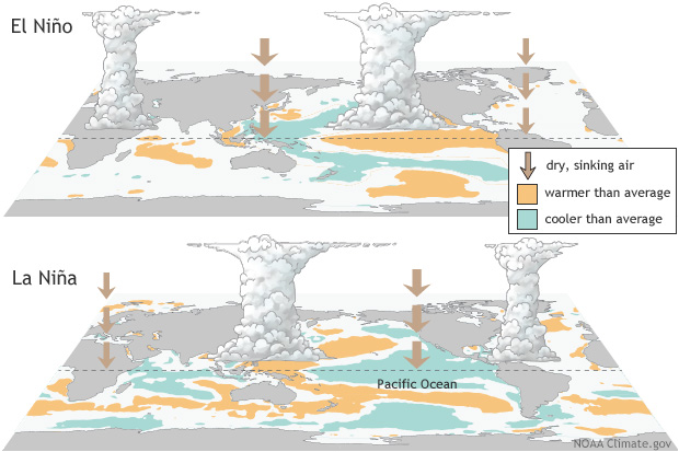
El Niño and La Niña are part of a natural climate pattern in the tropical Pacific called the El Niño-Southern Oscillation, or ENSO. These two phases are different sides of the same coin, creating equally extreme shifts in temperature and air pressure.
El Niño occurs when surface water in the equatorial Pacific becomes warmer than average and easterly winds weaken. La Niña is the opposite: cooler-than-normal sea surface temperatures and stronger easterly winds. ENSO cycles can last up to seven years. El Niño and La Niña significantly impact weather patterns in all corners of the globe, often leading to more extreme weather, storm frequency and intensity.
A strong El Niño can cause flooding in some regions and drought, heat waves and wildfires in others. It often causes crop losses, coral bleaching and marine die-offs due to unusually warm ocean temperatures. El Niño tends to suppress Atlantic hurricane activity, though it increases the risk of heavy precipitation and harm to fisheries elsewhere. In the Northern Hemisphere, El Niño typically builds between March and June, peaks in December, and weakens by February.
La Niña, by contrast, often fuels an active Atlantic hurricane season and increases tornado frequency across the southern United States. Like El Niño, it builds in spring and peaks around December.
Get Ocean Updates in Your Inbox
Sign up with your email and never miss an update.
Predicting ENSO
In 1923, the physicist Sir Gilbert Walker discovered the “Southern Oscillation,” or large-scale changes in sea level pressure across the tropical Pacific. However, it wasn’t until the late 1960s that the metorologist Jacob Bjerknes found that the changes in the ocean and the atmosphere were connected, and the hybrid term “ENSO” was born. In 1974, researchers at Oregon State University attempted to predict ENSO for the first time.
Modeling has greatly advanced since the early days. Today, scientists at the National Oceanic and Atmospheric Administration (NOAA) issue regular predictions about ENSO, which are now more accurate than ever.
NOAA gives a one-in-four chance that an El Niño could reach “very strong” intensity later in 2026, qualifying it as a “super El Niño.” This threshold has been crossed only a handful of times in recorded history, each triggering droughts, floods and record temperatures across multiple continents. NOAA’s data and models deliver life-saving early warning forecasts, like that of the predicted super El Niño, which allow communities to better prepare for and respond to extreme weather events.
Take Action
Every American, regardless of where they live, depends on NOAA’s scientists and professionals, whose work spans from the ocean floor to the far reaches of space. Unfortunately, NOAA is under threat. The Trump administration has proposed billions of dollars in cuts to the agency, which could weaken weather forecasting, disrupt fisheries management and stall critical ocean research, putting American lives and global scientific leadership at risk.
Ocean Conservancy is committed to working with NOAA to keep the public informed on climate and ocean science. We all benefit from a healthier ocean, and investing in research is the most effective way to restore ocean health and reduce the impact of severe weather events caused by El Niño and La Niña. Our ocean is not partisan, and protecting it requires all hands on deck and all sides of the aisle. Now, it’s more important than ever to demand that members of Congress prioritize our ocean. Add your name now.
The post Do You Know the Difference Between El Niño and La Niña? appeared first on Ocean Conservancy.
Ocean Acidification
Wind, waves, and boat noise: The first four weeks of underwater sound research in Akkeshi, Japan.
This is the first blog from GAME 2026
Learning to listen
What does the ocean sound like? There is the wind moving across Akkeshi Bay, deer grazing in the woods next to the ocean, and the soft rhythm of the waves against the jetty. Moreover, there is a fox foraging along the shore (かわいい。- kawaii), the seagulls` sharp calls from the sky, and the distant hum of fishing boats. And beneath the water surface? There is an entirely different world of sound.
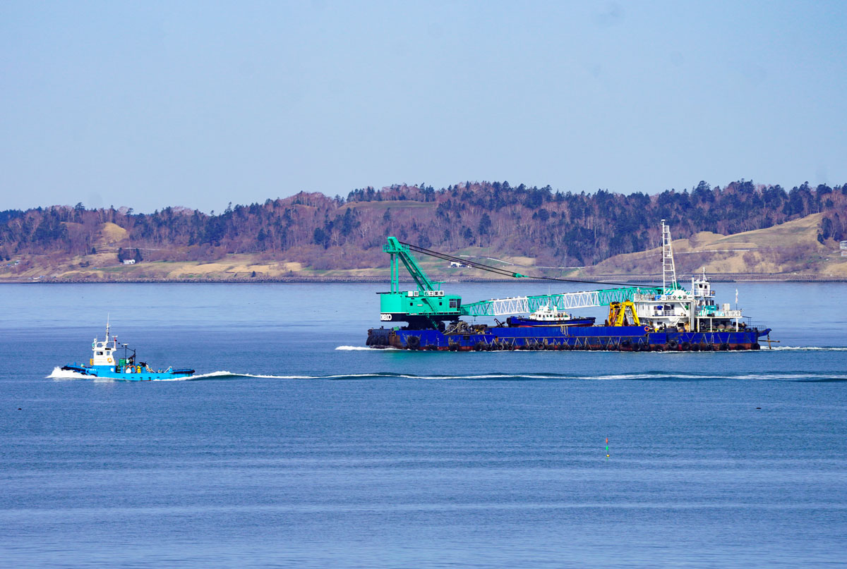
Underwater sound travels faster, farther and often in all directions. The underwater world is constantly active, even though it appears silent to us humans. Tiny larvae drift and swim through the water, searching for a place to settle to become adults. They are guided by chemical cues, light, and sound. What happens if that process is distracted by sounds like boat noise? Will the larvae still settle or will they look for other places?
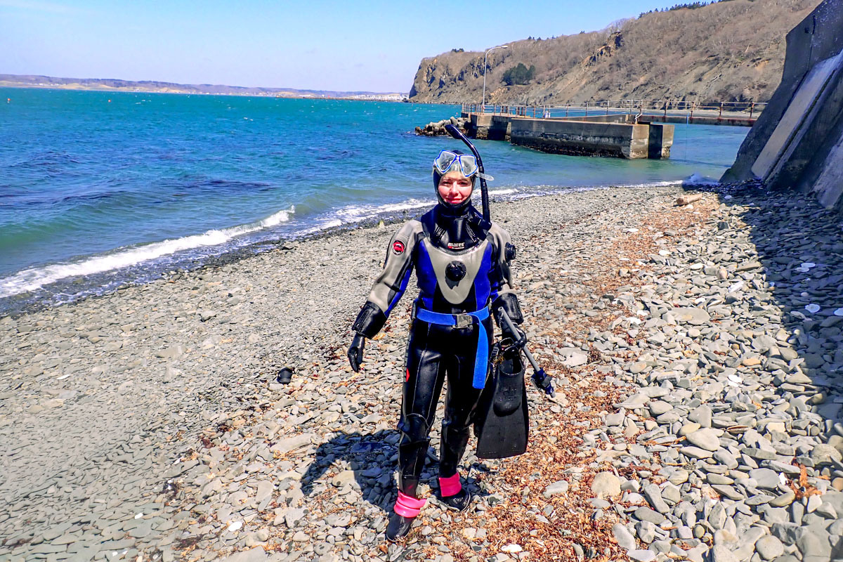
Four weeks ago, I arrived in Japan, to begin the fieldwork for my Master´s thesis as part of GAME 2026 at the Akkeshi Marine Station (AMS in short).
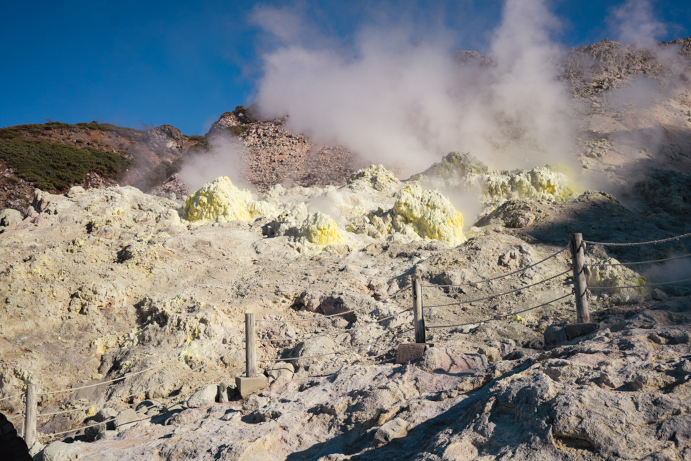
Akkeshi has a small fishing economy, which is mainly known for oyster farming. The town is remote, windswept, and deeply connected to the sea — making it an ideal natural laboratory for marine research.
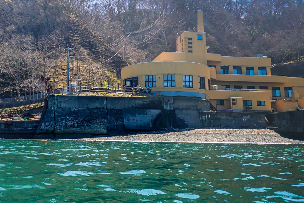
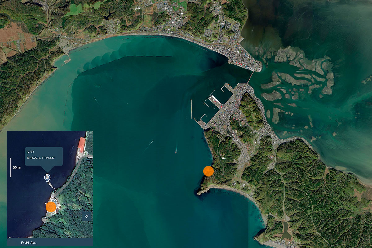
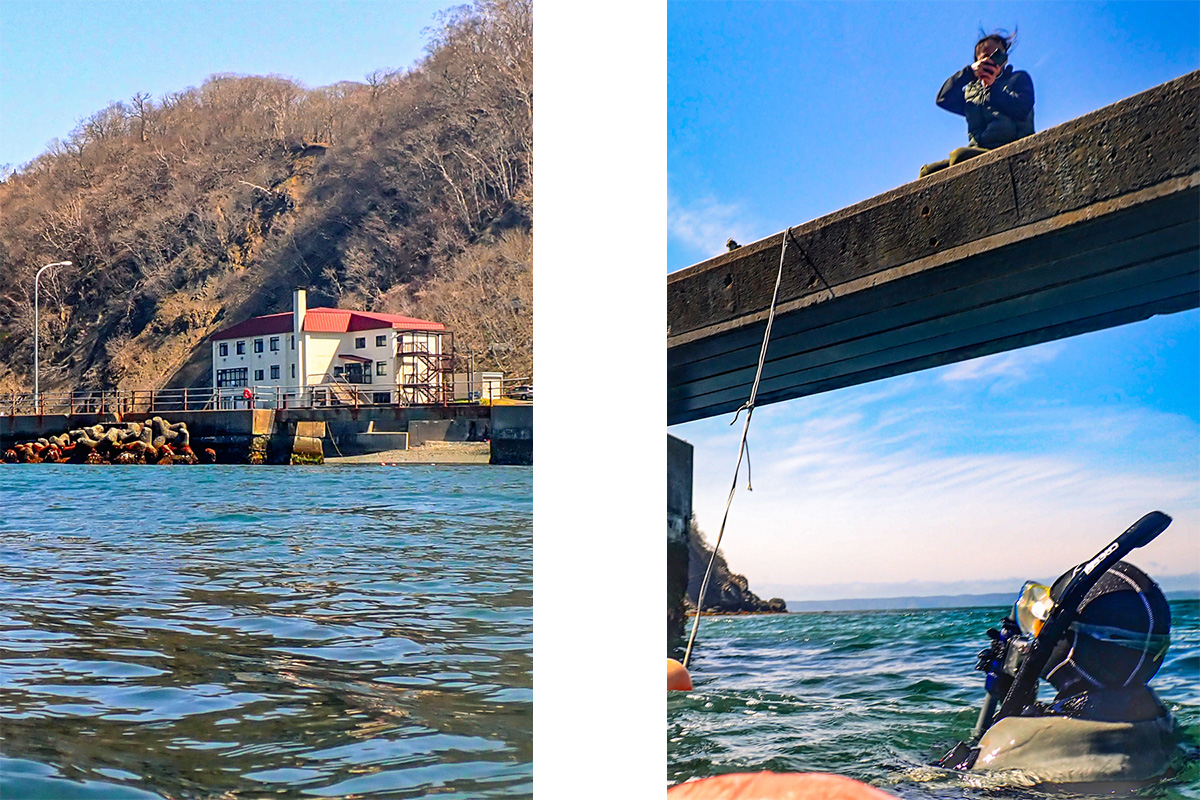
Akkeshi is located in eastern Hokkaido, in a remote and largely natural region with extensive wetlands that are rich in birdlife, while the town is surrounded by coastal cliffs and forests. An iconic red bridge leads from the town of Akkeshi to the marine station, which lies within a protected area.
The marine station, where I am based, is located directly at the coast and experiences strong tidal variation both seasonally and daily. From the very first day, it was clear that this project would not only be about data collection, but also about adapting to a new environment — scientifically, culturally, and personally.
My research explores how underwater soundscapes, such as noise from ship engines, interacts with hard-bottom communities. In particular, I will examine whether boat noise affects the formation and early development of these communities. To test this, I will deploy an underwater loudspeaker that plays back boat noise towards PVC settlement panels, which simulate a vertical surface for the settlement of invertebrate larvae. During and after the experiment, I will analyse the composition of the communities that establish on the settlement panels and will compare it to the composition of assemblages that developed in the absence of boat noise.
Over the past four weeks, I have been laying the groundwork for this field experiment by testing the equipment, observing the weather and wave conditions at the experimental site, and building the experimental setup that will later allow me to collect the data for my thesis. Come with me and get a glimpse on how I conduct the preliminary work.
Building the foundation: Preliminary work
GAME projects are usually carried out by two-person teams. However, in 2026 no Japanese student was found for Team Japan and therefore I am working more independently with some support by Jun Hirose, who is an employee at AMS. I also get a lot of help from other people working at the station, including the very kind technicians. To make sure we understand each other about setups and difficult constructions, I established to draw things out to make it easy for everyone to follow my ideas.
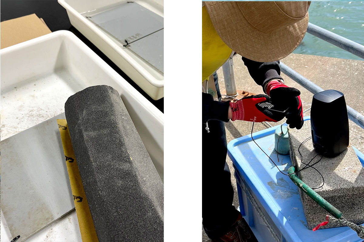
The first phase of my stay in Akkeshi has been dedicated almost entirely to tests and preparations. Before any meaningful data collection can begin, it is essential to test how the equipment performs under real-world conditions.
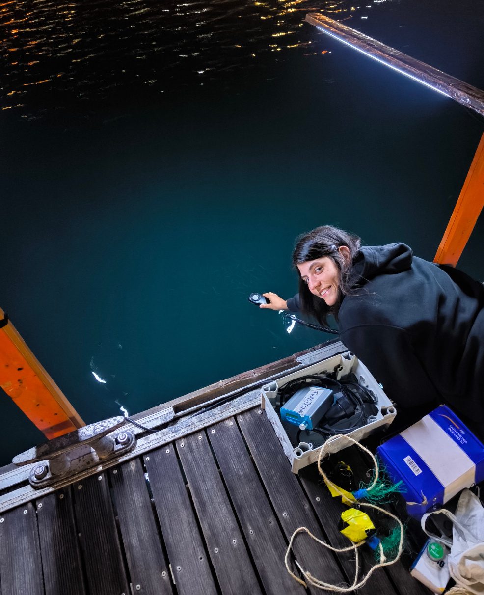
One of the key components of my project is an underwater sound system for recordings and playbacks. I began with testing the hydrophones and the sound playback devices under controlled conditions in the laboratory, e.g. in tanks, before gradually moving to open-water trials. During these tests, I verified signal clarity and noise levels, experimented with different cable configurations, and evaluated how sound propagates in coastal waters.
In addition to the technical setup, I also started with doing preliminary underwater recordings. They will serve as a baseline for assessing acoustic isolation, i.e. making sure that the treatment level that does not include sound playbacks does not receive sounds from the boat noise treatment level.
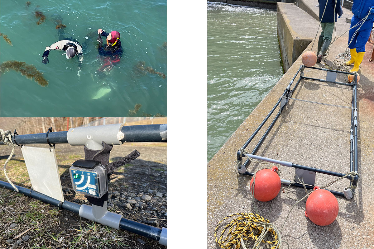
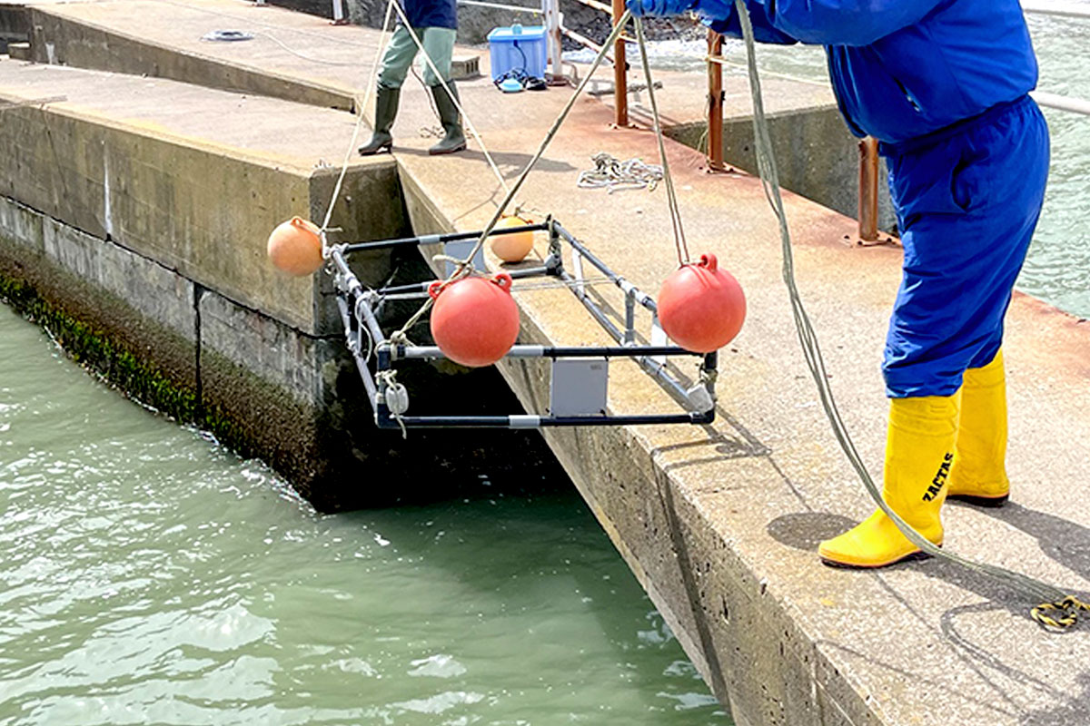
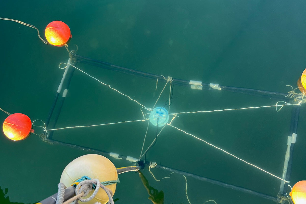
Designing and testing the experimental frame A milestone in these first weeks was the construction and testing of the experimental frame. This structure is designed to hold the settlement panels and the acoustic equipment in place at specific depths in the water column. It is built from PVC pipes, which are stabilized with ropes and buoys, and is anchored near the pier of the marine station. One of the first tasks was to attach panels to the frame, which will later be used as settlement substrata, but for now the goal was simply to test their stability and positioning.
Field deployment is rarely straightforward as wind, waves, and currents constantly interfere with even the simplest tasks. Lowering the frame into the water required careful coordination, and retrieving it was often even more challenging. During these activities, I spent a significant amount of time on the pier, working close to the water, adjusting ropes, checking connections, and observing whether the setup remains intact over time.
Communication beyond language One unexpected but important aspect of my work here has been communication across language barriers. The technician I work closely with does not speak English, and my Japanese is still very basic. To bridge this gap, I began drawing detailed sketches of the experimental setups.
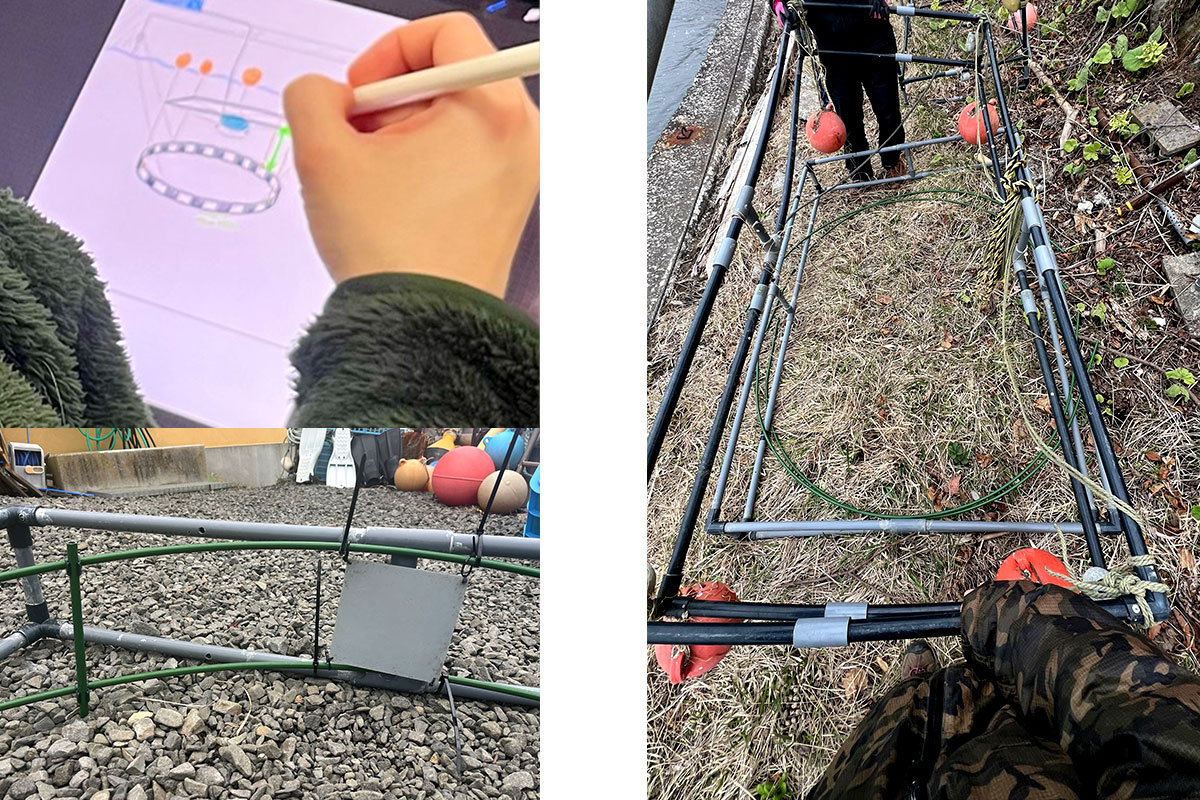
Every adjustment of the setup, no matter whether it was the placement of a hydrophone, the angle of a panel, or the water depth in which a frame is deployed, was first translated into a visual diagram. Over time, this method proved incredibly effective. It not only improved communication, but also forced me to think more clearly about the design of my experiment.
The experimental site: Knowing nature
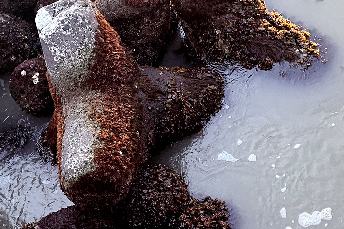
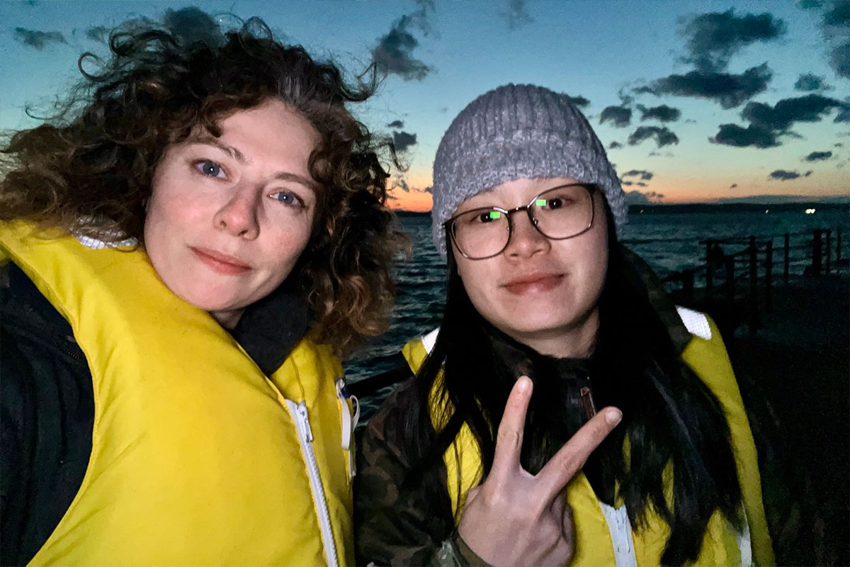
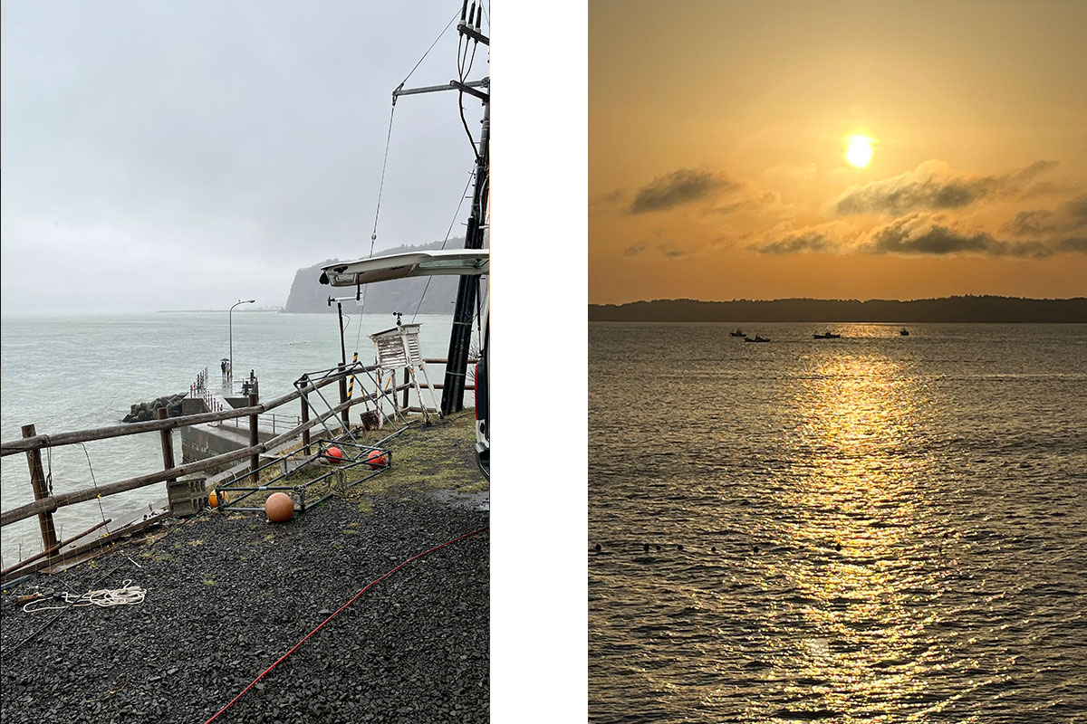
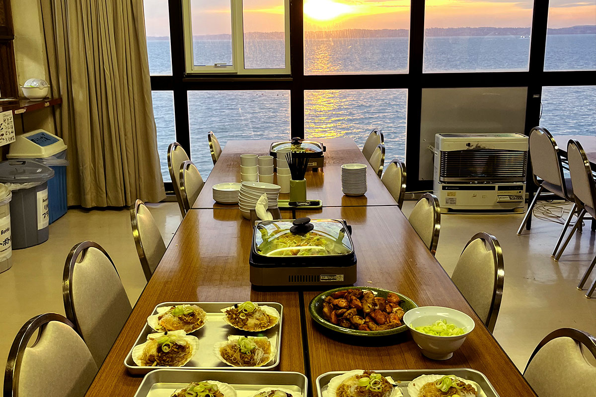
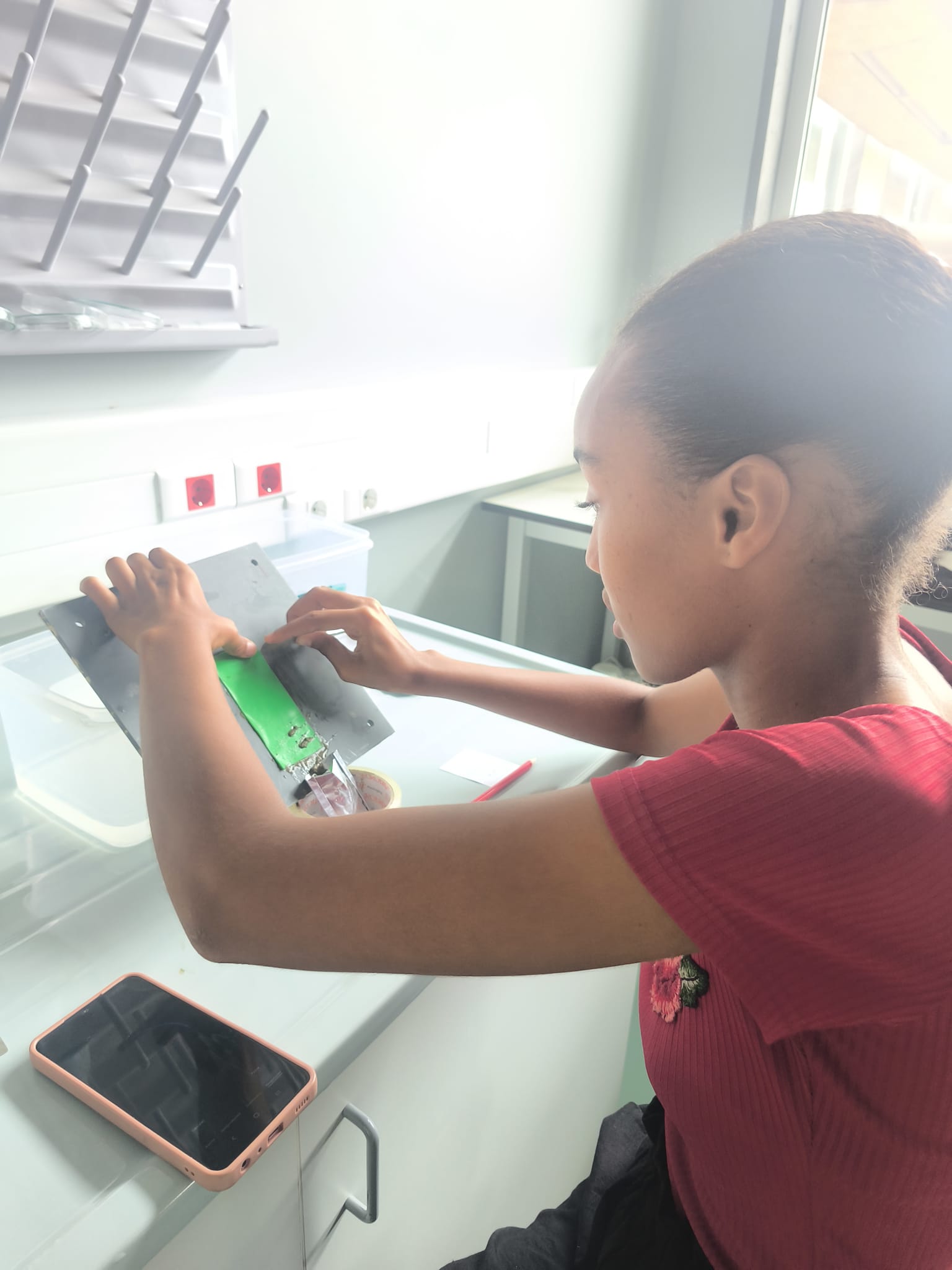
A crucial part of my project so far has been documenting the conditions at the experimental site. To make sure that the experimental setup will not be damaged, it was important to get to know the tides, the currents and the weather conditions. At times, harsh weather conditions forced us to take a break from field work. In those moments, I enjoyed the cinematic scenery of sunsets, and I turned to other tasks, such as sanding the settlement panels in order to make their surface more suitable for colonizers.
Life at the marine station
Life at the marine station is a balance between fieldwork and lab work. After long hours outside, I often return to the lab to clean equipment, process preliminary data, or prepare for the next deployment.
I have also spent time helping others with their work, which has been an important part of integrating into the team. Whether assisting with equipment, handling or sharing observations, these interactions have made the experience of working at AMS more collaborative and less isolating. The station itself is modest but well-equipped. It provides everything that is necessary for field-based marine research, and its proximity to the water makes transitions between lab and field seamless.
Surprisingly, Jun Hirose and I got a welcome party from the whole office. It was a great opportunity to talk (or gesture) with other members of the station. And of course, there was great food, cooked by some of the researchers.
Nature and wildlife encounters
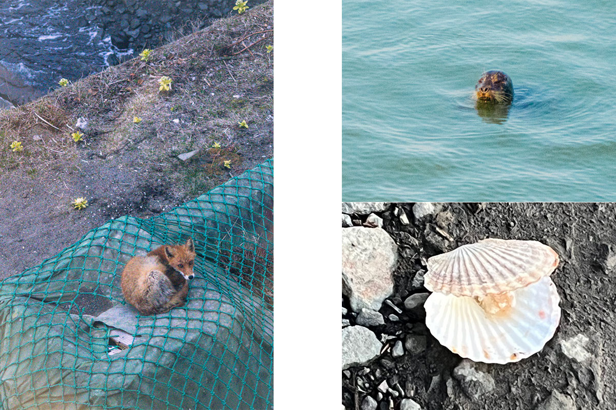
While the focus of my project is on underwater acoustics, the environment near the marine station constantly reminds me that this is a living ecosystem. Deer frequently wander near the station, sometimes appearing unexpectedly along the road. On a few occasions, I have even spotted a fox passing by quietly or lying next to the dining area at the guesthouse.
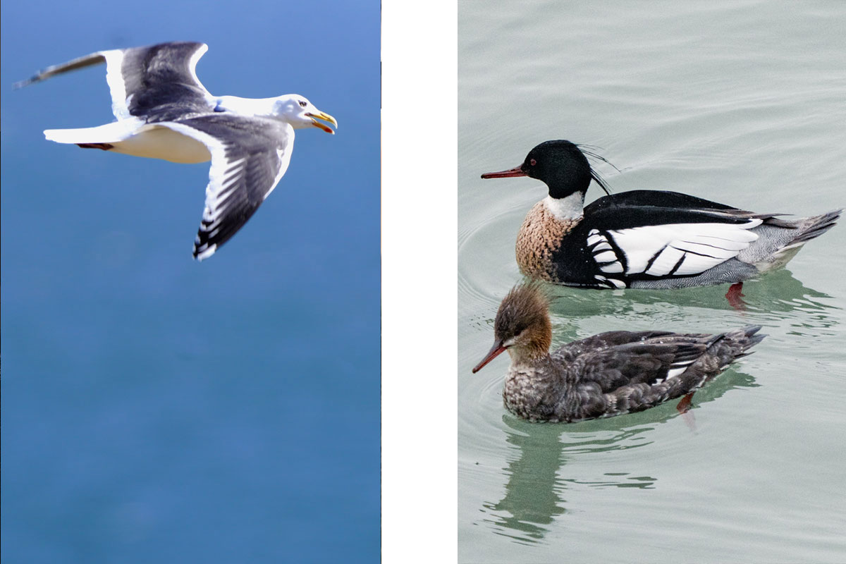
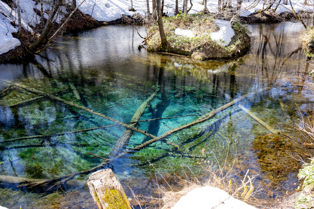
During a weekend break, I took the opportunity to explore Hokkaidō’s nature further to watch birds and seals. Watching seals swimming in the water, while seabirds circled overhead added another dimension to my understanding of the site. These animals are not just part of the scenery, they are also part of the acoustic environment I am studying.
What comes next
In the next phase of the project, I will shift from preparations to the systematic collection of data. With the setup tested and refined, I will run a controlled experiment to analyze whether sound interferes with the settlement of larvae.
What comes next
In the next phase of the project, I will shift from preparations to the systematic collection of data. With the setup tested and refined, I will run a controlled experiment to analyze whether sound interferes with the settlement of larvae.
I already started collecting data when I did recordings for assessing whether the frame that holds the settlement panels, which will not be exposed to boat noise, is acoustically isolated from the frame that holds the speaker.
Fieldwork is rarely smooth. Equipment fails, weather changes quickly, and even simple tasks can take much longer than expected. There have been days when strong winds made it impossible to deploy the setup, and others when technical issues forced me to repeat tests. However, each challenge has also led to small improvements such as better cable management, clearer protocols, and more efficient workflows.

Beyond the data, this experience has been shaped by the place and the people who made it possible. Working here in Akkeshi is a reminder that research is not just about results. It is about a process, adaptation, and observation. It is about learning to listen, not only to underwater soundscapes, but also to the environment and the people around you. I feel very lucky to be able to be here and I appreciate the moments I have been collecting so far and I am looking forward to the next four months. Because sometimes, the most interesting discoveries are not the ones you set out to find, but the ones you encounter along the way.
厚岸、ありがとうございました。
お疲れ様です。
Maximiliane
Wind, waves, and boat noise: The first four weeks of underwater sound research in Akkeshi, Japan.
This post is the last blog of the GAME 2025 project. Unfortunately, it was delayed by several months (the project ended in December 2025), but it was not forgotten. Read now about the extraordinary and dramatic experiences that Andrea and Sarah made in Cabo Verde in 2025.
In April 2025, GAME returned once again to the islands of Cabo Verde, this time with Andrea (Technical University of the Atlantic, Cabo Verde) and Sarah (University of Potsdam, Germany). As in previous years, we were exploring the influence of artificial light at night (ALAN) on coastal organisms. The project in 2025 was supposed to bring more knowledge about its influence on the growth of marine epiphytes.
Cabo Verde comprises 10 main islands and a few islets, which are lined up in an arc in the Northern Atlantic. The archipelago was formed by underwater volcanoes that started to emerge from the depths of the ocean about 20 million years ago. The islands are characterized by a dry landscape that has arid and poorly permeable soils, which are almost infertile, and by rainfalls that do not appear every year. Hence, the inhabitants of the archipelago always found their greatest wealth in the sea. As the westernmost African country, its isolation has led to the evolution of marine species that are unique to the islands, while other species that arrived from elsewhere found favourable conditions here. As a relatively young nation, Cabo Verde has yet to explore much of its biodiversity, as well as the marine ecosystems in its waters. Partnerships between Cabo Verde and Germany, which result in projects such as the one we are participating in in the framework of GAME, are always celebrated as they contribute to the scientific enrichment of the country.
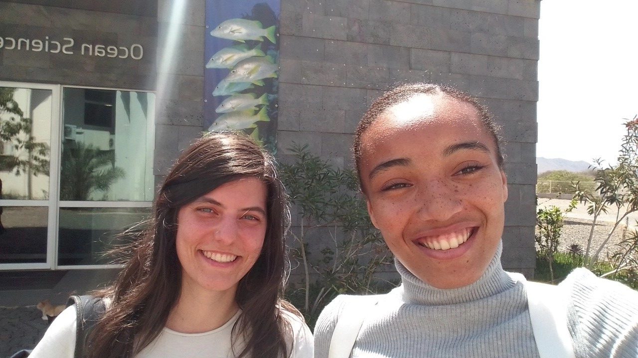
Our project was conducted in collaboration with the OSCM (Ocean Science Center Mindelo). The center is, on the one hand, linked to GEOMAR (GEOMAR Helmholtz Centre for Ocean Research Kiel) in Germany and, on the other hand, to IMar (Instituto do Mar) in Cabo Verde. It is dedicated to oceanographic observations and research, and also acts as a connection point for common research activities and the exchange between international scientific institutions. Laboratory work can, for instance, be carried out by using the center facilities and the available equipment. Our experiment, however, was conducted in the field, because of the need for a constant supply with seaweed spores that mediated the colonization of the substrates we provided by epiphytes.
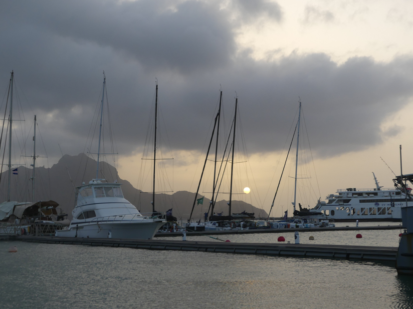
To meet the specific requirements of our study, Porto Grande Bay, more specifically the Mindelo Marina, was chosen as the study site. As its name suggests, this bay is one of the largest in Cabo Verde, and it is located in the northwest of the island of São Vicente. Its calm and shallow waters made it the ideal site for the study we were planning. Except for the intense sun and very strong wind that we felt during the first months of our field work, the place was one of the most interesting and dynamic ones in Mindelo. We spent our days on pontoon B, in front of the Marina Bistro bar, working from morning to night.
In the mornings, we could smell the aroma of stewed “catchupa” and of the seafood that was served there. In the afternoons, the atmosphere was enlivened by the most famous pop songs played at the Ponte d’Água Hotel. Whenever a familiar song came on, we couldn’t resist singing along: “Kiss me hard before you go, Summertime sadness…” At dawn, everything then became calmer. The water was still, and under the lights of the pier, fish swam in circles and created a silent spectacle. Furthermore, in the months before the nesting season in Cabo Verde, it was common to see sea turtles coming to the surface to breathe. Unfortunately, they were so fast that it was almost impossible to get a photo. So fast that Sarah rarely managed to see them. If it were a game, the score would be: Cabo Verde 7 x 1 Germany.
During our work, we met people, both local and from other countries, who were friendly and willing to help, whether with a screwdriver, a tape measure, or a kayak. They were teaching us how to tie a knot, they took photos and videos of us, were giving us ideas and suggestions, or simply provided us company. However, there were also plenty of curious onlookers, mainly elderly tourists who came from the bar-bistro over to the pier, and were interested in what we were doing.
We started our work with one of the biggest challenges of the project: finding a macroalga that could be suitable for the experiment. This alga would needed to have a leathery texture, a flat and broad surface, and should inhabit the subtidal. This was no easy task for us, because although Cabo Verde has a rich marine biodiversity, the biomass of macroalgal species is limited by the nutrient deficiency in the oligotrophic waters of the archipelago. Hence, macroalgae can only be found in small quantities. Furthermore, as it is a tropical country, this task was further complicated by the fact that the waters are warm and shallow, and such conditions mainly favour encrusting and filamentous macroalgae. We began our endeavor by searching online for inventory lists of marine macroalgae on the island of São Vicente, but this was without success. We then invested in more practical approaches, such as diving and snorkeling. We went to the Laginha Coral Cove accompanied by Professor Guilherme, who is a marine biology enthusiast. There, we found two species of macroalgae, both potentially invasive and possibly belonging to the genus Grateloupia, which were qualified to serve as “living substrates” in our experiment.
We collected several specimens of the two species to hang them into the harbour in Mindelo for a pilot study. This was to test if epiphytes would settle on the macroalgae and whether the macroalgae themselves would survive the conditions in the harbour.
Both species made it into the final round. One of them had the perfect shape, but it was far too rare for our needs, while the other candidate was much more abundant. So, we focused on the second one. A further problem we faced was that the macroalgae we worked with had not been scientifically described for Cabo Verde. This meant that there was no literature that we could have consulted to learn about morphological or physiological traits. Furthermore, we had no idea how the algae would performed at different water depths or during low tide when exposed to air.
After some weeks, however, it became clear that our chosen species were rather trapping sediment on their surface than hosting a healthy community of epiphytes. Actually, even under the microscope, sediment and epiphytes were almost impossible to separate. Our supervisor, Corrine Almeida, suspected that the algae’s branched structure made it a natural sediment trap and this was not ideal for our purposes.
Given the high sediment load and the generally murky water in the harbour, we realized that we needed a new plan. We revisited the idea of using our first, more promising species, but after extensive searching, we had to admit that there simply were not enough specimens.
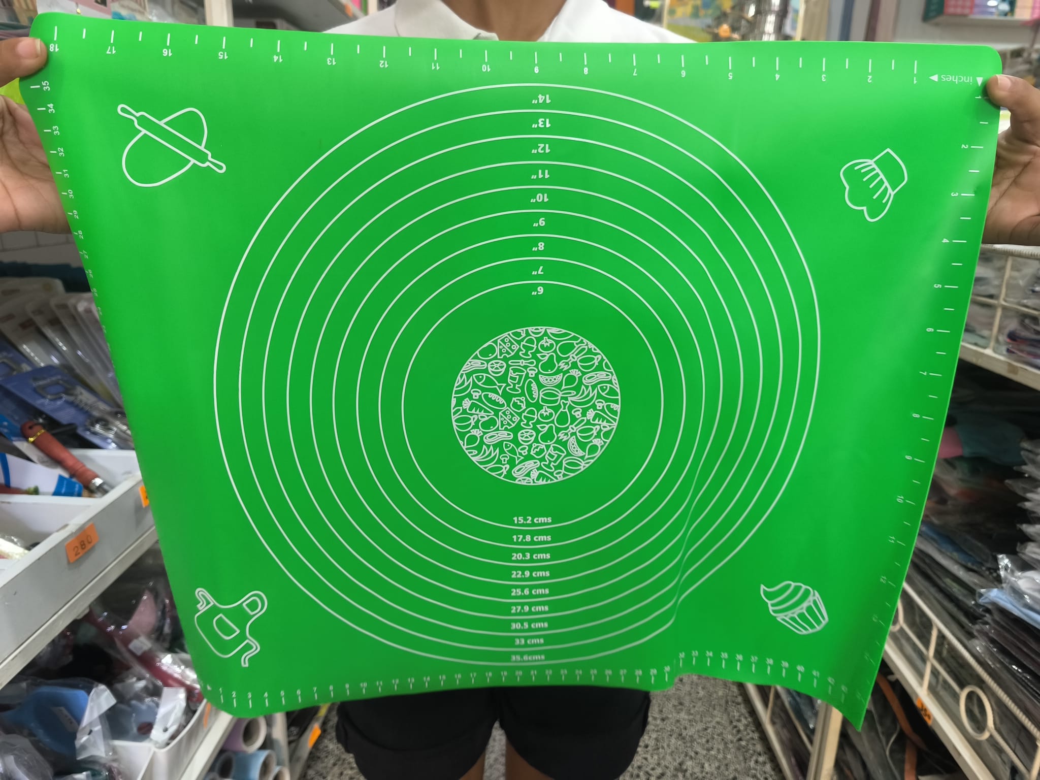
Due to this problem, we were unable to continue with the experiment, but the GAME programme coordinator, Mark, came up with a suggestion. The idea was to replace the living substrate with an artificial material that could, at least partly, simulate the traits of macroalgae, such as a flexible structure. Initially, we thought of using PVC tarpaulin, but this material has high chemical concentrations, which could affect the attachment of epiphytes. We continued searching in Mindelo until we finally found a silicone cooking mat in a Chinese store. The material was thin and malleable, requiring only to be soaked in drinking water for a few days to make its surface rougher. We bought eight green ones, which, after soaking, were cut into pieces that had the same size as the PVC plates.
For building the set up, we unpacked some materials that were left behind at OSCM by previous GAME teams, tested the LEDs, and cleaned the frames. One frame needed patching, while we built another one from the scratch. Mindelo does not have a giant all-in-one hardware store like the ones you can find in Germany – instead, you need to visit several smaller shops, while explaining every time at the counter what excatly you need. If they do not have it, they’ll usually send you to another store that might have it. After a few visits, the shopkeepers start to recognize you and let you rummage around in their storage rooms to find suitable alternatives.
We brought PVC panels from Germany and hand-cut them into 5 × 12 cm pieces. For the frames, we glued PVC pipes together and used thin ropes to create the inner structure. The panels were then attached to the ropes with cable ties, while the fake algae were sewed onto them with needle and thread.
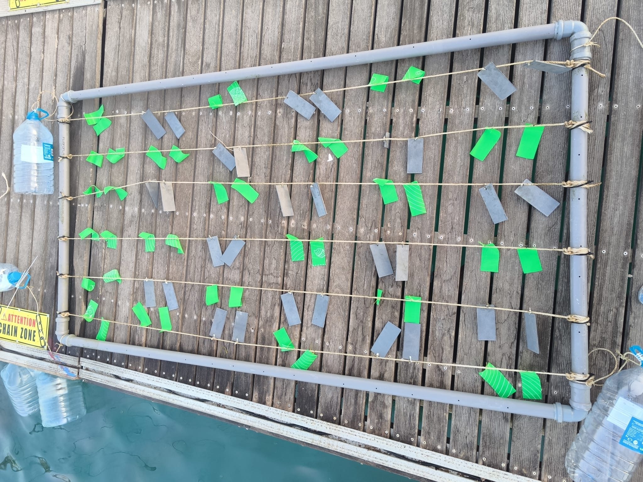
We then installed the lighting system with the help of Eder, who is a technician at OSCM. All electronics were kept in waterproof dry boxes, and we built wooden arms with metal brackets to hold them in their place on the pontoon. We aimed to create similar light fields for both of our frames: Andrea’s with an intensity of 10–20 lux, while Sarah’s had 20–30 lux. After some trial and error, we managed to tune the LEDs perfectly.
However, the real challenge in June was not the construction – it was the wind. With daily gusts of 25–40 km/h, anything lightweight was instantly blown away and we are proud to say that we only lost one measuring tape to the sea. Along the way, we pulled plenty of harbour trash from the water, but also some unusual finds – like a fully inflated unicorn float. We even managed to recover the lid of our dry box from the seafloor, along with a couple of our caps. Hats, in fact, did not stand a chance in the winds of June and keeping them on our heads required constant hand support, so we eventually gave up.
By early July, just in time for our first experiment, the weather turned calmer. This made deploying the frames with our kayak much easier. Earlier, any pause in paddling would have sent us drifting straight back to the pontoon. The kayak also came in handy for measuring the water depth at the experimental site and for adjusting our mooring lines.
In this moment, we were optimistic: The project was starting to get on track. It seemed that we could finally switch on the autopilot and continue the work as outlined in the GAME 2025 manual. However, first we had to test the different steps of the analytical processes in the laboratory. We collected some of the fake algae that we had placed on the frames as backups in case of losses, put them in freezer bags and packed the freezer bags in larger black bags that we filled with ice and transported them to the laboratory. The first step, i.e. scraping the epiphytes from the substrates, went well, but a problem emerged when we tried to perform vacuum filtration. For this, the suspension of seawater, epiphytes, and sediment was poured into the funnel of the filtration unit, and the device was turned on. After a considerable amount of time, we could see that the volume in the funnel had not changed, because the sediment had clogged the flow of water through the filter. We were once again faced with a new impasse, and this one required a solution within a week. This was because the first experiment had already been running for more than seven days and could only continue for one more week. We tried decanting, but the epiphytes and sediment settled at a similar rate at the bottom of the beaker, making it difficult to separate them. Then we tried sieving through different sized meshes, but in doing so we lost a lot of biomass, what would have compromised our results. We also tried a method involving aliquots, which could have worked, but it took too long to test it a second time.
With no time left, we decided to remove the filtration step and to leave the sediment in our samples, as we simply could not get rid of it. Hence, the freezer bags were already drained at the study site. In the laboratory, the epiphytes were scraped off and directly transferred to test tubes, which were then filled up with ethanol. This method proved to be successful as we obtained chlorophyll a concentrations that were similar to those of the other GAME teams. For the biomass samples, a similar method was used, but their processing required the use of a muffle oven to obtain the ash-free dry weight. As none of the institutions here in Mindelo have such equipment, the samples were transported to Germany to muffle them at GEOMAR.
At this point, we were already thinking about what aspects could be improved in our second experiment, which was already underway. Furthermore, Sarah recently completed her first dive, spotting a nurse shark, plenty of fish, and sea turtles. She was hoping to spend more evenings at the beach in the coming weeks, playing volleyball and enjoying live music, especially during the Baía das Gatas Festival—one of the largest festivals in the country—which was approaching. In the words of our advisor, “The project is now running smoothly.” However, no one expected that in August a country that rarely receives rain throughout the year would be shaken by the biggest storm in living memory.
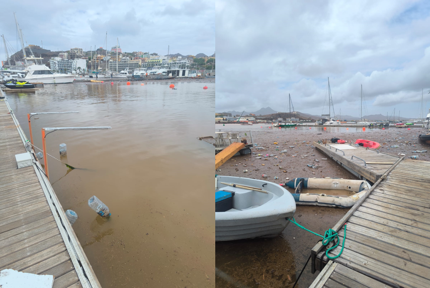
In the early hours of August 11th, storm Erin arrived without warning, causing material losses and, sadly, claiming the lives of nine people on the island of São Vicente. During the night, the scene was one of horror, with streets turned into rivers, lightning illuminating the entire city, and people desperately fighting for their lives and those of their loved ones as rainwater flooded their homes. In the morning, it was then possible to get a real sense of what had happened. Buildings had been knocked down, cars carried out to sea, shops destroyed, all caused by the force of the rainwater. The Mindelo micro-watershed, characterized by a mountainous terrain and a rugged topography, allowed the rainwater that fell on the city to flush to Porto Grande Bay, resulting in an exacerbated discharge of muddy water accompanied by trash. Experiment 2, which had already been in the water for a week, was canceled as the conditions in the bay no longer met the requirements for conducting an experiment. Square kilometers of water that had been crystal clear had turned brown and opaque, and we had no idea how long these conditions would last.
Soon after the storm, it was decided that the team would split up: Sarah would go to Finland to continue her project with the GAME team there, and Andrea would stay here to continue as soon as conditions had improved. A month passed, and the bay was slowly returning to its normal colour, but then another rain came and turned it brown again. Then it was too late to repeat experiment 2. But all is not lost. In January 2026, after we had completed the last phase of the project at GEOMAR in Kiel, Andrea considered to continue with the experimental work. At this time, the rainy season in Cabo Verde was over, and the water was still at mild temperatures.
The unforgettable catastrophe of August 11th 2025 in São Vicente allowed us to speculate on the origin of the mud/sediment that affected our experiment. The sediment that accumulated on the substrates probably came from the muddy water that floods Porto Grande Bay every year during the rainy season. Somehow—possibly due to the regular entry and exit of ferries from the port—the sediment gets resuspended frequently and travels through the water column by the forces of tidal currents and others. At least one riddle was solved.


-
Climate Change10 months ago
Guest post: Why China is still building new coal – and when it might stop
-
Greenhouse Gases10 months ago
Guest post: Why China is still building new coal – and when it might stop
-

 Greenhouse Gases2 years ago
嘉宾来稿:满足中国增长的用电需求 光伏加储能“比新建煤电更实惠”
-

 Climate Change2 years ago
嘉宾来稿:满足中国增长的用电需求 光伏加储能“比新建煤电更实惠”
-
Climate Change2 years ago
Bill Discounting Climate Change in Florida’s Energy Policy Awaits DeSantis’ Approval
-

 Renewable Energy8 months ago
Sending Progressive Philanthropist George Soros to Prison?
-

 Carbon Footprint2 years ago
US SEC’s Climate Disclosure Rules Spur Renewed Interest in Carbon Credits
-
Greenhouse Gases11 months ago
嘉宾来稿:探究火山喷发如何影响气候预测