

Die bisherigen Blogeinträge haben die atemberaubende und wunderschöne Arbeit der JellyWeb-Expedition gezeigt: Wir haben über farbenfrohe Kreaturen, hochmoderne Technologien und mutige Physiker allein unter Biolog:innen berichtet. Ja, unsere Projekte auf der Expedition MSM126 sind sehr vielfältig, und neben ihrer aufregenden Natur haben sie noch eine weitere Gemeinsamkeit: Sie alle produzieren tonnenweise Daten. Daten, die verwaltet und gepflegt werden müssen.
Ich will ehrlich sein: In einem Blog über eine Tiefsee-Biologie-Expedition würde ich den Beitrag zum Datenmanagement wahrscheinlich überspringen. Und ich denke, das ist einer der Gründe, warum es Jobs wie den meinen gibt – Wissenschaftler:innen lieben es, Daten zu generieren, aber ihre eigenen Daten zu verwalten? Das ist eine andere Geschichte.
Wenn eine wissenschaftliche Ausfahrt ein Piratenabenteuer wäre, wären die von uns gesammelten Daten der Schatz. Und alle hier an Bord arbeiten hart daran, die Schatzsuche erfolgreich zu gestalten. So bunt wie eine Schatztruhe voller Diamanten, Gold, Münzen und edlen Gewürzen, so vielfältig sind auch die von uns gesammelten Daten. Zum Beispiel sammeln Nahrungsnetz-Ökolog:innen wie Jamileh, Sonia und Florian (siehe Blogeintrag vom 21.02.2024) tausende individueller Organismen mit verschiedenen Netztypen aus unterschiedlichen Tiefen und Gebieten. Jeder einzelne Organismus durchläuft eine spezifische Prozedur, wird mehrmals fotografiert, möglicherweise in mehreren Experimenten verwendet und schließlich in noch mehr Unterproben für Museumssammlungen, Nahrungsnetze, genetische und andere Analysen aufgeteilt.
Es geht also nicht nur um einen Datensatz, sondern um eine Vielzahl von physischen Messungen, organischen Proben und Metadaten. Und wie es die gute wissenschaftliche Praxis verlangt, müssen diese Informationen im Auge behalten und gepflegt werden, um Verwirrung, falsche Datenerfassung oder im schlimmsten Fall Datenverlust zu vermeiden. Um eine Struktur in das bedrohliche Chaos zu bringen, verwenden Wissenschaftler:innen in der Regel standardisierte Protokolle, die alle notwendigen Informationen vor Ort abfragen.
Eine völlig andere Art von Daten sind Bilddaten. Eine wahre Besonderheit von MSM126 war die Vielfalt der optischen Geräteoperationen. Mit kamera- und sensorbestückten Geräten wie dem Meeresboden-Beobachtungssystem XOFOS, dem pelagischen Beobachtungssystem PELAGIOS und dem ROV PHOCA hatten wir drei Plattformen, die Untersuchungen des Meeresbodens und des Freiwassers durchführten – und dabei Terabytes an Bilddaten generierten.
Genauso wie physische Proben, wie gefangene Tiere oder gefiltertes Wasser müssen auch ihre digitalen Äquivalente ordnungsgemäß betreut werden und bestimmte Standards erfüllen, um in verschiedenen Forschungsprojekten verwendet werden zu können. Um nur einen zu nennen (der für alle Arten von Daten gilt), müssen die so genannten FAIR-Prinzipien eingehalten werden. FAIR bedeutet, dass die Daten auffindbar, zugänglich, interoperabel und wiederverwendbar sein sollen. Außerdem müssen alle digitalisierten Daten kopiert werden, um sicherzustellen, dass wir mehrere Backups haben. Man könnte also sagen, dass die eigentliche Arbeit erst beginnt, nachdem eine Probe vom Meeresboden an Bord gebracht wurde.

Eine echte Herausforderung während einer Forschungsfahrt ist nicht nur die Menge an stressiger Arbeit, sondern auch das Auftreten unvorhergesehener Situationen. Die schönsten Protokolle und durchdachtesten Arbeitsabläufe können der rauen Arbeitsrealität auf See zum Opfer fallen. Dann ist es von großem Vorteil, jemanden an Bord zu haben, der den Überblick über die geborgenen Schätze behält. Bei MSM126 hatte ich diese große Ehre. Es war das erste Mal in meinem jungen wissenschaftlichen Leben, dass ich diese Position innehatte, und ich denke, dass ich bis zum Ende der Reise genauso viel über Datenmanagement gelernt habe wie über den Umgang mit schwierigen menschlichen Interaktionen. Denn Datenmanager:innen müssen lästig sein. Als junge Datenmanagerin, die gerade ihr Masterstudium abgeschlossen hatte und ständig ihre älteren Kolleg:innen dazu bringen musste, das zu tun, was sie von ihnen wollte, brauchte ich ein gewisses Maß an Belastbarkeit und Kreativität.
Ich denke, es war ganz praktisch, dass ich eine Art dunkle Vergangenheit habe, denn eigentlich bin ich ausgebildete Meeresbiologin! Das kann durchaus hilfreich sein: Erstens habe ich Hintergrundwissen über eine ganze Reihe von wissenschaftlichen Aktivitäten hier an Bord und kann daher überschauen, was wir beim Umgang mit den Daten beachten müssen. Außerdem ist es sehr hilfreich, wenn man Artennamen in handgeschriebenen Protokollen entziffern muss (sorry, das musste ich einfach erwähnen). Zweitens bekommt man einen Eindruck davon, wie schwierig es ist, für die eigene Station, den Einsatz des Fanggerätes und die anschließende Verteilung der Proben verantwortlich zu sein und natürlich, dass alles dem eigentlichen wissenschaftlichen Ziel dienen muss.
Obwohl eigentlich alle Beteiligten ihre Daten sicher und unversehrt wissen wollen, dachte ich mir, dass ein bisschen Werbung für unsere Datenerfassungsstation nicht schaden könnte. Zum Beispiel mit dem Slogan „Dateneingabe ist so cool und hat mich von meinen Rückenschmerzen geheilt“ oder indem wir einen Monitor mit einem ROV-Livestream neben dem Datenlaptop aufstellen, um die Eingabe von hunderten Zeilen Metadaten in eine riesige Excel-Datei zu erleichtern…

Ich denke, wir alle haben die Bergung der riesigen Menge an Schätzen, die wir während der MSM126 erbeutet haben, gut gemeistert und mir bleibt nur noch zu sagen: Macht eure Backups! Vielen Dank fürs Lesen!
Sophie Valerie Schindler, Datenmanagerin (und heimliche Biologin)
Auge um Auge, Zahl um Zahl – das verborgene Wirken der Datenmanagerin


Ocean Acidification
Dr Heidarzadeh’s TV interview with SkyNews on the massive M7.7 Panama earthquake on 9 October 2026
Dr Heidarzadeh’s TV interview with SkyNews on the massive M7.7 Panama earthquake on 9 October 2026. Click here for the full story.
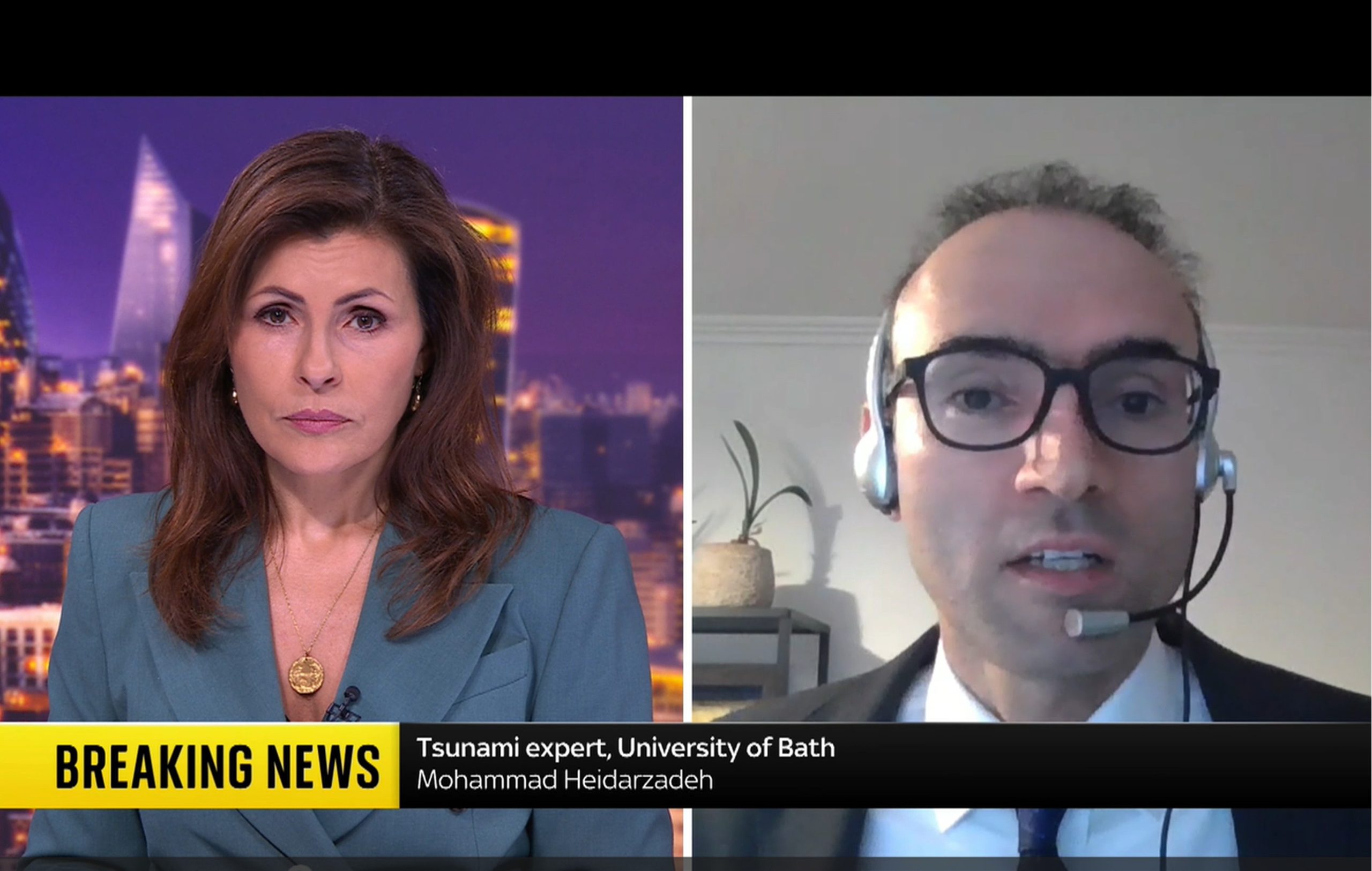
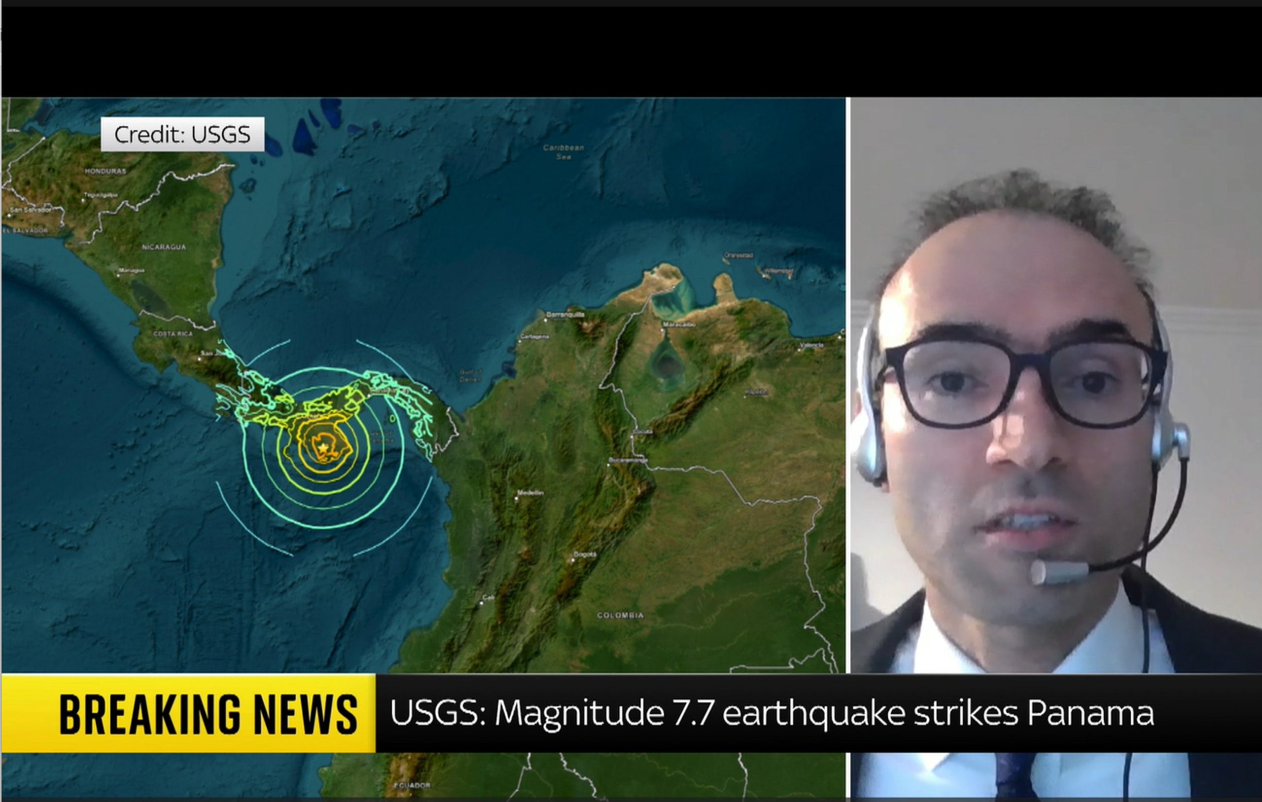
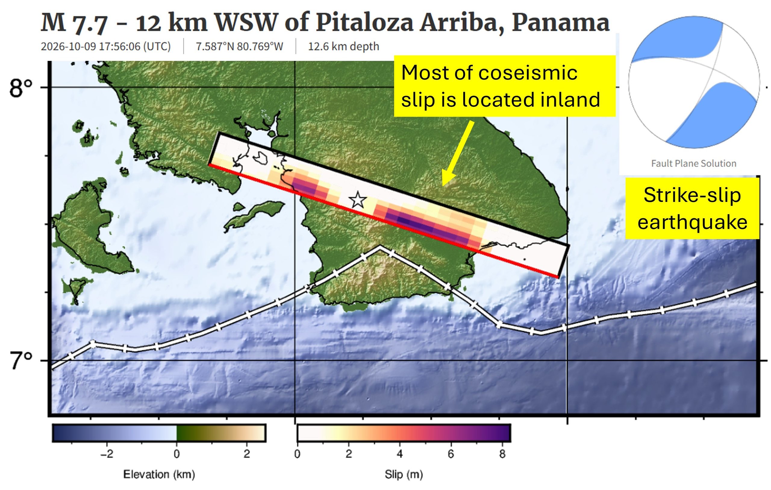
Dr Heidarzadeh’s TV interview with SkyNews on the massive M7.7 Panama earthquake on 9 October 2026
Our ocean is an incredibly vast and mysterious place. And there is no place where that is more evident than the deepest ocean area in the world: the legendary Mariana Trench. Located east of the Philippines, the Mariana Trench lies in the Mariana Archipelago in the western portion of the North Pacific. The greater area of the Mariana Trench Marine National Monument is made up of more than 95,000 square miles of ocean. Beneath these waters lie incredibly complex aggregations of submerged islands and volcanoes … and of course, an astoundingly massive trench.
Dive in with us to have your biggest questions answered about the famed Mariana Trench.
How deep is the Mariana Trench?
The deepest part of the Mariana Trench, known as Challenger Deep, is almost 36,000 feet below the ocean’s surface. For context, Mount Everest is about 29,000 feet above sea level, so the Mariana Trench is about 7,000 feet deeper than Mount Everest is tall. For one more comparison, the RMS Titanic lies at a depth of about 12,500 feet below sea level. The Challenger Deep is in waters nearly three times deeper than this ship’s final resting place.
Due to its enormous size, the Mariana Trench has at times been affectionately nicknamed the Grand Canyon of the ocean. This is certainly a picturesque image, but don’t let the mammoth size of this U.S. national terrestrial park fool you into thinking the Mariana Trench matches its size. The trench’s footprint is estimated to be 120 times larger than the Grand Canyon’s, and to reach the bottom of Challenger Deep, you’d need to descend through almost six Grand Canyons stacked on top of each other before you’d reach the seafloor.
Oh … and did we mention it’s five times wider than it is deep? It’s about 43 miles wide!
What is Challenger Deep, and how long would it take to reach it?
Challenger Deep is the deepest point of the Mariana Trench. Fewer than 30 people have ever journeyed to this area. The trek below the surface is long, dark and time-consuming, and it’s not an expedition considered lightly by scientists and explorers.
The first people to descend into the depths of this area in 1960 were oceanographers Jacques Piccard and Don Walsh, and it took them close to five hours to reach Challenger Deep. Since then, more advanced submersibles have been created, but it still takes two to four hours for modern vessels to reach such depths. For example, explorer and filmmaker James Cameron reached the seafloor in a little more than 2.5 hours in the first documented solo submarine dive to the area, and it took oceanographer Dr. Dawn Wright about four hours in 2022. It is crucial that these submersibles descend slowly and steadily beneath the surface, as the immense water pressure compounds with every mile a submersible descends. Speaking of pressure …
Get Ocean Updates in Your Inbox
Sign up with your email and never miss an update.
What is the water pressure at the bottom of the Mariana Trench?
If you thought the depth of the Mariana Trench was its only jaw-dropping feature, think again. Water pressure is one of the most important factors affecting deep-sea life. In the ocean, pressure increases by one atmosphere for every 33 feet (10 meters) of depth. One atmosphere (a unit of measurement for pressure equivalent to average air pressure at sea level) is equal to about 14.7 pounds per square inch (PSI), which is the approximate standard atmospheric pressure at sea level. If you were to convert atmospheric pressure into weight, one atmosphere is about the weight of a bowling ball. Stay with me, friends.
If a vessel were to dive 2,000 feet below the surface, the pressure would equal that of 60 bowling balls stacked atop every square inch of that submersible. But 60 bowling balls is simply nothing compared to the pressure in the Mariana Trench. The atmospheric pressure at the depths of Challenger Deep is equal to about 16,000 PSI. That pressure is about the same as the weight of an entire full-grown elephant on every square inch of a submersible!
Need a more extreme comparison? If a human were to be placed at the bottom of the Mariana Trench, the pressure would be equal to that of 50 jumbo jets piled on top of a person!
Do any animals live in the Mariana Trench?
The depths of the Mariana Trench come with immense pressure and extreme darkness, but somehow, life finds a way to survive. Organisms that live at an extreme depth, like that of Challenger Deep, have to be highly adapted to low temperatures (typically just above freezing), high pressure and virtually no light at all.
Species found in the depths of the Mariana Trench might look vastly different from animals from other ocean depths because their anatomy has been refined to thrive in harsh conditions. At such great depths, these animals typically depend on chemosynthesis (using nutrient-rich waters being pumped out of hydrothermal vents) or descending detritus (dead matter that has fallen from higher parts of the ocean) for food, such as whale falls. Just a handful of these animals include species of octopuses and squids, sea cucumbers, amphipods, sea jellies, shrimp, sea worms and some wild-looking fish!
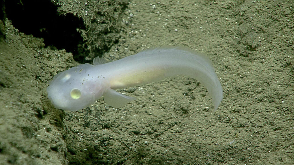
In 2025, more than 7,000 new species were discovered in the Mariana Trench, including the hadal snailfish (Pseudoliparis swirei). This is the deepest-dwelling fish currently known to science. Now, the fish has been dubbed “the Mariana snailfish.”
How was the Mariana Trench formed?
The process by which the Mariana Trench was created is a geologically fascinating one known as subduction. On the Earth’s surface, there are thin plates that cover the planet’s mantle, which is made of molten rock. If two of these plates collide, one pushes down into the Earth’s mantle while the other is pushed over the bottom plate. When this happens, a trench is formed from the drag of the bottom plate. This process can sometimes create incredibly strong earthquakes. The plates that forged the Mariana Trench’s creation are estimated to be up to approximately 180 million years old.
This trench was unknown to scientists until 1875. It was then that a team of explorers on the HMS Challenger measured the depth of the sea by simply lowering a weighted rope into the water. They were baffled when they measured that first portion of the seafloor to be five miles below the surface. And so was born the origin of some of the most daring deep-sea explorations known to mankind to date.
Is the Mariana Trench protected?
The Mariana Trench is in waters off Guam and the Mariana Islands. The region is protected from some human activities under its status as a marine monument. The creation of the Mariana Trench Marine National Monument signified that international, national and local leaders all recognize the importance of protecting this area.
However, just because the region is protected does not mean it’s not vulnerable to modern threats to ocean health. Plastic bags have been spotted in the Mariana Trench during several expeditions, highlighting the