

This month marks 10 years since the UK recorded its first named storm.
Storm Abigail struck in November 2015, bringing high winds, lightning and snow and causing power cuts and school closures in northern Scotland.
In the decade that has passed, storm naming has become a key part of how the Met Office warns the public about impending storms.
Storm naming is a public safety tool that makes severe weather easier to remember, talk about and follow.
The success of the scheme offers lessons for how clear communication can help communities prepare, adapt and build resilience in a changing climate.
Here, we look back at a decade of naming storms in the UK and some of the most notable events.
Storms in the UK
Storms in the UK typically take place during the autumn and winter months and last for between two and three days.
The number of named storms varies from year to year. Some storm seasons – for example, 2023–24 – are exceptionally active, while others are much quieter.
The UK owes its stormy climate in large part due to the jet stream – fast-moving winds that blow from west to east high in the atmosphere and push low-pressure weather systems across the Atlantic.
These low-pressure systems can bring heavy rain and strong winds to the UK, which, in turn, causes storms.
Storms in the UK can cause serious damage, felling trees, destroying infrastructure and causing travel disruptions.
Some have resulted in widespread flooding – and others, tragically, in loss of life.
Over the last decade, the UK has seen a number of storms with extreme wind speeds and heavy rainfall.
The table below sets out a list of records set by storms between November 2015 and October 2025.
| Maximum hourly gust speeds | Storm Eunice, 2022 | 122 miles per hour (mph) |
| Highest daily rainfall total | Storm Desmond, 2015 | 264.4mm |
| Lowest mean sea level pressure | Storm Éowyn, 2025 | 941.9 hectopascals (hPa) |
UK storm records for the period November 2015–October 2025. Source: Met Office
Storm naming
Storm naming was introduced in the UK and Ireland at the start of the 2015 storm season.
Launched by the Met Office and Ireland’s weather service, Met Éireann, Dutch weather service the Royal Netherlands Meteorological Institute (KNMI) joined the storm-naming scheme in 2019.
This collaboration between the UK, Ireland and Netherlands is one of three storm-naming groups in Europe. Each group releases a new alphabetical list of storm names in September.
The graphic below highlights the storm names picked by the Western European storm-naming group for 2025-26.

Not all storms are named. A storm will be named if the Met Office anticipates it having potential to cause disruption or damage.
This is often linked to whether strong winds are expected, but impacts caused by other weather types – for instance, heavy rain, hail or snow – are also considered.
Once named, the storm is referred to consistently by weather services and other authorities in Ireland, Netherlands and the UK.
Storm naming was introduced to improve communication of the weather forecast to the public and help people stay safe during severe weather.
Using a single, authoritative name for a storm allows government and media outlets to deliver a consistent message about approaching severe weather.
In this way, the public will be better placed to keep themselves, their homes and businesses safe.
There have typically been around half a dozen named storms each year since November 2015, although this varies on a year-to-year basis.
The 2023-24 storm season saw the most named storms to date. In August 2024, Storm Lillian became the 12th named storm of that season.
Below is a table of all the storms that have been named since 2015.
Storms named between November 2015 and October 2025. Source: Met Office.
Notable named storms
While every year since the scheme began has seen storms strong enough to be named, some storms have been particularly significant.
Storm Desmond, December 2015
Storm Desmond brought extreme rainfall to north-west England. The weather station in Honister Pass in Cumbria recorded 34.1cm of rainfall in just 24 hours in a new UK record. Another record was set when 405mm of rain fell at Thirlmere in Cumbria over two consecutive days.
The subsequent floods affected thousands of homes and businesses across Cumbria and other parts of northern England, sweeping away several bridges and cutting road and rail links.
Storm Desmond led to the government launching the National Flood Resilience Review.

Storm Arwen, November 2021
Storm Arwen is an example of how the damages caused by a storm depends on more than its overall strength. A storm’s location, duration and wind direction also plays a role.
This storm occurred after an area of pressure in the North Sea drove very strong northerly winds across north-eastern parts of the UK. Winds gusted at up to 98mph at Brizlee Wood in Northumberland.
The unusual wind direction of Storm Arwen resulted in the felling of thousands of trees and left more than a million homes without power. Parts of the Pennines also saw significant disruption from lying snow.
Storms, like Arwen, that have a wind direction different to the prevailing south-westerly direction are less frequent, but are nevertheless a key part of the UK’s climate.
Storm Eunice, February 2022
In February 2022, three named storms affected the UK within the space of a week. The second of these storms was Storm Eunice.
Storms in close succession can cause particular problems because clean-up efforts can be hampered by further severe weather.
Storm Eunice was the most severe and damaging storm to affect England and Wales since February 2014. Gusts reached 122mph at Needles on the Isle of Wight – the highest on record for England at a low-level station.
The storm caused deaths, widespread damage to buildings and major travel disruption, including the temporary closure of the Port of Dover.

Storm Babet, October 2023
Storm Babet was notable for prolonged and intense rainfall which led to severe flooding, evacuations and sadly, deaths. In eastern Scotland, particularly in the county of Angus, rainfall totals reached 150-200mm, with some areas experiencing their wettest day on record since 1891.
A key factor with this storm was its unusual track, or path. The storm moved south to north, picking up additional moisture as it crossed the Bay of Biscay. A high-pressure “blocking” weather system over Scandinavia prevented Babet clearing the UK eastwards into the North Sea. As a result, high wind speeds were sustained across north-east England and much of Scotland for a prolonged period.

Storm Éowyn, January 2025
Storm Éowyn was the UK’s most powerful windstorm in more than decade, with the brunt of impacts felt in Northern Ireland and Scotland’s populous Central Belt.
Gusts exceeded 90mph in Northern Ireland – where this was the most severe wind storm since 1998 – while a 100mph gust was recorded at Drumalbin in Lanarkshire.
Roads were closed, flights, ferries and trains were cancelled and more than a million homes were reported to be without power at the peak of the storm. Scotland’s national botanical collection at the Royal Botanic Garden in Edinburgh saw several dozen felled or badly damaged trees.
Storm Éowyn’s intensity and geographic reach made it a standout event in recent years.
The timeline below shows how the Met Office worked with Met Éireann and KNMI to alert the public about Storm Éowyn.

Climate change and storms
There is no evidence of positive or negative trends in windstorm number or intensity in the UK’s recent climate.
Trends in windstorm frequency are difficult to detect, because numbers vary year-to-year and decade-to-decade.
Most climate projections indicate that winter windstorms will increase slightly in number and intensity over the UK, including disproportionately more severe storms. However, scientists have “medium confidence” in these projections – because a few climate models indicate differently.
This uncertainty highlights the need for ongoing research into how climate change may influence the severity and frequency of windstorms in northern Europe.
On the other hand, scientists are confident that climate change is making rainfall during storms more intense.
A 2024 attribution study involving Met Office scientists showed that climate change has made rainfall during storms more intense through autumn and winter in the UK. The researchers noted that this trend is set to increase as the planet warms.
Recent increases in flooding in the UK have also been linked to climate change.
Other research, meanwhile, has found that sea level rise caused by climate change will worsen storm surges and high waves during windstorms.
The continuing unpredictability of UK storms – combined with projections of increased rainfall and heightened coastal damage under climate change – means that being prepared for, and adapting to, the future weather is crucial.


The post Met Office: Ten years of naming UK storms to warn the public appeared first on Carbon Brief.
Met Office: Ten years of naming UK storms to warn the public

Next week, diplomats from around the world will descend on Yerevan, Armenia, to negotiate a series of decisions under the UN Convention on Biological Diversity (CBD).
Between 19 and 30 October, 196 parties will gather to hammer out the precise wording of the dozens of legal texts that make up the decisions under the Conference of the Parties (COP) to the CBD.
This year’s summit is particularly significant, as it marks the halfway point between the agreement of the Kunming-Montreal Global Biodiversity Framework and the deadline for achieving its targets.
The CBD has found that countries are currently not on track to meet 22 out of the framework’s 23 targets.
During the fortnight, delegates will also be negotiating decisions relating to the two supplemental protocols to the CBD: the Cartagena Protocol, which covers biosafety; and the Nagoya Protocol, which covers access and benefit-sharing for the use of genetic resources.
(The Cartagena and Nagoya Protocols, which are each governed by a “meeting of the parties”, or “MOP”, have fewer parties than the CBD as a whole, with 173 and 141, respectively.)
Carbon Brief is tracking the progress of countries towards consensus on dozens of negotiating texts using the interactive table below.
The tracker includes texts from the COP, as well as the MOPs for the Cartagena and Nagoya protocols. It also includes draft decisions from the most recent subsidiary body meetings, as these form the starting point for the negotiations in Yerevan.
The CBD has three subsidiary bodies: the subsidiary body on scientific, technical and technological advice (SBSTTA), the subsidiary body on implementation (SBI) and the subsidiary body on article 8(j) and other provisions (SB8J).
SB8J focuses on issues related to the Indigenous peoples and local communities. It was established at COP16 in Cali, Colombia, in 2024.
The first two columns of the interactive tracker list the topic of each agenda item and the relevant body, with subsequent columns including dates, page counts and links to the original documents.
The table is searchable and can be sorted using the arrows in the header.
Areas of disagreement in UN draft texts are denoted by square brackets. Counting the brackets in a particular iteration of a text therefore gives a sense of how far parties are from reaching consensus.
The bracket column is colour-coded, with dark green indicating a low number of brackets and red indicating a high number of brackets remaining.
Texts can also present parties with choices using “options” or alternatives (“alt”), which are counted together in the sixth column of the table.
The key discussions in Yerevan will centre around two agenda items in particular. The first is the global review, which will assess progress towards the GBF and make recommendations for accelerating action.
The second is finance, which can be separated into two parts: resource mobilisation and the financial mechanism. On resource mobilisation, biodiverse global south countries are likely to push for an increased amount of international finance for conservation.
Disagreement over the creation of the financial mechanism led to the suspension of COP16 in Cali in October 2024, as parties failed to find agreement on the mobilisation of finance before the end of the summit.
Global south countries want the establishment of a separate financial mechanism under the control of the CBD; global north countries largely prefer to maintain the existing mechanism, which sits under the Global Environment Facility.
At the resumed session of COP16 in Rome in early 2025, countries agreed on a roadmap that would lead to the establishment of a permanent mechanism.
related

Analysis: Lula presidency saved at least 20,000km2 of Brazilian Amazon since 2022
Why land-use emissions have fallen by a third this century – in six charts

Analysis: 84% of nations miss deadline to identify ‘nature-harming’ subsidies by 2025

UK withdraws millions in funding from world’s second-largest rainforest in Congo
The post Interactive: Tracking negotiating texts at the COP17 biodiversity summit appeared first on Carbon Brief.
Interactive: Tracking negotiating texts at the COP17 biodiversity summit
A beacon of love
On an outer island of Fiji, two thousand nautical miles from Sydney, is a shining light of hope and resilience for our troubled world.
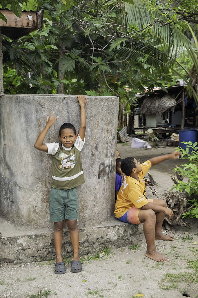
The island of Kioa is home to a Tuvaluan community who migrated from their atoll of Vaitupu in the late 1940s. It is a land of warm hearts, big smiles, and deep cultural roots; a place where the sound of a conch still summons the island together, where islanders paddle out to fish in carved outrigger canoes, and healthy happy children walk barefoot to school.
Here, culture is life. Kioans live sustainably through their traditional knowledge and practices. The island is alive with song, dance and the rhythms of a life tied to the tides, the winds, and the seasons.
Facing the future
Greenpeace has been lucky to have a relationship with Kioa for a number of years now, and we are continually learning from this remarkable community.
Last week, as part of our Voyaging Oceania project, we returned to the island. Our purpose was twofold —- to carry messages from the island to leaders gathering in Nadi this week for the Pacific Pre-COP, and to support the Kioa community in their efforts to improve water security for the island.
Unlike Tuvalu itself, with its eight atolls, Kioa is a mountainous, forested and richly fertile island. It will remain habitable far into the future. Kioans did not initially migrate from Vaitupu due to climate change, but the move was prophetic. They now have a lifeboat.
However, even Kioa faces challenges on our rapidly warming planet, in particular when it comes to water. Climate change is shifting once reliable rainfall patterns. On top of this, the island is already feeling the effect of this year’s intensifying El Niño event, which for Fiji means reduced rainfall and prolonged dry spells.
Right now, fresh water has to be carefully rationed, and is only available for a few hours a day. During last week’s visit aboard our campaigning ship Oceania, Greenpeace was privileged to work with the Kioa community on a new solar-powered water distribution project for the island.
Designed and led by the island, the project involves using a solar pump to move water from a reliable source to a storage tank and then using gravity to distribute the water around the village.
It was a lesson in how local knowledge and ingenuity can be the backbone of today’s climate solutions. To build a dam around the source, the local community knew the exact spot where they could gather gravel at low tide to mix with the cement. They took only what was needed, knowing that all resources must be carefully conserved. Kioa has no roads and no machinery, and it was an all-of-island effort to carry the materials up to the project site, including many heavy bags of sand and rock.
Such projects truly bring to life the vision of a resilient, locally-led, fossil fuel free Pacific.