
This blog was written by Kassidy Troxell, Ph.D., a Research Assistant Professor at Florida international University’s Institute of Environment, and collaborator with Ocean Conservancy on our work to promote healthy Florida aquatic ecosystems. Dr. Troxell is a lead scientist executing the nitrogen fingerprinting discussed in this blog.
November was Manatee Awareness Month, a month dedicated to highlighting the popular aquatic mammal and the broader importance of clean, healthy waterways in Florida. One of the greatest challenges to water quality in areas like Tampa Bay is nutrient pollution. Excess nutrients in coastal waters fuel harmful algae which “bloom” into patches, one example is the well-known Karenia brevis referred to as red tide, causing fish kills and human respiratory problems while also reducing the sunlight needed by underwater seagrasses to flourish. These blooms diminish essential seagrass habitats, impacting marine species like manatees, harming local ecosystems and affecting human health. Identifying the primary sources of nutrient pollution is crucial for developing targeted strategies to control nutrient levels and maintain the health of delicate ecosystems.
Love ocean content?
Enter your email and never miss an update
In Tampa Bay, my lab at Florida International University has partnered with Ocean Conservancy to do just that: understand and address nitrogen pollution, the nutrient that contributes to water quality impairment, in the Hillsborough Bay and the larger Tampa Bay ecosystem. By using manmade or commonly used chemicals, we can pinpoint the sources of nitrogen—whether from untreated stormwater street runoff, treated home, business or industrial wastewater, or agriculture—allowing for more targeted management efforts. Just as each of us humans have our own unique fingerprints made of various patterns and distinctions, contamination sources have a unique makeup of compounds that allows us to fingerprint and track their movements throughout a watershed.

Key findings from recent study in Tampa Bay
The Hillsborough River, which flows into Hillsborough Bay and is vital to the health of Tampa Bay’s ecosystem, serves as the geographic focus of our study. Our preliminary results reveal that nitrogen levels in these waters rise significantly during the wet season when runoff is at its peak. Chemical tracers, which act like “markers” for pollution sources, suggest that reused non-drinkable treated water (reclaimed water), stormwater and agriculture are contributing sources of nitrogen into the waterway. Within the Hillsborough River watershed, nitrogen levels show distinct patterns (i.e., “fingerprints”) linked to various sources: reclaimed water and agricultural activities are prominent in the upper watershed, while urban stormwater runoff and wastewater inputs are notable near the river’s mouth. Potential contributions from other sources, such as septic systems, are still under investigation.

Now that we have identified the preliminary nitrogen sources and hotspots, the next phase of the project will focus on the sources that are contributing the largest nitrogen loads, the geographic origins of those sources and the amounts of the nitrogen going into the waterways. Future sampling will expand sampling sites in the tributaries that feed into the preliminary hotspot locations along the mainstem (the primary downstream river segment in contrast to its tributaries). This information will help tailor interventions to reduce nitrogen loads at the source and guide management efforts to improve water quality and ecosystem recovery in Tampa Bay.
The future of Florida’s water quality
Our research underscores the need to better manage nutrient levels to protect Florida’s coastal waters. The data generated from our study will give policymakers a more precise geographical understanding of nitrogen hotspots for prioritizing actions to curb nutrient pollution. Indeed, Ben Albritton, the incoming Majority Leader of the Florida state senate, recently said as much when he pointed to the importance of fresh, accurate data needed to drive solutions, whether these are new policies, investments or on-the-ground management practices.

Our activities on land—whether through treated wastewater, stormwater runoff or agricultural practices—have direct impacts on coastal ecosystems. While the Hillsborough River is the focus of this pilot study, we believe the nutrient fingerprinting techniques will be a valuable water quality management tool in other Florida estuaries and bays as well. By pinpointing and quantifying the largest nutrient sources, we can better protect the health of our marine environments and communities alike, which will benefit all Floridians.
Undoubtedly, Florida’s waterways are facing enormous challenges. Ocean Conservancy is dedicated to addressing nitrogen pollution, in part, for marine species like manatees that are so greatly impacted by threated water quality. Take action with Ocean Conservancy to demand greater protections for imperiled manatees and improvements in water quality in Florida and beyond.
The post Fingerprinting the Source of Nitrogen Pollution in Tampa Bay appeared first on Ocean Conservancy.
Fingerprinting the Source of Nitrogen Pollution in Tampa Bay
After a slight delay of the Maria S. Merian caused by late-arriving containers our research cruise MSM142 finally got underway. By last Tuesday (24.03.2026), the full scientific team had arrived in Nuuk, the capital of Greenland, and the ship reached port on Wednesday (25.03.2026) morning. That same day, scientists and technicians moved on board and immediately began preparations, assembling and testing our instruments. Although the mornings on Wednesday and Thursday were grey and overcast, the afternoons cleared up beautifully. This gave us valuable time to organize equipment on deck and store empty boxes back into the containers before departure.
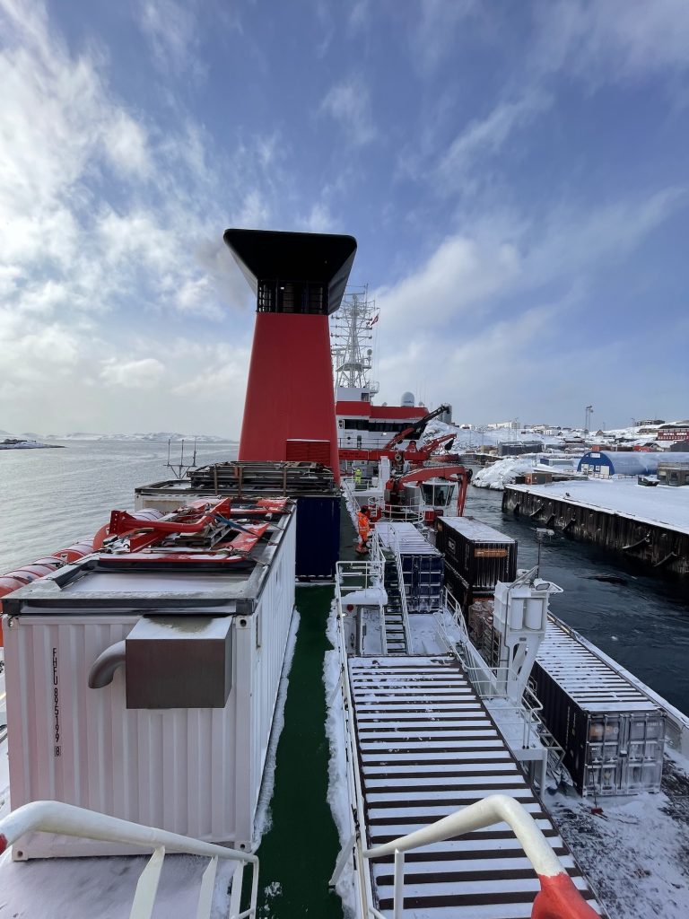
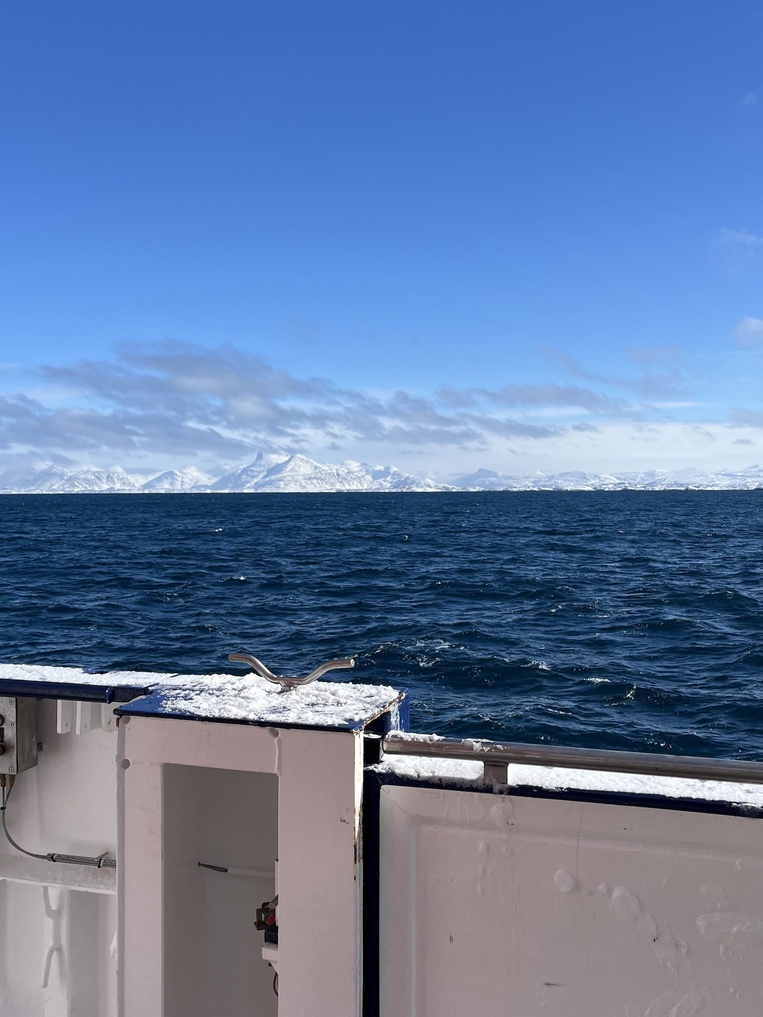
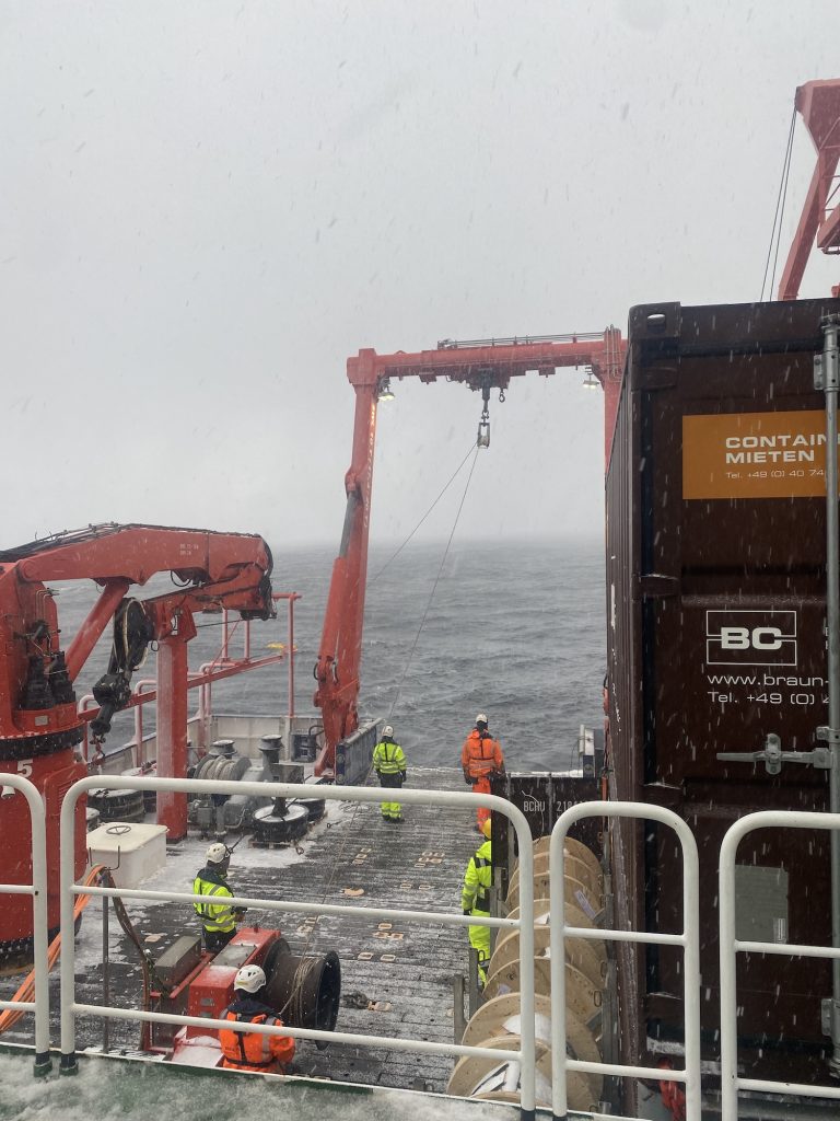
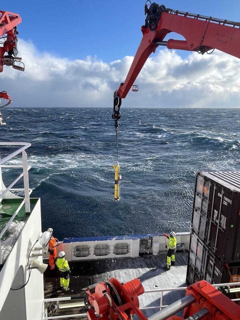
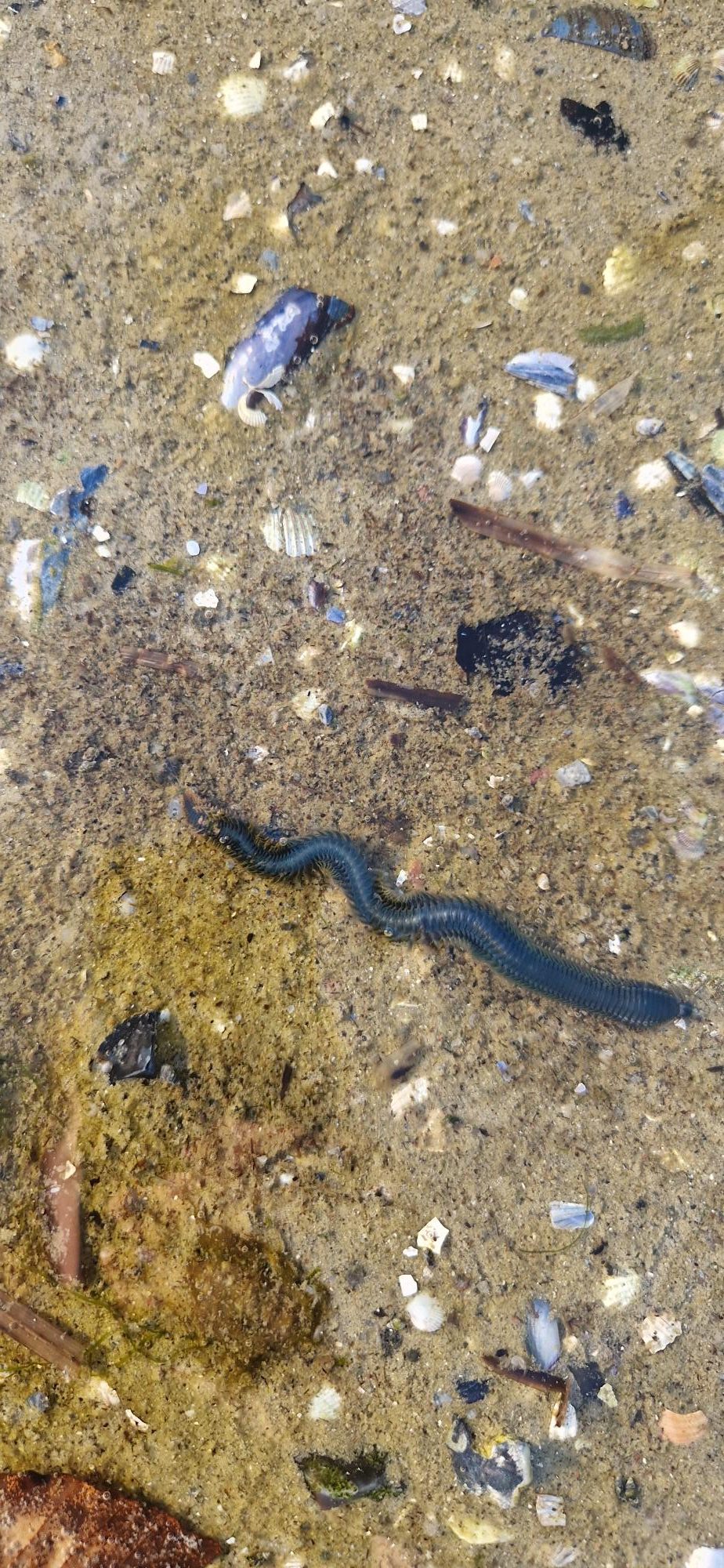
Given the forecast of harsh conditions outside the fjord, we carried out the mandatory safety drill while still in harbour. This included practicing emergency procedures and boarding the lifeboat. After completing border control, we were finally ready to leave Nuuk. We set sail on March 27th, heading into the Labrador Sea to begin our mission. Even before starting scientific operations, we tested the setup for deploying our gliders without releasing them during the transit out of the fjord. Once we reached open waters, we were met by high waves the following morning. For some on board, this was their first experience under such rough sea conditions. Seasickness quickly became a challenge for a few, while scientific work had to be temporarily postponed due to the strong winds and sea conditions. Together with the crew, we discussed how best to adapt our measurement plans to the given weather conditions. On March 29th, we were finally able to begin our scientific program with the first CTD deployment. A CTD is an instrument used to measure conductivity, temperature, and depth, which are key parameters for understanding ocean structure.
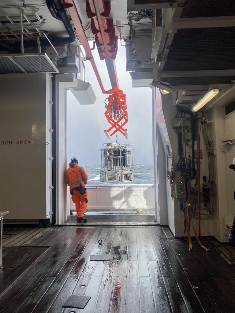
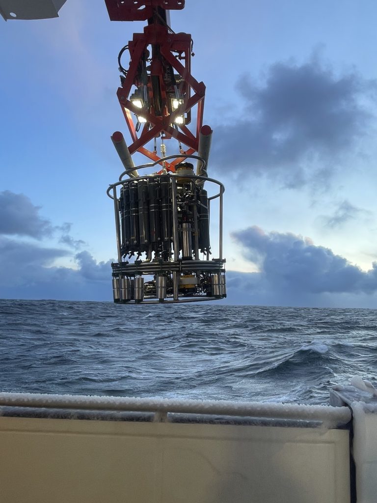
During the following night, we continued with additional CTD stations and successfully recovered two moorings: DSOW 3 and DSOW 4, located south of Greenland. These moorings carry instruments at various depths that measure velocity, temperature, and salinity. DSOW 4 was redeployed on the same day, while DSOW 3 followed the next day. In addition, the bottles attached to the CTD’s rosette can be used to collect water samples from any desired depth. These samples can be used, for example, to determine the oxygen content, nutrient levels, and organic matter.
Both are part of the OSNAP array, a network of moorings spanning the subpolar North Atlantic. On these moorings are a few instruments, for example microcats which measure temperature, pressure and salinity.
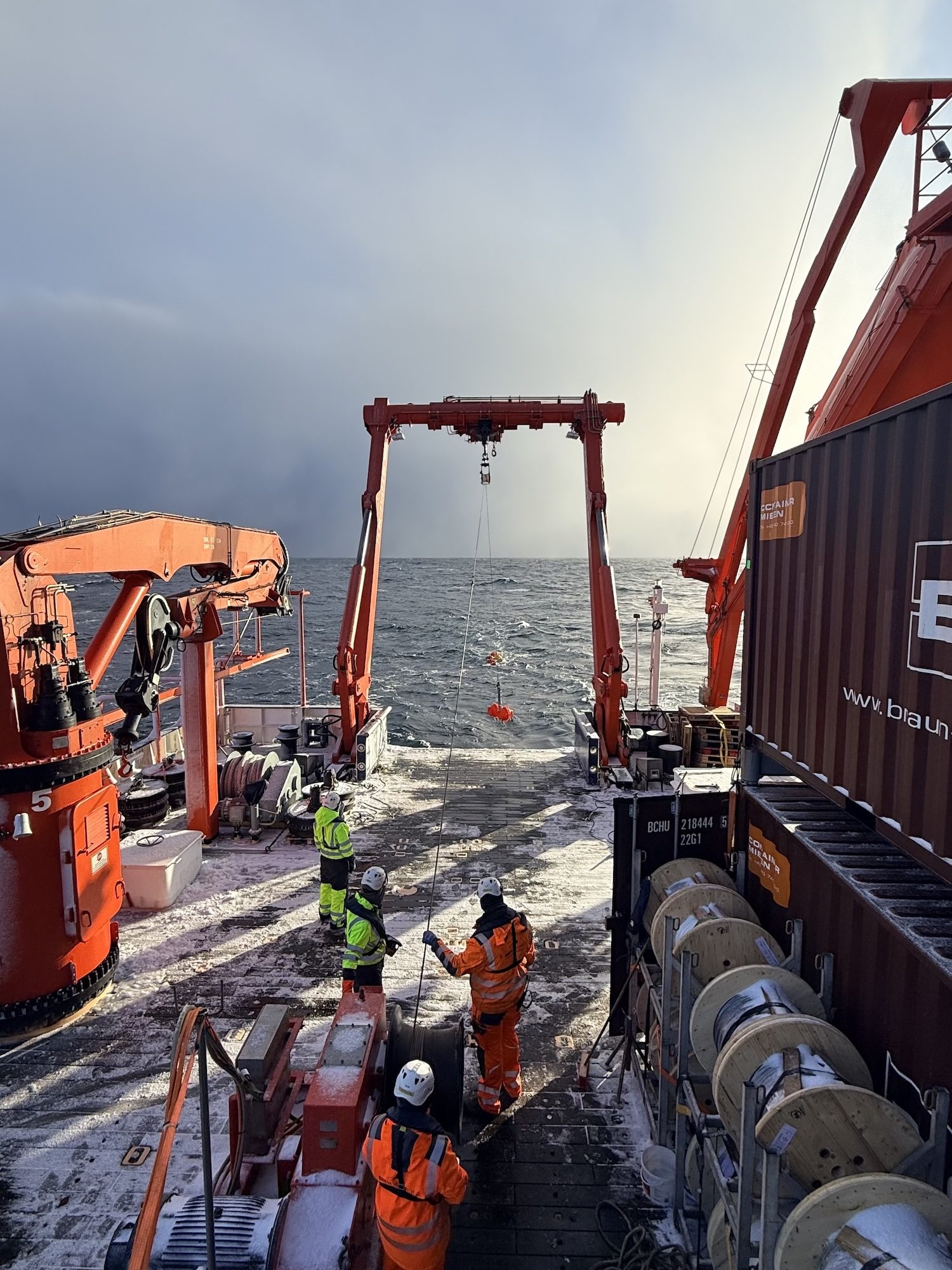
We then conducted around 25 CTD stations spaced approximately 3 nautical miles apart across an Irminger ring identified from satellite data. This high-resolution sampling was necessary to capture the structure of an Irminger Ring, which had a radius of about 12 km wide.
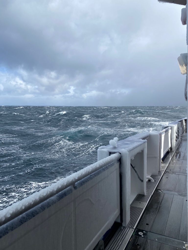
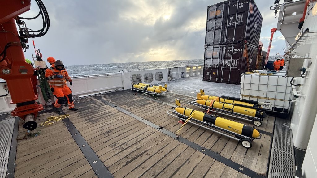
The days leading up to April 2nd were marked by very rough weather conditions. Life on board became both challenging and, at times, unintentionally entertaining sliding chairs were not uncommon. During the night from April 1st to April 2nd, winds reached 11 Beaufort with gusts up to 65 knots, forcing us to pause our measurements. Fortunately, conditions improved by morning, allowing us to resume our work. As well as with the help of the crew we had to adapt to the harsh weather conditions to continue our scientific work. On the 3rd of April, we were able to deploy a few gliders and one float. An ocean glider is an autonomous underwater Vehicle, which you can steer remotely and send to different locations, while it is measuring oceanographic key parameters.
This research cruise focuses on understanding small-scale processes in the ocean and their connection to the spring bloom, an essential phase in marine ecosystem in subpolar regions. Despite the challenging start, we have already gathered valuable data and look forward to the weeks ahead in the Labrador Sea.
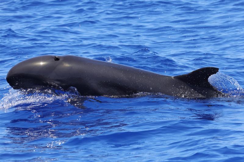
Despite their dramatic name, false killer whales aren’t an orca species. These animals are dolphins—members of the same extended family as the iconic “killer whale” (Orcinus orca). Compared to their namesake counterparts, these marine mammals are far less well-known than our ocean’s iconic orcas.
Let’s dive in and take a closer look at false killer whales—one of the ocean’s most social, yet lesser-known dolphin species.
Appearance and anatomy
False killer whales (Pseudorca crassidens) are among the largest members of the dolphin family (Delphinidae). Adults can grow up to 20 feet long and weigh between 1,500 and 3,000 pounds, though some individuals have been recorded weighing even more. For comparison, that’s roughly double the size of a bottlenose dolphin—and slightly larger than a typical sedan.
These animals are incredibly powerful swimmers with long, torpedo-shaped bodies that help them move efficiently through the open ocean in search of prey. Their skull structure is what earned them their name, as their head shape closely resembles that of orcas. With broad, rounded heads, muscular jaws and large cone-shaped teeth, early scientists were fascinated by the similarities between these two marine mammal species.
Although their heads may look somewhat like those of orcas, there are several ways to distinguish false killer whales from their larger namesake counterparts.
One of the most noticeable differences has to do with their coloration. While orcas are known for their iconic black-and-white pattern with paler underbellies, alternatively, false killer whales are typically a uniform dark gray to black in color—almost as if a small orca decided to roll around in the dirt. If you’ve ever seen the animated Disney classic 101 Dalmatians, the difference is a bit like when the puppies roll in soot to disguise themselves as labradors instead of showing their usual black-and-white spots.
Their teeth also present a differentiator. The scientific name Pseudorca crassidens translates almost literally to “thick-toothed false orca,” a nod to their sturdy, cone-shaped teeth that help these animals capture prey. Orcas tend to have more robust, bulbous heads, while false killer whales appear slightly narrower and more streamlined.
Behavior and diet
False killer whales are both highly efficient hunters and deeply social animals. It’s not unusual to see them hunting together both in small pods and larger groups as they pursue prey like fish and squid.
Scientists have even observed false killer whales sharing food with each other, a behavior that is very unusual for marine mammals. While some dolphin and whale species work together to pursue prey, they rarely actively share food. The sharing of food among false killer whales spotlights the strong social bonds within their pods. Researchers believe these tight-knit social connections help false killer whales thrive in offshore environments where they’re always on the move.
Maintaining these close bonds and coordinating successful hunts requires constant effective communication, and this is where false killer whales excel. Like other dolphins, they produce a variety of sounds like whistles and clicks to stay connected with their pod and locate prey using echolocation. In the deep offshore waters where they live, sound often becomes more important than sight, since sound travels much farther underwater than light.
Where they live
False killer whales are highly migratory and travel long distances throughout tropical and subtropical waters around the world. They prefer deeper waters far offshore, and this pelagic lifestyle can make them more difficult for scientists to study than many coastal dolphin species.
However, there are a few places where researchers have been able to learn more about them—including the waters surrounding the Hawaiian Islands.
Scientists have identified three distinct groups of false killer whales in and around Hawaii, but one well-studied group stays close to the main Hawaiian Islands year-round. Unfortunately, researchers estimate that only about 140 individuals remained in 2022, with populations expected to decline without action to protect them. This is exactly why this group is listed as endangered under the U.S. Endangered Species Act and is considered one of the most vulnerable marine mammal populations in U.S. waters.
Never Miss An Update
Sign up for Ocean Conservancy text messages today.
Current threats to survival
False killer whales are currently listed as Near Threatened on the IUCN Red List. From climate change-induced ocean acidification and harmful algal blooms to marine debris and fishing bycatch, false killer whales face the same mounting pressures that are impacting marine ecosystems around the world. As their prey becomes scarce due to increasing threats, populations of top predators like these decline, serving as a powerful signal that the ocean’s overall health is in critical need of protection.
Here at Ocean Conservancy, we’re working daily to confront these threats head-on and protect the ecosystems and wildlife we all cherish so dearly. But we can’t do it without you. Support from ocean lovers is what powers our work to protect our ocean, and right now, our planet needs all the help it can get. Visit Ocean Conservancy’s Action Center today and join our movement to create a better future for our ocean, forever and for everyone.
The post All About False Killer Whales appeared first on Ocean Conservancy.
https://oceanconservancy.org/blog/2026/03/31/false-killer-whales/
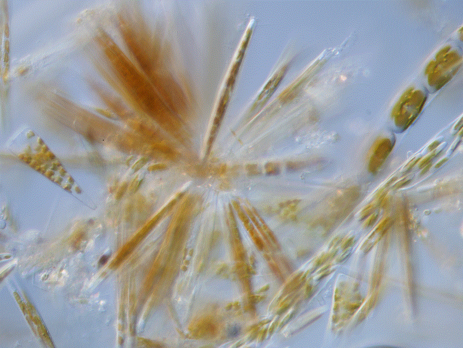
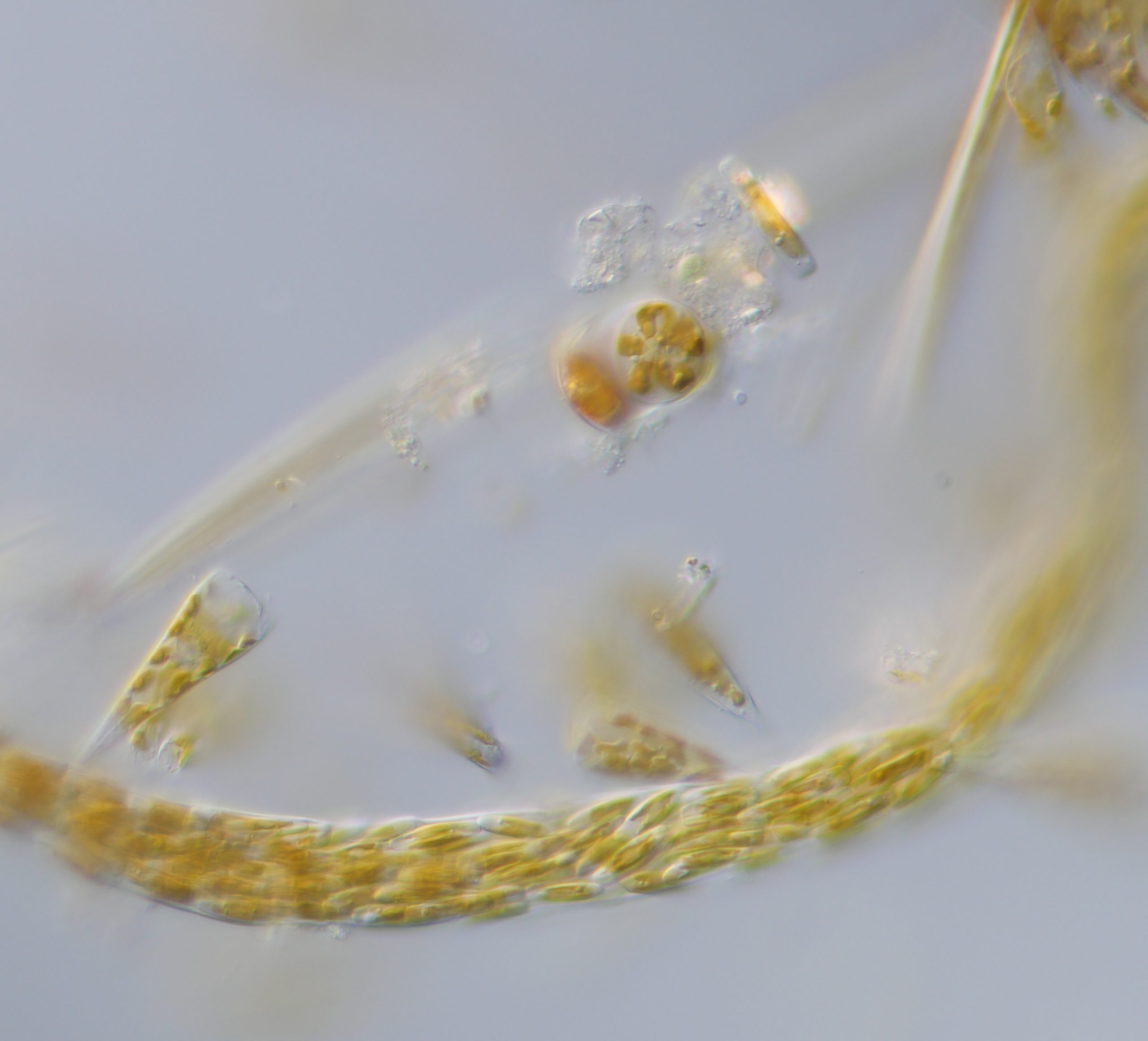
A lot has happened in the meantime: I became an Associate Professor at the University of Southern Denmark, we all lived through the Corona period, then slowly adjusted to the post‑pandemic stability, only to find ourselves again in turbulent political times. I am now affiliated with the Marine Research Center in Kerteminde, a beautiful coastal town on the island of Fyn. My plan is to share small updates on my research and activities every now and then. So let’s start with yesterday’s sampling trip for benthic phytoplankton, carried out by my colleague, Prof. Kazumasa Oguri. The sampling will help prepare for the first‑semester bachelor students who will join his small but fascinating project. This project is all about the benthic diatoms that form dense, photosynthetic communities on tidal‑flat sediments. Their daytime oxygen production enriches the sediment surface and allows oxygen to penetrate deeper, supporting diverse organisms that rely on aerobic respiration. The project will explore how oxygen distribution and oxygen production/consumption in sediments change under different light conditions (day, night, sunrise/sunset). The team will incubate benthic diatom communities in jars and measure oxygen profiles using an oxygen imaging system under controlled light regimes.
Yesterday, we visited several potential sampling sites where students can carry out their fieldwork. I encourage all PIs in our group to define at least one small project related to Kerteminde Fjord, where our laboratories are located. Over time, I hope we can build a more integrated dataset describing the marine and coastal ecosystems of the area.
Another activity currently in preparation is a project on marine invasive species in Kerteminde, which will feed into a course I will run in July and a master’s thesis project. More will come later.
Let’s hope for a more continuous blog from here on, keeping track of our activities, with or without jellyfish!


-
Climate Change8 months ago
Guest post: Why China is still building new coal – and when it might stop
-
Greenhouse Gases8 months ago
Guest post: Why China is still building new coal – and when it might stop
-

 Greenhouse Gases2 years ago
嘉宾来稿:满足中国增长的用电需求 光伏加储能“比新建煤电更实惠”
-
Climate Change2 years ago
Bill Discounting Climate Change in Florida’s Energy Policy Awaits DeSantis’ Approval
-

 Climate Change2 years ago
嘉宾来稿:满足中国增长的用电需求 光伏加储能“比新建煤电更实惠”
-
Climate Change Videos2 years ago
The toxic gas flares fuelling Nigeria’s climate change – BBC News
-

 Renewable Energy6 months ago
Sending Progressive Philanthropist George Soros to Prison?
-

 Carbon Footprint2 years ago
US SEC’s Climate Disclosure Rules Spur Renewed Interest in Carbon Credits