
Bright sunshine, intense thunderstorms, storms up to wind force 9 – the weather during the CYRTACI journey M195 is diverse and varied. Observant eyes even witnessed mirages and waterspouts, not to mention colorful rainbows, sunrises, and sunsets, especially captivating due to the mostly unobstructed sea horizon.
Seafaring and weather are traditionally closely intertwined. The success of our research expedition is naturally dependent on the weather. For example, sediment cores cannot be taken in too rough seas. To make the most of the expedition days, there is a Meteorological Office on board from the German Weather Service, providing the ship’s crew and scientists with daily weather observations and forecasts. There, Andreas and Felix work. Andreas has been sailing on various research vessels for 14 years. Felix usually works on land in aviation weather forecasting at Hamburg Airport, and M195 is his first voyage with the METEOR.
Their workday starts every morning at 06:00. First, the overnight data is evaluated to track the weather progress. Onboard, various data such as temperature, humidity, wind, and cloud height are recorded. These automatically collected data are supplemented by observations, such as waves, and regularly sent as weather reports worldwide. After a tour around the ship to get a detailed picture of cloud cover, visibility, weather conditions, and sea state, the observations are complemented with additional data. This includes images from weather satellites and calculations from various weather forecast models, sent multiple times a day from the Marine Meteorological Centre in Hamburg to the ship. A weather forecast for the voyage area is then developed, tailored precisely to the route and research plans. Our “weather frogs” observe the weather all day, and in the evening, there is an updated weather forecast. If we were able to observe unusual weather phenomena, they willingly and vividly explain them to us. So, in addition to our main research, we also learn a bit about meteorology.
When bad weather looms, Felix and Andreas, in cahoots with the captain, tweak our route to navigate safely. We have adjusted the sequence of research stations several times to avoid storms and high waves. The entrance and exit at the Ambrakian Gulf were particularly sensitive. The passage is relatively narrow and shallow, so the 98-meter-long METEOR can only safely navigate it in calm winds and calm seas. In the Gulf, we were able to work well despite an approaching storm and avoid five-meter-high waves that had built up in the Ionian Sea.
While much of Germany has seen the first snowfall, we have weathered our last storm yesterday. With temperatures around 20 degrees Celsius and the sun reclaiming the skies, we enjoy a few more days of escaping winter’s grip in Germany before most of us from the science crew head home on Sunday.
Lasst uns über’s Wetter sprechen
Strahlender Sonnenschein, kräftige Gewitter, Sturm bis Windstärke 9 – das Wetter während der CYRTACI-Expedition ist vielfältig und abwechslungsreich. Aufmerksame Augen konnten sogar Luftspiegelungen und Wasserhosen beobachten. Und natürlich farbenfrohe Regenbögen sowie Sonnenauf- und -untergänge, die durch den freien Horizont auf See besonders gut zu verfolgen sind.
Seefahrt und Wetter sind traditionell eng miteinander verbunden. Selbstverständlich ist auch das Gelingen der CYRTACI-Expedition vom Wetter abhängig. So können z.B. bei zu hohem Seegang keine Sedimentkerne entnommen werden. Um die Expeditionstage bestmöglich ausnutzen zu können, gibt es an Bord eine Wetterwarte des Deutschen Wetterdienstes, von der aus Schiffsführung und Wissenschaft täglich mit Wetterbeobachtungen und -vorhersagen versorgt werden. Dort arbeiten Andreas und Felix. Andreas fährt bereits seit 14 Jahren auf verschiedenen Forschungsschiffen zur See. Felix arbeitet normalerweise an Land in der Flugwettervorhersage am Hamburger Flughafen, für ihn ist M195 die erste Fahrt mit der METEOR.
Ihr Arbeitstag beginnt jeden Morgen um 06:00 Uhr. Zuerst werden die Messdaten der Nacht ausgewertet, um den Wetterablauf zu verfolgen. An Bord werden u.a. Temperatur, Luftfeuchtigkeit, Wind und Wolkenhöhe erfasst. Diese und weitere automatisch erfasste Daten werden durch Beobachtungen z.B. der Wellen ergänzt und regelmäßig als Wettermeldung in die ganze Welt verschickt. Nach einem Rundgang um das Schiff, um sich ein detailliertes Bild von Bewölkung, Sicht, Wetterzustand und See zu verschaffen, werden die Beobachtungen mit zusätzlichen Daten ergänzt. Dies sind u.a. Bilder von Wettersatelliten und Berechnungen verschiedener Wettervorhersagemodelle, die täglich mehrfach vom Seewetteramt in Hamburg zum Schiff geschickt werden. Daraus wird eine Wettervorhersage für das Fahrtgebiet erarbeitet, passgenau zugeschnitten auf die Fahrtroute und die Forschungsvorhaben. Unsere „Wetterfrösche“ beobachten das Wetter den ganzen Tag, am Abend gibt es noch einmal eine aktualisierte Wettervorhersage. Wenn wir außergewöhnliche Wettererscheinungen beobachten konnten, erklären sie uns diese bereitwillig und anschaulich. So lernen wir nebenbei noch ein wenig über die Meteorologie.
Wenn sich schlechtes Wetter abzeichnet, beraten sich Felix und Andreas mit dem Kapitän und der Fahrtleitung und besprechen, wie die Route am besten geplant werden kann. So haben wir mehrfach die Reihenfolge der Forschungsstationen angepasst, um Sturm und hohen Wellen auszuweichen. Besonders empfindlich waren die Ein- und Ausfahrt beim Ambrakischen Golf: Die Fahrrinne, die den Golf mit der offenen See verbindet, ist vergleichsweise eng und flach, so dass die 98 m lange METEOR sie nur bei schwachem Wind und ruhiger See sicher passieren kann. Im Golf konnten wir dann trotz aufziehenden Sturms gut arbeiten und fünf Meter hohen Wellen ausweichen, die sich im Ionischen Meer aufgebaut hatten.
Während in weiten Teilen Deutschlands der erste Schnee gefallen ist, haben wir gestern unseren letzten Sturm überstanden. Bei Temperaturen um 20 Grad Celsius und zunehmendem Sonnenschein genießen wir noch ein paar Tage lang die Flucht vor dem Winter in Deutschland, bevor die meisten von uns aus dem wissenschaftlichen Team am Sonntag nach Hause fahren.
-


Sunrise in the Aegean Sea. Sonnenaufgang in der Ägäis. Credit: Felix Herz / OceanBlogs -

-

-


Ocean Acidification
Humans Just Flew Around the Moon This Week. But Would Babies Born There Ever Truly Feel Gravity? Ask Jellyfish Babies.
This week, NASA’s Artemis II crew made history by flying around the Moon and returning safely to Earth, the first human journey to the Moon’s vicinity in more than 50 years. It was a stunning reminder that humanity is no longer just dreaming about living beyond Earth. We are actively rehearsing for it.
And that leads to a much stranger, deeper question: even if one day we build skyscrapers on the Moon, raise families there, and turn space into a place to live, will babies born away from Earth develop a normal sense of gravity? Or will their bodies learn the universe differently?
To explore that question, NASA once turned to an unexpected stand-in for human babies: jellyfish babies. On the STS-40 mission, scientists sent thousands of tiny jellyfish polyps into space because jellyfish, like humans, rely on gravity-sensing structures to orient themselves. The experiment asked a simple but profound question: if a living body develops in microgravity, will it still know how to handle gravity later?
The answer was both fascinating and unsettling. The jellyfish developed in space in large numbers, but once back under Earth’s gravity, the ones that had developed in microgravity showed far more pulsing abnormalities than the Earth-grown controls. In other words, their bodies formed, but their sense of balance did not seem to work quite the same way.
That is why this old jellyfish experiment still matters today. Before we imagine lunar cities, schools, nurseries, and generations born off-world, we need to ask not only whether humans can survive in space, but whether developing there changes how the body understands something as basic as up, down, and movement. Jellyfish babies cannot tell us everything about human children, but they may have given us one of the first clues that life born beyond Earth might not come home unchanged.
Reference: https://nlsp.nasa.gov/view/lsdapub/lsda_experiment/0c10d660-6b12-573d-8c3b-e20e071aed3b
Image: GEOMAR, Sarah Uphoff
After a slight delay of the Maria S. Merian caused by late-arriving containers our research cruise MSM142 finally got underway. By last Tuesday (24.03.2026), the full scientific team had arrived in Nuuk, the capital of Greenland, and the ship reached port on Wednesday (25.03.2026) morning. That same day, scientists and technicians moved on board and immediately began preparations, assembling and testing our instruments. Although the mornings on Wednesday and Thursday were grey and overcast, the afternoons cleared up beautifully. This gave us valuable time to organize equipment on deck and store empty boxes back into the containers before departure.
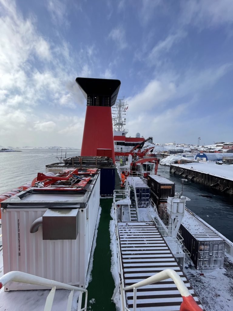
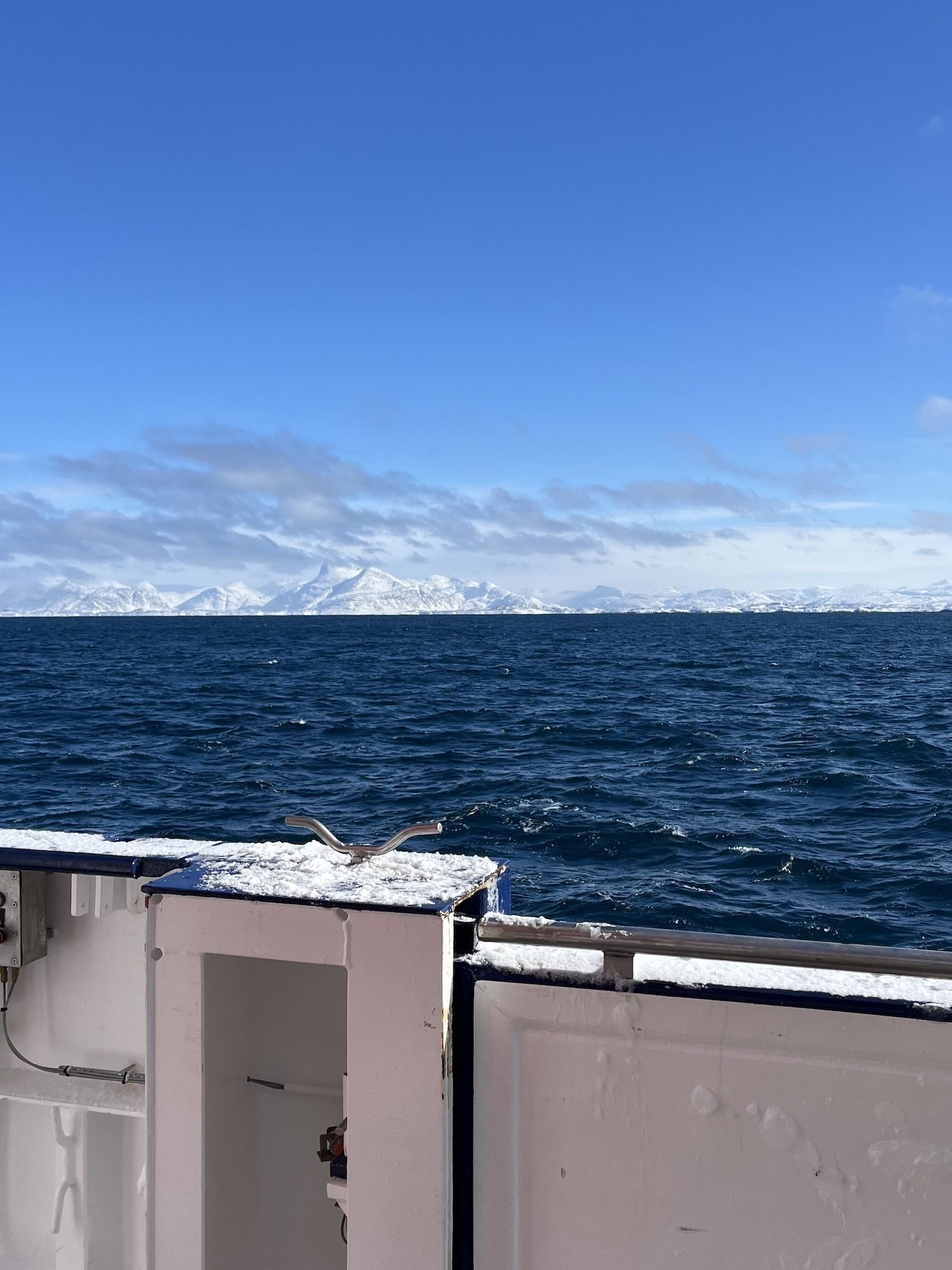
Given the forecast of harsh conditions outside the fjord, we carried out the mandatory safety drill while still in harbour. This included practicing emergency procedures and boarding the lifeboat. After completing border control, we were finally ready to leave Nuuk. We set sail on March 27th, heading into the Labrador Sea to begin our mission. Even before starting scientific operations, we tested the setup for deploying our gliders without releasing them during the transit out of the fjord. Once we reached open waters, we were met by high waves the following morning. For some on board, this was their first experience under such rough sea conditions. Seasickness quickly became a challenge for a few, while scientific work had to be temporarily postponed due to the strong winds and sea conditions. Together with the crew, we discussed how best to adapt our measurement plans to the given weather conditions. On March 29th, we were finally able to begin our scientific program with the first CTD deployment. A CTD is an instrument used to measure conductivity, temperature, and depth, which are key parameters for understanding ocean structure.
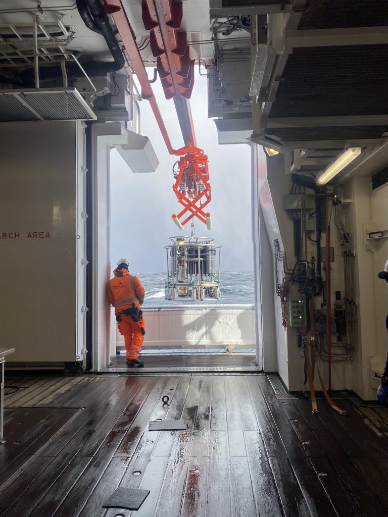
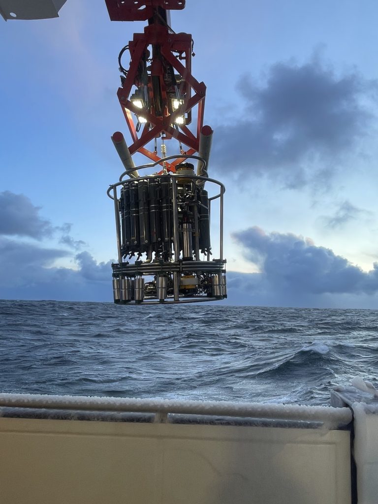
During the following night, we continued with additional CTD stations and successfully recovered two moorings: DSOW 3 and DSOW 4, located south of Greenland. These moorings carry instruments at various depths that measure velocity, temperature, and salinity. DSOW 4 was redeployed on the same day, while DSOW 3 followed the next day. In addition, the bottles attached to the CTD’s rosette can be used to collect water samples from any desired depth. These samples can be used, for example, to determine the oxygen content, nutrient levels, and organic matter.
Both are part of the OSNAP array, a network of moorings spanning the subpolar North Atlantic. On these moorings are a few instruments, for example microcats which measure temperature, pressure and salinity.
We then conducted around 25 CTD stations spaced approximately 3 nautical miles apart across an Irminger ring identified from satellite data. This high-resolution sampling was necessary to capture the structure of an Irminger Ring, which had a radius of about 12 km wide.
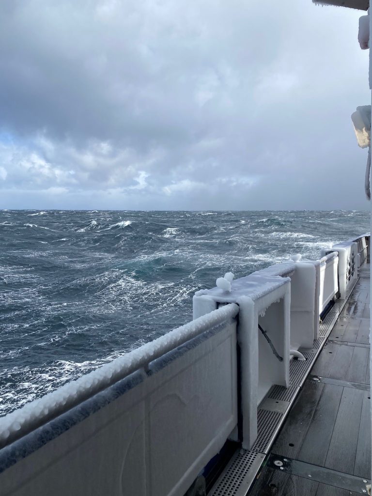
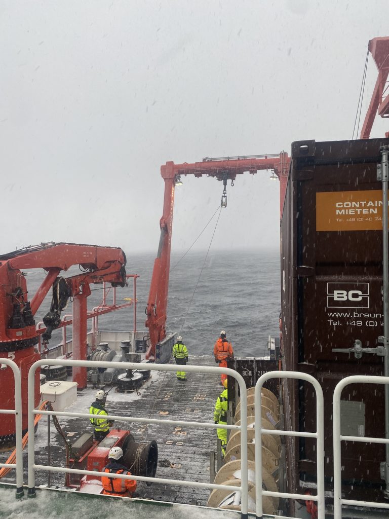
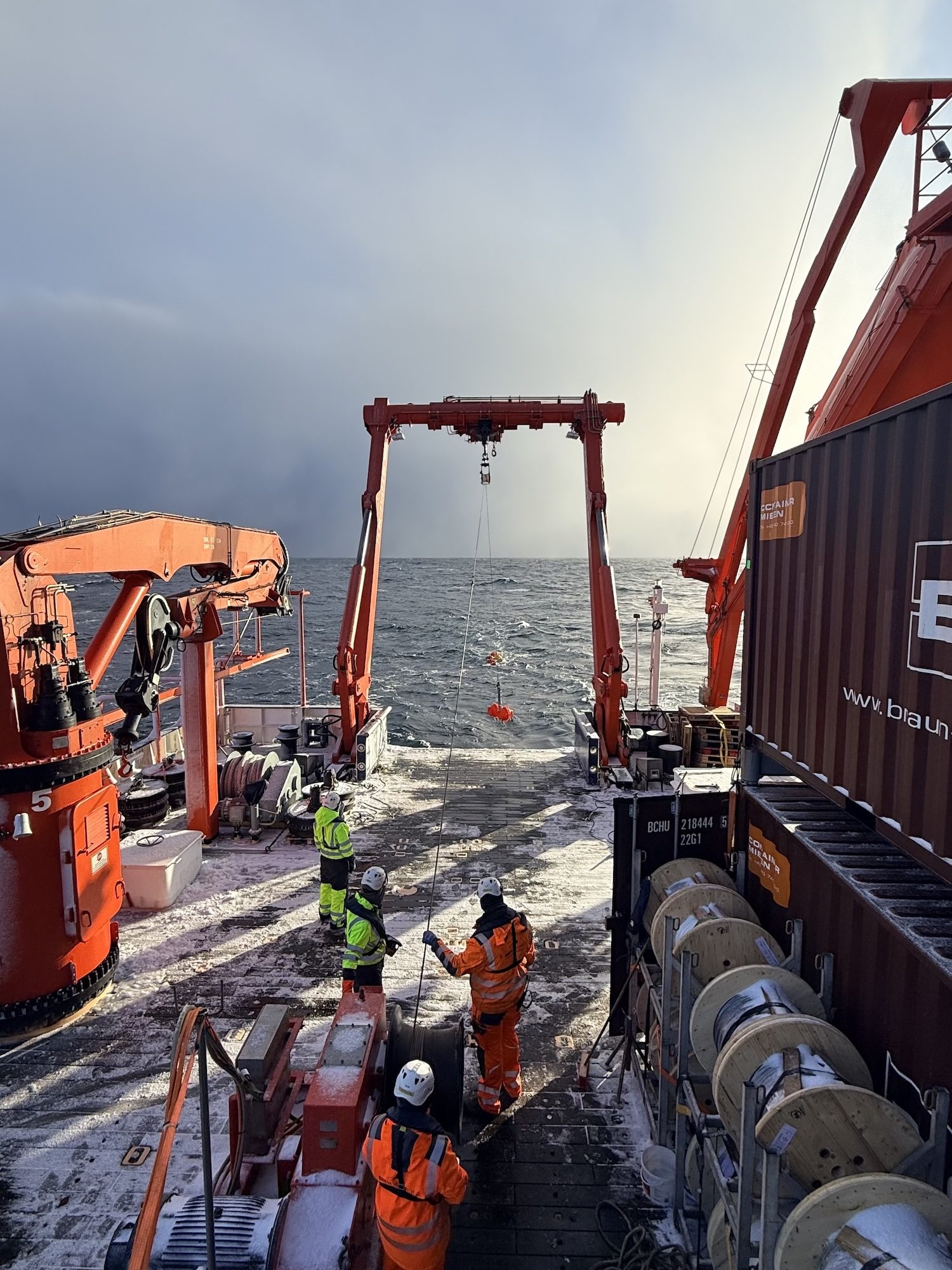
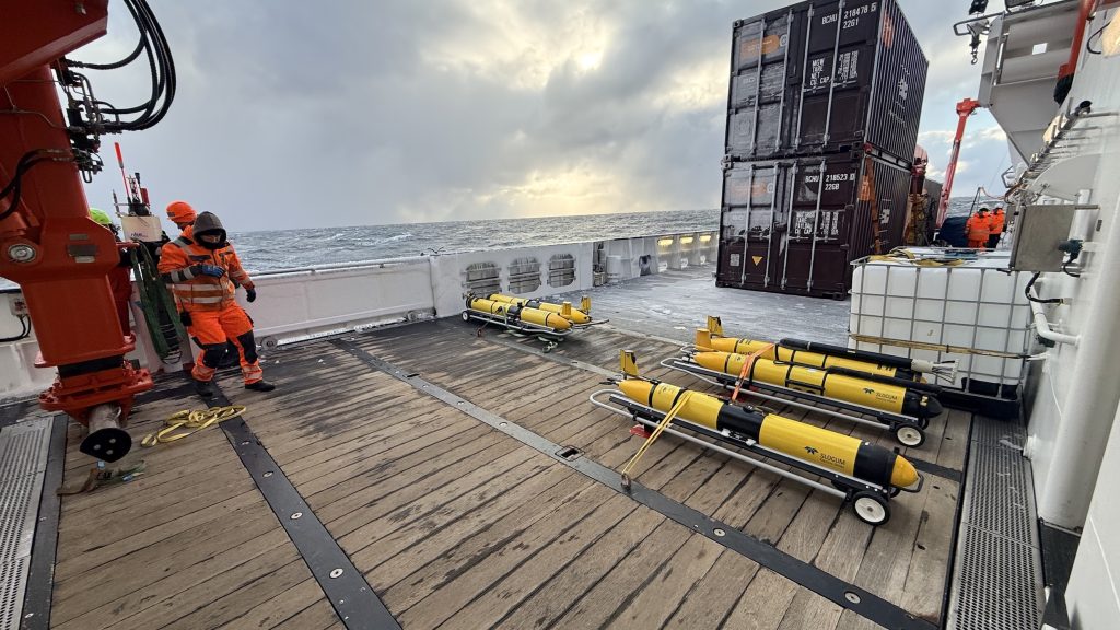
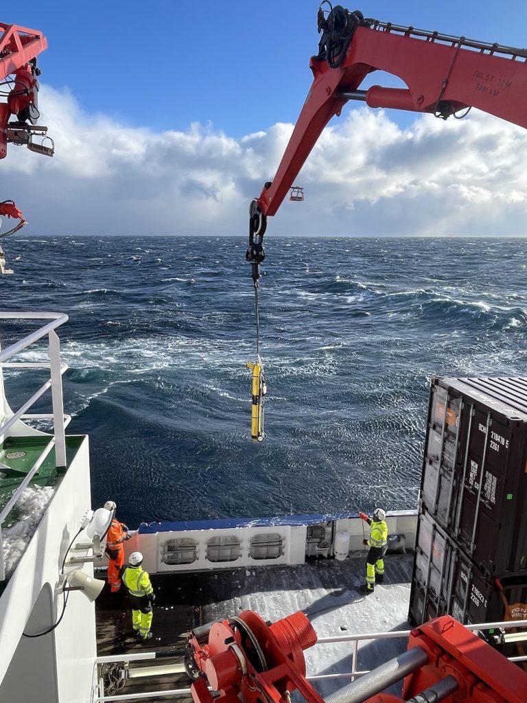
The days leading up to April 2nd were marked by very rough weather conditions. Life on board became both challenging and, at times, unintentionally entertaining sliding chairs were not uncommon. During the night from April 1st to April 2nd, winds reached 11 Beaufort with gusts up to 65 knots, forcing us to pause our measurements. Fortunately, conditions improved by morning, allowing us to resume our work. As well as with the help of the crew we had to adapt to the harsh weather conditions to continue our scientific work. On the 3rd of April, we were able to deploy a few gliders and one float. An ocean glider is an autonomous underwater Vehicle, which you can steer remotely and send to different locations, while it is measuring oceanographic key parameters.
This research cruise focuses on understanding small-scale processes in the ocean and their connection to the spring bloom, an essential phase in marine ecosystem in subpolar regions. Despite the challenging start, we have already gathered valuable data and look forward to the weeks ahead in the Labrador Sea.
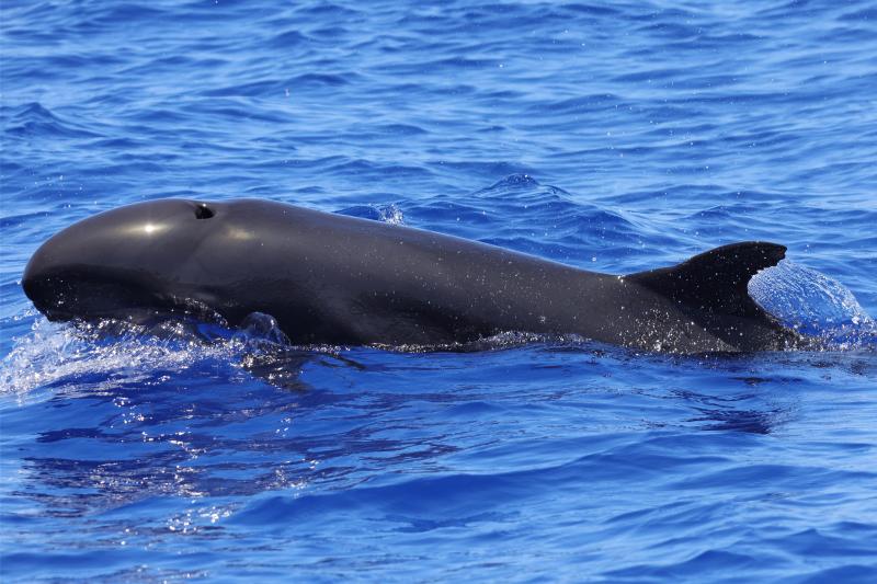
Despite their dramatic name, false killer whales aren’t an orca species. These animals are dolphins—members of the same extended family as the iconic “killer whale” (Orcinus orca). Compared to their namesake counterparts, these marine mammals are far less well-known than our ocean’s iconic orcas.
Let’s dive in and take a closer look at false killer whales—one of the ocean’s most social, yet lesser-known dolphin species.
Appearance and anatomy
False killer whales (Pseudorca crassidens) are among the largest members of the dolphin family (Delphinidae). Adults can grow up to 20 feet long and weigh between 1,500 and 3,000 pounds, though some individuals have been recorded weighing even more. For comparison, that’s roughly double the size of a bottlenose dolphin—and slightly larger than a typical sedan.
These animals are incredibly powerful swimmers with long, torpedo-shaped bodies that help them move efficiently through the open ocean in search of prey. Their skull structure is what earned them their name, as their head shape closely resembles that of orcas. With broad, rounded heads, muscular jaws and large cone-shaped teeth, early scientists were fascinated by the similarities between these two marine mammal species.
Although their heads may look somewhat like those of orcas, there are several ways to distinguish false killer whales from their larger namesake counterparts.
One of the most noticeable differences has to do with their coloration. While orcas are known for their iconic black-and-white pattern with paler underbellies, alternatively, false killer whales are typically a uniform dark gray to black in color—almost as if a small orca decided to roll around in the dirt. If you’ve ever seen the animated Disney classic 101 Dalmatians, the difference is a bit like when the puppies roll in soot to disguise themselves as labradors instead of showing their usual black-and-white spots.
Their teeth also present a differentiator. The scientific name Pseudorca crassidens translates almost literally to “thick-toothed false orca,” a nod to their sturdy, cone-shaped teeth that help these animals capture prey. Orcas tend to have more robust, bulbous heads, while false killer whales appear slightly narrower and more streamlined.
Behavior and diet
False killer whales are both highly efficient hunters and deeply social animals. It’s not unusual to see them hunting together both in small pods and larger groups as they pursue prey like fish and squid.
Scientists have even observed false killer whales sharing food with each other, a behavior that is very unusual for marine mammals. While some dolphin and whale species work together to pursue prey, they rarely actively share food. The sharing of food among false killer whales spotlights the strong social bonds within their pods. Researchers believe these tight-knit social connections help false killer whales thrive in offshore environments where they’re always on the move.
Maintaining these close bonds and coordinating successful hunts requires constant effective communication, and this is where false killer whales excel. Like other dolphins, they produce a variety of sounds like whistles and clicks to stay connected with their pod and locate prey using echolocation. In the deep offshore waters where they live, sound often becomes more important than sight, since sound travels much farther underwater than light.
Where they live
False killer whales are highly migratory and travel long distances throughout tropical and subtropical waters around the world. They prefer deeper waters far offshore, and this pelagic lifestyle can make them more difficult for scientists to study than many coastal dolphin species.
However, there are a few places where researchers have been able to learn more about them—including the waters surrounding the Hawaiian Islands.
Scientists have identified three distinct groups of false killer whales in and around Hawaii, but one well-studied group stays close to the main Hawaiian Islands year-round. Unfortunately, researchers estimate that only about 140 individuals remained in 2022, with populations expected to decline without action to protect them. This is exactly why this group is listed as endangered under the U.S. Endangered Species Act and is considered one of the most vulnerable marine mammal populations in U.S. waters.
Never Miss An Update
Sign up for Ocean Conservancy text messages today.
Current threats to survival
False killer whales are currently listed as Near Threatened on the IUCN Red List. From climate change-induced ocean acidification and harmful algal blooms to marine debris and fishing bycatch, false killer whales face the same mounting pressures that are impacting marine ecosystems around the world. As their prey becomes scarce due to increasing threats, populations of top predators like these decline, serving as a powerful signal that the ocean’s overall health is in critical need of protection.
Here at Ocean Conservancy, we’re working daily to confront these threats head-on and protect the ecosystems and wildlife we all cherish so dearly. But we can’t do it without you. Support from ocean lovers is what powers our work to protect our ocean, and right now, our planet needs all the help it can get. Visit Ocean Conservancy’s Action Center today and join our movement to create a better future for our ocean, forever and for everyone.
The post All About False Killer Whales appeared first on Ocean Conservancy.
https://oceanconservancy.org/blog/2026/03/31/false-killer-whales/

-
Climate Change8 months ago
Guest post: Why China is still building new coal – and when it might stop
-
Greenhouse Gases8 months ago
Guest post: Why China is still building new coal – and when it might stop
-

 Greenhouse Gases2 years ago
嘉宾来稿:满足中国增长的用电需求 光伏加储能“比新建煤电更实惠”
-
Climate Change2 years ago
Bill Discounting Climate Change in Florida’s Energy Policy Awaits DeSantis’ Approval
-

 Climate Change2 years ago
嘉宾来稿:满足中国增长的用电需求 光伏加储能“比新建煤电更实惠”
-
Climate Change Videos2 years ago
The toxic gas flares fuelling Nigeria’s climate change – BBC News
-

 Renewable Energy6 months ago
Sending Progressive Philanthropist George Soros to Prison?
-

 Carbon Footprint2 years ago
US SEC’s Climate Disclosure Rules Spur Renewed Interest in Carbon Credits