Kenyan environmentalists have overtaken the government again in a fifteen-year legal battle to stop the expansion of a road inside the Aberdare Forest, where wider tensions between economic development and protection for nature and the climate are playing out.
Conservationists have challenged the road construction project in the East African nation’s courts since 2009, arguing it threatens the region’s rich ecosystem and wildlife. But in January, President William Ruto declared his government would proceed with the works, a decision critics said undermined his climate-friendly image on the global stage.
The road – now a rough dirt track punctuated with mounds of elephant dung – dissects the Aberdare Forest in central Kenya, cutting through an expanse of dense woods mingled with thick bamboo and colourful alpine vegetation. It also crosses the mountainous Aberdare National Park, a haven for wildlife including lions, antelope and elephants.
The government wants to widen and tarmac the picturesque road to connect the two agricultural counties of Nyandarua and Nyeri, which it says would reduce local travel time and the cost of farm produce while boosting tourism.
Environmentalists argue that the potential negative consequences for the forest, biodiversity and climate change far outweigh the purported benefits.
“I don’t feel that this is what we want to offer to the Kenyan people in terms of connectivity,” Christian Lambrechts, executive director of conservation trust Rhino Ark, told journalists during a trip to the Aberdare Forest in Nyeri County.
“We feel that this road is not justifiable from a socioeconomic standpoint. It will cut the Aberdare ecosystem into two, and lead to road user-wildlife conflicts.”
Rhino Ark Executive Director Christian Lambrechts addresses journalists in Nyeri County, Kenya, during a media tour of Aberdare Forest and National Park on February 29, 2024. (Photo: Joseph Maina)
Threat to wildlife and water
In March, the East African Wild Life Society – in response to Ruto’s decision to press ahead with the project – filed a fresh petition to a local court in Nyeri. It ordered the road’s construction to be put on hold, pending a hearing in early June.
Conservationists are calling for the government to upgrade an alternative road instead, which largely skirts around the forest, saying it will still cut travel time while protecting wildlife and the Aberdare ecosystem that is vital for the water cycle.
Enock Ole Kiminta, CEO of KeNAWRUA, a national organisation bringing together local water user associations, told Climate Home that expanding the Ihithe-Ndunyu Njeru road in the Aberdare Forest would destroy almost 400 hectares of indigenous forests and 327 water springs.
It would also negatively impact close to 70 percent of local biodiversity, including endangered birds and animals, and elephant breeding areas, he added.
“And yet the president appears to be saying, ‘To hell with you – go to court. We don’t care what the courts will say; we’ll still go ahead and do it’,” Kiminta said, before the latest suspension of the project.
A scene in the Aberdare National Park, central Kenya, pictured on March 1, 2024 (Photo: Joseph Maina)
In January, the National Environment Management Authority approved the road’s construction in a surprise move, after earlier opposing it, and issued a license for the roadworks to the Kenya National Highways Authority (KeNHA).
It did, however, give instructions to reduce the road’s width from 40 metres to 25 metres in sections traversing the Aberdare Forest and the Aberdare National Park.
On a tour of the region that month, Ruto asked a local crowd if they wanted the road’s expansion to proceed or to wait for the court’s final decision. After gaining their backing, Ruto instructed government officials to allocate funds to push ahead immediately.
Neither KeNHA nor the Kenya Wildlife Service responded to requests for comment for this article.
International accolades
Kenyan climate policy experts told Climate Home the Aberdare case symbolises a wider disconnect between Ruto’s vocal support for greater climate action on the global stage and decisions by his government that threaten natural ecoystems and carbon sinks at home.
Ruto has pushed for more climate finance for the African continent and hosted the African Climate Summit last September in Nairobi, which secured $23 billion in funding for green projects for the continent.
Last November, he made it onto Time Magazine’s list of the 100 most influential leaders driving business to real climate action.
He also rolled out an ambitious plan in 2022 to plant 15 billion trees in Kenya by 2032, in a bid to reach 30% tree cover, with all ministries urged to allocate funds for the initiative.
Loss and damage board speeds up work to allow countries direct access to funds
“His right hand doesn’t know what his left is doing,” said Kiminta. “He’s not being honest when he’s out of the country speaking all about climate change in rosy terms and doing something different on the ground.”
While attempting to plant billions of trees, the Kenyan authorities have also been dishing out permits to timber dealers, Kiminta added.
According to the Global Forest Watch monitoring service, tree loss in Kenya increased to 11,000 hectares in 2023, of which about 10,000 hectares was natural forest. That rise followed a two-year decline in 2021 and 2022, when the country recorded its lowest deforestation levels since 2001.
Failed effort to lift logging ban
The Aberdare row is not the first time Ruto has pitted himself against the justice system over decisions involving forests.
Last July, less than two years after coming to power, he unilaterally lifted a six-year logging ban in the country’s forests, saying it would benefit local economies – sparking a legal backlash.
The Law Society of Kenya (LSK) petitioned against the move, saying it disregarded the crucial role forests play in mitigating climate change, preserving biodiversity and safeguarding vital ecosystems.
“It may be for lack of vision, foresight, or even commitment to sustainable development, but it is by all means a blow to Kenya’s environmental conservation efforts and international standing,” wrote Faith Odhiambo, the current LSK president, in a post on Twitter.
The LSK argued the public had not been involved in the process leading to the decision to lift the ban, as stipulated in the constitution – and in October succeeded in its push for the Environmental and Lands Courts to void the president’s directive.
Farmers tilling land cleared from the forest in Kinale on March 7, 2024 (Photo: Joseph Maina)
Indigenous rights
Another row erupted last year over the Mau Forest Complex in Kenya’s Rift Valley, following an effort by the government to evict indigenous communities who have resisted such attempts for years.
The evictions are part of an official strategy to protect Kenya’s principal water catchment areas, with speculation the latest round may also have been tied to a deal with UAE-based firm Blue Carbon to generate carbon credits for use under the Paris Agreement on climate change.
The Mau – Kenya’s largest forest – has been the theatre of drawn-out conflict between the government and forest communities, particularly the Ogiek, a minority ethnic group that lays claim to the forest as its ancestral land.
The African Court on Human and Peoples’ Rights determined in 2022 that the state had violated the Ogiek’s rights over a substantial period and directed it to adopt appropriate measures to prevent the recurrence of abuses.
But in a surprise twist last October, the government embarked on another forceful eviction of forest communities, including the Ogiek.
Damaris Bonareri, an advocate of the High Court of Kenya and senior programme advisor for legal affairs at the Kenya Human Rights Commission, told Climate Home the Ogiek people are protected by the constitution and the African Charter on Human and Peoples’ Rights.
“According to our constitution, the Ogiek have a right to be in that forest. The president is wrong,” she added, noting that Ruto has spoken about the country’s judiciary in ways that could turn public opinion against it.
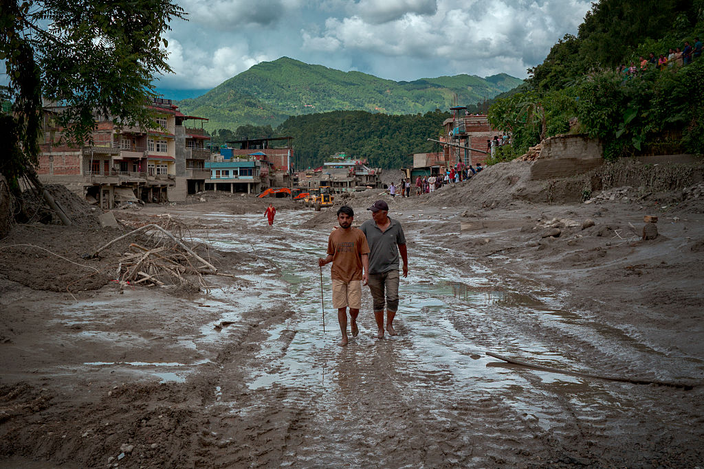
The president has publicly defended his green agenda, and often ties climate change and its causes to the extreme weather hitting the country, including torrential rains that have caused severe flooding and landslides in recent weeks, killing around 230 people.
“We must be careful on environmental issues,” Ruto told a political rally in March in Kericho, one of four counties covered by the Mau Forest, stressing that his administration would not permit people to graze animals or cultivate crops in forests.
“You have heard about climate change. Kenya was almost destroyed by adverse weather conditions just the other year and it was because of environmental degradation,” he said.
(Reporting by Joseph Maina; editing by Megan Rowling)
The post Road row in protected forest exposes Kenya’s climate conundrum appeared first on Climate Home News.
Road row in protected forest exposes Kenya’s climate conundrum
Climate Change
Woodside’s own modelling reveals catastrophic oil spill risk at Scott Reef
What if Australia’s worst offshore oil spill hasn’t happened yet?
I’m terrified by the thought.
Our new report in partnership with Environs Kimberley analyses Woodside’s own oil spill modelling and it reveals a worst-case blowout at the corporation’s proposed Browse gas project at Scott Reef could be up to 30 times larger than the Montara oil spill – one of Australia’s worst environmental disasters to date.
Woodside’s own modelling warns that oil pollution could spread across Scott Reef, the Kimberley coast and beyond, with impacts Woodside itself describes as “severe”, “potentially irreversible” and “catastrophic”.

What’s at stake?
Scott Reef really is like nowhere else on Earth.
Scott Reef is Australia’s largest freestanding oceanic reef, a pristine marine ecosystem that has thrived for around 15 million years. About 270 kilometres off the Kimberley coast, it supports more than 2,000 marine species, including endangered pygmy blue whales, nesting green sea turtles, the endangered dusky sea snake and ancient corals.
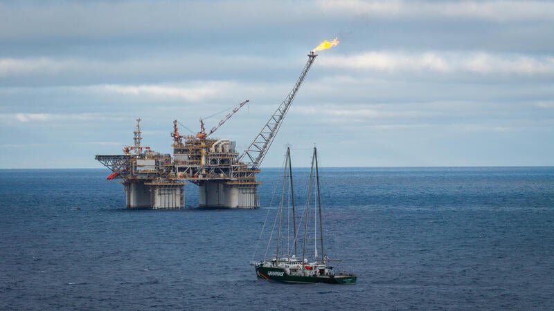
Yet Woodside wants to drill up to 57 toxic wells around and underneath it, causing decades of deafening seismic blasting, light and noise pollution, shipping traffic and, of course, the risk of a ‘catastrophic’ oil spill.

What did Woodside’s modelling find?
Before Browse can be approved, Woodside is required to assess what could happen if something goes wrong. We analysed the corporation’s own environmental assessment documents, and the findings are deeply concerning.
Woodside’s modelling shows that the most severe Browse scenario would be the worst oil spill in Australian history, releasing up to 893,739 barrels of condensate into the Timor Sea. For context, the Montara oil spill released 30,000 barrels of oil.
A blowout of this scale could see oil spread hundreds of kilometres, reaching some of Australia’s most important marine environments, extending into Indonesian and Timor-Leste waters and even washing up along parts of the Kimberley coast. Entrained oil – oil mixed throughout the water column – is predicted to travel up to 863 kilometres from the spill site.
The modelling identifies potential impacts to at least nine marine parks, eight reefs and three Indigenous Protected Areas, as well as important habitats for endangered species, including pygmy blue whales, green sea turtles, seabirds and other marine life.

These aren’t just places on a map. They are globally significant marine ecosystems that support ancient coral reefs, endangered wildlife, tourism, fisheries and coastal communities. A spill of this scale wouldn’t simply affect one reef; it has the potential to impact an entire connected marine ecosystem.
Why this matters now
The most important thing is that Browse has not yet been approved. That means there is still time to stop Browse and the serious risks outlined in Woodside’s own modelling.
The science has been done. The risks have been modelled. The decision now rests with the Australian Government.
Governments are often forced to respond after environmental disasters happen. This is one of those rare moments where they have the opportunity to act before one does.
What you can do
Together, we still have the power to stop Woodside and save Scott Reef.
You can help by:
- Sending an email to Environment Minister Murray Watt and Prime Minister Anthony Albanese, calling on them to reject Browse.
- Sharing this story to help more Australians understand what’s at stake.
- Encouraging your friends and family to take action.
The more people who support saving Scott Reef, the harder it is for governments to approve Woodside’s drilling plans – Browse.
Together, we can ensure a reef that has existed for millions of years is known for its incredible biodiversity – not as the site of Australia’s worst oil spill.
Let’s save Scott Reef.
What if Australia’s worst offshore oil spill hasn’t happened yet?
Climate Change
REPORT: ‘Catastrophic” Browse Oil Spill Report
Analysis by Greenpeace and Environs Kimberley shows that a severe oil spill at Scott Reef could be the worst in Australian history — Woodside has labeled the impact of such a spill ‘catastrophic’.
According to the fossil fuel company the impacts to Scott Reef ‘would likely be severe and potentially irreversible’. Oily pollution could reach as far as the Kimberley coast to the coasts of Indonesia and Timor Leste while endangered marine species live, breed, forage and migrate within the potential disaster zone: whales, seabirds, turtles and other marine life are all at risk.
Report Summary
Woodside’s Browse drilling plans at Scott Reef have been found to pose unacceptable risks to the Western Australian environment once before. To secure their approvals under Federal and Western Australian law, Woodside has modelled a number of possible oil spill scenarios that could result from the Browse project.

Key Findings
- The most severe Browse scenario would be the worst oil spill in Australian history – up to 30 times bigger than the 2009 Montara oil spill disaster. According to Woodside, the environmental impact of such a spill would be ‘catastrophic’.
- Scott Reef and Sandy Islet could be covered in oily pollution. Woodside has conceded that the impacts to Scott Reef from a major spill ‘would likely be severe and potentially irreversible’.
- A blowout of this scale could see oil washing up on the Western Australian Kimberley Coast, and affect at least nine marine parks, eight reefs, three Indigenous Protected Areas, and several islands in Australian, Indonesian and Timor Leste waters.
- Endangered and vulnerable marine species live, breed, forage and migrate within the potential disaster zone: whales, seabirds, turtles and other marine life are all at risk.
- A Browse oil spill threatens important tourism, diving, surfing and fishing hotspots, with potential ‘long term impacts’ for tourism operators in the Kimberley or visiting Rowley Shoals or Scott Reef.

Scott Reef: An ancient oceanic reef system
Scott Reef, located around 270 kilometres off the Western Australian Kimberley coast, is one of Australia’s largest oceanic reef systems. Ancient Scott Reef has been thriving for 15 million years, having adapted to changing seas. Today, it is a haven for marine life, providing vital habitat for more than a thousand species, including corals, fish, sharks and rays.
The deep waters surrounding the reef are home to 29 known species of whale and dolphin, including endangered pygmy blue whales, which travel along the Western Australian coast and stop at Scott Reef during their annual migration to forage and feed. The dusky sea snake, also classified as endangered, lives at Scott Reef. Sandy Islet, part of Scott Reef, is a nesting ground for a small population of genetically distinct green sea turtles, a species classified as vulnerable.
If Woodside, Australia’s largest oil and gas company, were to gain approval to drill for gas at Scott Reef, the ecosystem would face a barrage of industrial impacts, including seismic blasting, gas flaring, underwater noise, artificial lighting, pipe- laying, and fast-moving vessels over years of construction and operation. Add to that the risk of a major oil spill that could be Australia’s worst environmental disaster, with consequences spreading far beyond Scott Reef.

A disaster worse than Montara, according to Woodside itself
Woodside has proposed drilling 50 new wells around Scott Reef to extract oil and gas from beneath the reef as part of the Browse project. Woodside has proposed to build a 900-kilometre-long undersea pipeline to connect the Scott Reef-Browse site with its North West Shelf facility at Karratha in Western Australia, where the gas would be processed, mostly for international export. Woodside has modelled a number of possible oil spill scenarios that could result from the Browse project. Woodside performed this modelling to comply with mandatory environmental impact assessment requirements under Federal and Western Australian laws.
To identify which areas are at risk of an oil spill from the Browse project, Woodside engaged experts to conduct probabilistic modelling. Experts simulated different spills, noting which locations would be contaminated by oil and how much oil would make it to shore. They also assessed how likely each location was to be affected.
” Woodside’s ‘worst case’ scenario is a blowout at the Torosa gasfield, directly under Scott Reef.”
Greenpeace Australia Pacific and Environs Kimberley’s analysis shows an oil spill at Torosa could see 893,739 barrels of condensate spilled into the Timor Sea. This would be up to 30 times bigger than the 2009 Montara oil spill, considered one of Australia’s worst environmental disasters. Oil leaked into the Timor Sea for days after an oil rig caught fire off the Western Australian coast, causing a 90,000 square kilometre oil slick that spread all the way to Indonesia.
People, places and wildlife at risk
Woodside’s modelling shows that an oil spill at Scott Reef could affect eight reefs, at least nine marine parks and three Indigenous Protected Areas. In the event of a worst-case oil spill, Scott Reef and Sandy Islet, being closest to the wellhead, would be worst affected.
Woodside’s modelling finds that the impacts to Scott Reef from a major spill like this ‘would likely be severe and potentially irreversible’. The impacts of an oil spill are not confined to Scott Reef – according to Woodside’s modelling, ‘hydrocarbon spills resulting from the proposed Browse to NWS Project have the potential to significantly impact shoreline habitats at Scott Reef, Ashmore Reef, Cartier Island and Rowley Shoals.’
Oil from a blowout could also reach neighbouring countries, including Pulau Rote, Savu, Sumba and West Timor in Indonesia, and Timor Leste. This is not an exhaustive list of all places that could be affected by an oil spill at Scott Reef. Once oil hits the water, its spread is influenced by the wind, tides, currents and other external conditions. An oil spill from the Browse project could have a less or more severe impact than the modelling indicates. Equally, Woodside cannot rule out other sites being affected.
A disaster for marine life
Woodside’s oil spill modelling shows that a blowout from the Browse project would put whales, turtles, seabirds, coral, significant feedstocks such as plankton and seagrass, fish, dolphins and other marine life at risk. According to Woodside, a Browse oil spill would:
- Directly threaten the coral at Scott Reef, with ‘potential for near total coral mortality in the worst affected areas’; a severe spill could also harm coral at Seringapatam Reef and the Rowley Shoals.
- ‘Significantly impact’ the plankton, seagrass and macroalgae that support the entire food chain.
- ‘Significantly impact bird species, including protected species’, which are ‘particularly vulnerable’ to oil spills.
A spill would not only threaten birds at Scott Reef, but those that nest or breed at Ashmore Reef and Cartier Island, Browse Island, islands along the Kimberley coastline (such as the Lacepede Islands) and Rowley Shoals. Woodside’s oil spill modelling specifically notes the potential risk to thirteen species of seabirds.
Oil spills also threaten whales and other cetaceans, especially concentrations of oil on the surface of the water. This can cause ‘sublethal and lethal effects’, especially when feeding, as whales and other marine mammals have been found to aspirate oil when breathing through an oil slick at the sea surface, thus absorbing hydrocarbons directly into their lungs, leading to sublethal and lethal impacts.
According to Woodside’s modelling, a Browse oil spill could be particularly harmful to the spinner dolphins living at Scott Reef with the potential for ‘a significant portion of this local population to be impacted in the event of a worst-case hydrocarbon spill’.
Marine reptiles, including the green sea turtles found at Scott Reef, are also at risk. Woodside’s modelling warns that an oil spill could cause ‘significant mortality amongst adults and hatchlings’, leading to ‘the potential for longer-term impacts on the Scott Reef – Browse Island genetic stock of green turtles’. Further, an oil spill could have lasting impacts on the breeding populations of olive ridley turtles, flatback turtles and hawksbill turtles. Essentially, all marine life found at or near the sea surface could be impacted by such a spill.

Woodside cannot be trusted
In Woodside’s inadequate response plan, Woodside states that it considers an oil spill to be ‘highly unlikely’ and the threat to the environment and wildlife to be ‘acceptable’. We do not believe these are credible assertions. For instance, the WA Environmental Protection Authority (EPA), which is assessing Woodside’s Browse to NWS proposal, did not agree. In August 2024, it emerged that the EPA advised Woodside that its Browse development posed ‘unacceptable’ risks to WA’s environment.
A potential oil spill from the Torosa field was one of the risks cited by the EPA in its preliminary decision not to approve the project. Woodside has subsequently revised its plans to drill for gas at Scott Reef, proposing to use unproven new technology that the company claims would bring a spill under control more quickly, reducing the spill time from 77 days to 13 days.
However, an independent assessment commissioned by Woodside did not support these claims. Instead, the expert questioned whether the piece of equipment proposed by Woodside — a capping stack — could be deployed in practice, and the time it would likely take to do so.
While Woodside has also claimed that a ‘pyrotechnic shear ram’ would reduce the spill time to as little as 24 hours, the company’s expert noted that this had yet to be ‘used in anger’ and that ‘there remains a risk’ that it fails to function.
Woodside’s alarming track record
Woodside’s stated ability to prevent or control a disaster is undercut by its poor environmental and safety track record. There have been numerous incidents at Woodside’s facilities over the last decade threatening the safety of its workers and the environment. These include:
- Whale calf collision: In August 2023, a tugboat operated by a Woodside contractor hit a whale calf in the Port of Dampier. The incident was only confirmed by the Department of Biodiversity, Conservation and Attractions (DBCA) after media inquiries.
- Explosion at Pluto LNG plant: In May 2023, an explosion forced Woodside to shut down and evacuate its Pluto LNG facility. Woodside was accused by unions of downplaying the incident. Eighteen months later, Woodside was again forced to put Pluto LNG into an emergency shutdown after the control systems failed.
- Oil spill near Ningaloo: In May 2025, Woodside spilled 16,000 litres of ‘hydrocarbons’ into the ocean near World Heritage listed Ningaloo Reef while decommissioning its Griffin facility. Three months later, the government regulator ordered Woodside to stop decommissioning operations at Griffin and nearby Stybarrow following a series of ‘preventable health and safety incidents’ at both sites.
- Oil spill in Cossack field: In 2016, a Woodside oil rig in the Cossack field leaked over 10,500 litres of oil into the ocean due to a degraded seal.
- Northern Endeavour clean-up debacle: Woodside evaded a $362 million decommissioning bill for its Northern Endeavour oil platform in the Timor Sea by offloading it onto a one-person operation. When the buyer went bankrupt, the Federal Government had to step in, eventually putting a levy on offshore oil and gas companies to recover the clean up costs.
- Cost-cutting and corrosion: In 2021, Woodside announced a 30% cut in operating costs, focusing on maintenance, despite repeated warnings from the government regulator about corrosion at its oil and gas facilities. The warnings continued. In July 2023, the regulator blamed Woodside’s ‘inadequate maintenance’ for serious corrosion of the flare bridge and support structure at its North Rankin complex.
- Abandoned infrastructure: Woodside finished extracting oil from the Enfield field in 2018. In 2019, the government regulator ordered Woodside to remove the Nganhurra Riser Turret Mooring (RTM), an 83-metre-long, 2,452 tonne piece of infrastructure. Woodside instead tried to sink the RTM near the World Heritage-listed Ningaloo Reef. After a public outcry, Woodside finally removed the RTM in October 2023.
A lasting legacy for our oceans: Save Scott Reef from Woodside’s pollution
Woodside’s Browse proposal to drill for oil and gas presents unacceptable risks to Scott Reef and the web of life it supports from Western Australia to Indonesia.
Greenpeace Australia Pacific and Environs Kimberley are calling on the WA and Federal Governments to save Scott Reef by rejecting Woodside’s Browse project once and for all.
What you can do
Together, we still have the power to stop Woodside and save Scott Reef.
You can help by:
- Sending an email to Environment Minister Murray Watt and Prime Minister Anthony Albanese, calling on them to reject Browse.
- Sharing this story to help more Australians understand what’s at stake.
- Encouraging your friends and family to take action.
Climate Change
Browse Oil Spill Report

Analysis by Greenpeace and Environs Kimberley shows that a severe oil spill at Scott Reef could be the worst in Australian history — Woodside has labeled the impact of such a spill ‘catastrophic’. According to the fossil fuel company the impacts to Scott Reef ‘would likely be severe and potentially irreversible’. Oily pollution could reach as far as the Kimberley coast to the coasts of Indonesia and Timor Leste while endangered marine species live, breed, forage and migrate within the potential disaster zone: whales, seabirds, turtles and other marine life are all at risk.
Woodside’s Browse drilling plans at Scott Reef have been found to pose unacceptable risks to the Western Australian environment once before. To secure their approvals under Federal and Western Australian law, Woodside has modelled a number of possible oil spill scenarios that could result from the Browse project.

GPAP illustration of a ‘worst case’ senario oil spill based on Woodside’s own modeling.
Key Findings
- The most severe Browse scenario would be the worst oil spill in Australian history – up to 30 times bigger than the 2009 Montara oil spill disaster. According to Woodside, the environmental impact of such a spill would be ‘catastrophic’.
- Scott Reef and Sandy Islet could be covered in oily pollution. Woodside has conceded that the impacts to Scott Reef from a major spill ‘would likely be severe and potentially irreversible’.
- A blowout of this scale could see oil washing up on the Western Australian Kimberley Coast, and affect at least nine marine parks, eight reefs, three Indigenous Protected Areas, and several islands in Australian, Indonesian and Timor Leste waters.
- Endangered and vulnerable marine species live, breed, forage and migrate within the potential disaster zone: whales, seabirds, turtles and other marine life are all at risk.
- A Browse oil spill threatens important tourism, diving, surfing and fishing hotspots, with potential ‘long term impacts’ for tourism operators in the Kimberley or visiting Rowley Shoals or Scott Reef.

Browse and Montara: Location and extent in the Timor Sea: GPAP illustration based on maps from ‘The Montara Oil Spill: A 2009 Well Blowout in the Timor Sea’ and a Browse loss of well containment.
Scott Reef: An ancient oceanic reef system
Scott Reef, located around 270 kilometres off the Western Australian Kimberley coast, is one of Australia’s largest oceanic reef systems. Ancient Scott Reef has been thriving for 15 million years, having adapted to changing seas. Today, it is a haven for marine life, providing vital habitat for more than a thousand species, including corals, fish, sharks and rays.
The deep waters surrounding the reef are home to 29 known species of whale and dolphin, including endangered pygmy blue whales, which travel along the Western Australian coast and stop at Scott Reef during their annual migration to forage and feed. The dusky sea snake, also classified as endangered, lives at Scott Reef. Sandy Islet, part of Scott Reef, is a nesting ground for a small population of genetically distinct green sea turtles, a species classified as vulnerable.
If Woodside, Australia’s largest oil and gas company, were to gain approval to drill for gas at Scott Reef, the ecosystem would face a barrage of industrial impacts, including seismic blasting, gas flaring, underwater noise, artificial lighting, pipe- laying, and fast-moving vessels over years of construction and operation. Add to that the risk of a major oil spill that could be Australia’s worst environmental disaster, with consequences spreading far beyond Scott Reef.

GPAP illustration of drilling sights at Scott Reef.
A disaster worse than Montara, according to Woodside itself
Woodside has proposed drilling 50 new wells around Scott Reef to extract oil and gas from beneath the reef as part of the Browse project. Woodside has proposed to build a 900-kilometre-long undersea pipeline to connect the Scott Reef-Browse site with its North West Shelf facility at Karratha in Western Australia, where the gas would be processed, mostly for international export. Woodside has modelled a number of possible oil spill scenarios that could result from the Browse project. Woodside performed this modelling to comply with mandatory environmental impact assessment requirements under Federal and Western Australian laws.
To identify which areas are at risk of an oil spill from the Browse project, Woodside engaged experts to conduct probabilistic modelling. Experts simulated different spills, noting which locations would be contaminated by oil and how much oil would make it to shore. They also assessed how likely each location was to be affected.
” Woodside’s ‘worst case’ scenario is a blowout at the Torosa gasfield, directly under Scott Reef.”
Greenpeace Australia Pacific and Environs Kimberley’s analysis shows an oil spill at Torosa could see 893,739 barrels of condensate spilled into the Timor Sea. This would be up to 30 times bigger than the 2009 Montara oil spill, considered one of Australia’s worst environmental disasters. Oil leaked into the Timor Sea for days after an oil rig caught fire off the Western Australian coast, causing a 90,000 square kilometre oil slick that spread all the way to Indonesia.
People, places and wildlife at risk
Woodside’s modelling shows that an oil spill at Scott Reef could affect eight reefs, at least nine marine parks and three Indigenous Protected Areas. In the event of a worst-case oil spill, Scott Reef and Sandy Islet, being closest to the wellhead, would be worst affected.
Woodside’s modelling finds that the impacts to Scott Reef from a major spill like this ‘would likely be severe and potentially irreversible’. The impacts of an oil spill are not confined to Scott Reef – according to Woodside’s modelling, ‘hydrocarbon spills resulting from the proposed Browse to NWS Project have the potential to significantly impact shoreline habitats at Scott Reef, Ashmore Reef, Cartier Island and Rowley Shoals.’
Oil from a blowout could also reach neighbouring countries, including Pulau Rote, Savu, Sumba and West Timor in Indonesia, and Timor Leste. This is not an exhaustive list of all places that could be affected by an oil spill at Scott Reef. Once oil hits the water, its spread is influenced by the wind, tides, currents and other external conditions. An oil spill from the Browse project could have a less or more severe impact than the modelling indicates. Equally, Woodside cannot rule out other sites being affected.
A disaster for marine life
Woodside’s oil spill modelling shows that a blowout from the Browse project would put whales, turtles, seabirds, coral, significant feedstocks such as plankton and seagrass, fish, dolphins and other marine life at risk. According to Woodside, a Browse oil spill would:
- Directly threaten the coral at Scott Reef, with ‘potential for near total coral mortality in the worst affected areas’; a severe spill could also harm coral at Seringapatam Reef and the Rowley Shoals.
- ‘Significantly impact’ the plankton, seagrass and macroalgae that support the entire food chain.
- ‘Significantly impact bird species, including protected species’, which are ‘particularly vulnerable’ to oil spills.
A spill would not only threaten birds at Scott Reef, but those that nest or breed at Ashmore Reef and Cartier Island, Browse Island, islands along the Kimberley coastline (such as the Lacepede Islands) and Rowley Shoals. Woodside’s oil spill modelling specifically notes the potential risk to thirteen species of seabirds.
Oil spills also threaten whales and other cetaceans, especially concentrations of oil on the surface of the water. This can cause ‘sublethal and lethal effects’, especially when feeding, as whales and other marine mammals have been found to aspirate oil when breathing through an oil slick at the sea surface, thus absorbing hydrocarbons directly into their lungs, leading to sublethal and lethal impacts.
According to Woodside’s modelling, a Browse oil spill could be particularly harmful to the spinner dolphins living at Scott Reef with the potential for ‘a significant portion of this local population to be impacted in the event of a worst-case hydrocarbon spill’.
Marine reptiles, including the green sea turtles found at Scott Reef, are also at risk. Woodside’s modelling warns that an oil spill could cause ‘significant mortality amongst adults and hatchlings’, leading to ‘the potential for longer-term impacts on the Scott Reef – Browse Island genetic stock of green turtles’. Further, an oil spill could have lasting impacts on the breeding populations of olive ridley turtles, flatback turtles and hawksbill turtles. Essentially, all marine life found at or near the sea surface could be impacted by such a spill.

GPAP illustration of pygmy blue whale and humpback whale migration path through Scott Reef and a ‘worst case’ oil spill senario based on Woodside’s own modeling.
Woodside cannot be trusted
In Woodside’s inadequate response plan, Woodside states that it considers an oil spill to be ‘highly unlikely’ and the threat to the environment and wildlife to be ‘acceptable’. We do not believe these are credible assertions. For instance, the WA Environmental Protection Authority (EPA), which is assessing Woodside’s Browse to NWS proposal, did not agree. In August 2024, it emerged that the EPA advised Woodside that its Browse development posed ‘unacceptable’ risks to WA’s environment.
A potential oil spill from the Torosa field was one of the risks cited by the EPA in its preliminary decision not to approve the project. Woodside has subsequently revised its plans to drill for gas at Scott Reef, proposing to use unproven new technology that the company claims would bring a spill under control more quickly, reducing the spill time from 77 days to 13 days.
However, an independent assessment commissioned by Woodside did not support these claims. Instead, the expert questioned whether the piece of equipment proposed by Woodside — a capping stack — could be deployed in practice, and the time it would likely take to do so.
While Woodside has also claimed that a ‘pyrotechnic shear ram’ would reduce the spill time to as little as 24 hours, the company’s expert noted that this had yet to be ‘used in anger’ and that ‘there remains a risk’ that it fails to function.
Woodside’s alarming track record
Woodside’s stated ability to prevent or control a disaster is undercut by its poor environmental and safety track record. There have been numerous incidents at Woodside’s facilities over the last decade threatening the safety of its workers and the environment. These include:
- Whale calf collision: In August 2023, a tugboat operated by a Woodside contractor hit a whale calf in the Port of Dampier. The incident was only confirmed by the Department of Biodiversity, Conservation and Attractions (DBCA) after media inquiries.
- Explosion at Pluto LNG plant: In May 2023, an explosion forced Woodside to shut down and evacuate its Pluto LNG facility. Woodside was accused by unions of downplaying the incident. Eighteen months later, Woodside was again forced to put Pluto LNG into an emergency shutdown after the control systems failed.
- Oil spill near Ningaloo: In May 2025, Woodside spilled 16,000 litres of ‘hydrocarbons’ into the ocean near World Heritage listed Ningaloo Reef while decommissioning its Griffin facility. Three months later, the government regulator ordered Woodside to stop decommissioning operations at Griffin and nearby Stybarrow following a series of ‘preventable health and safety incidents’ at both sites.
- Oil spill in Cossack field: In 2016, a Woodside oil rig in the Cossack field leaked over 10,500 litres of oil into the ocean due to a degraded seal.
- Northern Endeavour clean-up debacle: Woodside evaded a $362 million decommissioning bill for its Northern Endeavour oil platform in the Timor Sea by offloading it onto a one-person operation. When the buyer went bankrupt, the Federal Government had to step in, eventually putting a levy on offshore oil and gas companies to recover the clean up costs.
- Cost-cutting and corrosion: In 2021, Woodside announced a 30% cut in operating costs, focusing on maintenance, despite repeated warnings from the government regulator about corrosion at its oil and gas facilities. The warnings continued. In July 2023, the regulator blamed Woodside’s ‘inadequate maintenance’ for serious corrosion of the flare bridge and support structure at its North Rankin complex.
- Abandoned infrastructure: Woodside finished extracting oil from the Enfield field in 2018. In 2019, the government regulator ordered Woodside to remove the Nganhurra Riser Turret Mooring (RTM), an 83-metre-long, 2,452 tonne piece of infrastructure. Woodside instead tried to sink the RTM near the World Heritage-listed Ningaloo Reef. After a public outcry, Woodside finally removed the RTM in October 2023.
A lasting legacy for our oceans: Save Scott Reef from Woodside’s pollution
Woodside’s Browse proposal to drill for oil and gas presents unacceptable risks to Scott Reef and the web of life it supports from Western Australia to Indonesia.
Greenpeace Australia Pacific and Environs Kimberley are calling on the WA and Federal Governments to save Scott Reef by rejecting Woodside’s Browse project once and for all.
What you can do
Together, we still have the power to stop Woodside and save Scott Reef.
You can help by:
- Sending an email to Environment Minister Murray Watt and Prime Minister Anthony Albanese, calling on them to reject Browse.
- Sharing this story to help more Australians understand what’s at stake.
- Encouraging your friends and family to take action.
-
Climate Change1 year ago
Guest post: Why China is still building new coal – and when it might stop
-
Greenhouse Gases1 year ago
Guest post: Why China is still building new coal – and when it might stop
-
Greenhouse Gases2 years ago嘉宾来稿:满足中国增长的用电需求 光伏加储能“比新建煤电更实惠”
-
Climate Change2 years ago嘉宾来稿:满足中国增长的用电需求 光伏加储能“比新建煤电更实惠”
-
Climate Change2 years ago
Bill Discounting Climate Change in Florida’s Energy Policy Awaits DeSantis’ Approval
-
Renewable Energy10 months agoSending Progressive Philanthropist George Soros to Prison?
-
Greenhouse Gases1 year ago
嘉宾来稿:探究火山喷发如何影响气候预测
-
Carbon Footprint2 years agoUS SEC’s Climate Disclosure Rules Spur Renewed Interest in Carbon Credits