

This month marks 10 years since the UK recorded its first named storm.
Storm Abigail struck in November 2015, bringing high winds, lightning and snow and causing power cuts and school closures in northern Scotland.
In the decade that has passed, storm naming has become a key part of how the Met Office warns the public about impending storms.
Storm naming is a public safety tool that makes severe weather easier to remember, talk about and follow.
The success of the scheme offers lessons for how clear communication can help communities prepare, adapt and build resilience in a changing climate.
Here, we look back at a decade of naming storms in the UK and some of the most notable events.
Storms in the UK
Storms in the UK typically take place during the autumn and winter months and last for between two and three days.
The number of named storms varies from year to year. Some storm seasons – for example, 2023–24 – are exceptionally active, while others are much quieter.
The UK owes its stormy climate in large part due to the jet stream – fast-moving winds that blow from west to east high in the atmosphere and push low-pressure weather systems across the Atlantic.
These low-pressure systems can bring heavy rain and strong winds to the UK, which, in turn, causes storms.
Storms in the UK can cause serious damage, felling trees, destroying infrastructure and causing travel disruptions.
Some have resulted in widespread flooding – and others, tragically, in loss of life.
Over the last decade, the UK has seen a number of storms with extreme wind speeds and heavy rainfall.
The table below sets out a list of records set by storms between November 2015 and October 2025.
| Maximum hourly gust speeds | Storm Eunice, 2022 | 122 miles per hour (mph) |
| Highest daily rainfall total | Storm Desmond, 2015 | 264.4mm |
| Lowest mean sea level pressure | Storm Éowyn, 2025 | 941.9 hectopascals (hPa) |
UK storm records for the period November 2015–October 2025. Source: Met Office
Storm naming
Storm naming was introduced in the UK and Ireland at the start of the 2015 storm season.
Launched by the Met Office and Ireland’s weather service, Met Éireann, Dutch weather service the Royal Netherlands Meteorological Institute (KNMI) joined the storm-naming scheme in 2019.
This collaboration between the UK, Ireland and Netherlands is one of three storm-naming groups in Europe. Each group releases a new alphabetical list of storm names in September.
The graphic below highlights the storm names picked by the Western European storm-naming group for 2025-26.

Not all storms are named. A storm will be named if the Met Office anticipates it having potential to cause disruption or damage.
This is often linked to whether strong winds are expected, but impacts caused by other weather types – for instance, heavy rain, hail or snow – are also considered.
Once named, the storm is referred to consistently by weather services and other authorities in Ireland, Netherlands and the UK.
Storm naming was introduced to improve communication of the weather forecast to the public and help people stay safe during severe weather.
Using a single, authoritative name for a storm allows government and media outlets to deliver a consistent message about approaching severe weather.
In this way, the public will be better placed to keep themselves, their homes and businesses safe.
There have typically been around half a dozen named storms each year since November 2015, although this varies on a year-to-year basis.
The 2023-24 storm season saw the most named storms to date. In August 2024, Storm Lillian became the 12th named storm of that season.
Below is a table of all the storms that have been named since 2015.
Storms named between November 2015 and October 2025. Source: Met Office.
Notable named storms
While every year since the scheme began has seen storms strong enough to be named, some storms have been particularly significant.
Storm Desmond, December 2015
Storm Desmond brought extreme rainfall to north-west England. The weather station in Honister Pass in Cumbria recorded 34.1cm of rainfall in just 24 hours in a new UK record. Another record was set when 405mm of rain fell at Thirlmere in Cumbria over two consecutive days.
The subsequent floods affected thousands of homes and businesses across Cumbria and other parts of northern England, sweeping away several bridges and cutting road and rail links.
Storm Desmond led to the government launching the National Flood Resilience Review.

Storm Arwen, November 2021
Storm Arwen is an example of how the damages caused by a storm depends on more than its overall strength. A storm’s location, duration and wind direction also plays a role.
This storm occurred after an area of pressure in the North Sea drove very strong northerly winds across north-eastern parts of the UK. Winds gusted at up to 98mph at Brizlee Wood in Northumberland.
The unusual wind direction of Storm Arwen resulted in the felling of thousands of trees and left more than a million homes without power. Parts of the Pennines also saw significant disruption from lying snow.
Storms, like Arwen, that have a wind direction different to the prevailing south-westerly direction are less frequent, but are nevertheless a key part of the UK’s climate.
Storm Eunice, February 2022
In February 2022, three named storms affected the UK within the space of a week. The second of these storms was Storm Eunice.
Storms in close succession can cause particular problems because clean-up efforts can be hampered by further severe weather.
Storm Eunice was the most severe and damaging storm to affect England and Wales since February 2014. Gusts reached 122mph at Needles on the Isle of Wight – the highest on record for England at a low-level station.
The storm caused deaths, widespread damage to buildings and major travel disruption, including the temporary closure of the Port of Dover.

Storm Babet, October 2023
Storm Babet was notable for prolonged and intense rainfall which led to severe flooding, evacuations and sadly, deaths. In eastern Scotland, particularly in the county of Angus, rainfall totals reached 150-200mm, with some areas experiencing their wettest day on record since 1891.
A key factor with this storm was its unusual track, or path. The storm moved south to north, picking up additional moisture as it crossed the Bay of Biscay. A high-pressure “blocking” weather system over Scandinavia prevented Babet clearing the UK eastwards into the North Sea. As a result, high wind speeds were sustained across north-east England and much of Scotland for a prolonged period.

Storm Éowyn, January 2025
Storm Éowyn was the UK’s most powerful windstorm in more than decade, with the brunt of impacts felt in Northern Ireland and Scotland’s populous Central Belt.
Gusts exceeded 90mph in Northern Ireland – where this was the most severe wind storm since 1998 – while a 100mph gust was recorded at Drumalbin in Lanarkshire.
Roads were closed, flights, ferries and trains were cancelled and more than a million homes were reported to be without power at the peak of the storm. Scotland’s national botanical collection at the Royal Botanic Garden in Edinburgh saw several dozen felled or badly damaged trees.
Storm Éowyn’s intensity and geographic reach made it a standout event in recent years.
The timeline below shows how the Met Office worked with Met Éireann and KNMI to alert the public about Storm Éowyn.

Climate change and storms
There is no evidence of positive or negative trends in windstorm number or intensity in the UK’s recent climate.
Trends in windstorm frequency are difficult to detect, because numbers vary year-to-year and decade-to-decade.
Most climate projections indicate that winter windstorms will increase slightly in number and intensity over the UK, including disproportionately more severe storms. However, scientists have “medium confidence” in these projections – because a few climate models indicate differently.
This uncertainty highlights the need for ongoing research into how climate change may influence the severity and frequency of windstorms in northern Europe.
On the other hand, scientists are confident that climate change is making rainfall during storms more intense.
A 2024 attribution study involving Met Office scientists showed that climate change has made rainfall during storms more intense through autumn and winter in the UK. The researchers noted that this trend is set to increase as the planet warms.
Recent increases in flooding in the UK have also been linked to climate change.
Other research, meanwhile, has found that sea level rise caused by climate change will worsen storm surges and high waves during windstorms.
The continuing unpredictability of UK storms – combined with projections of increased rainfall and heightened coastal damage under climate change – means that being prepared for, and adapting to, the future weather is crucial.


The post Met Office: Ten years of naming UK storms to warn the public appeared first on Carbon Brief.
Met Office: Ten years of naming UK storms to warn the public

This is a republication of November’s edition of The Climate Agenda – a subscriber-only newsletter designed to keep you informed of the key events, negotiations and announcements happening every month. If you want to receive The Climate Agenda straight to your inbox at the start of each month, sign up as a subscriber today.
COP31 begins in one week, and we’ll have five specialist reporters on the ground in Antalya, Türkiye, bringing you every development as it happens. From the negotiations to leaders’ speeches and side events, we’ll be there to dissect what it all means for international climate policy on electrification, just transition, adaptation finance and much more.
Here’s what you need to know for November, why it matters and what to expect.
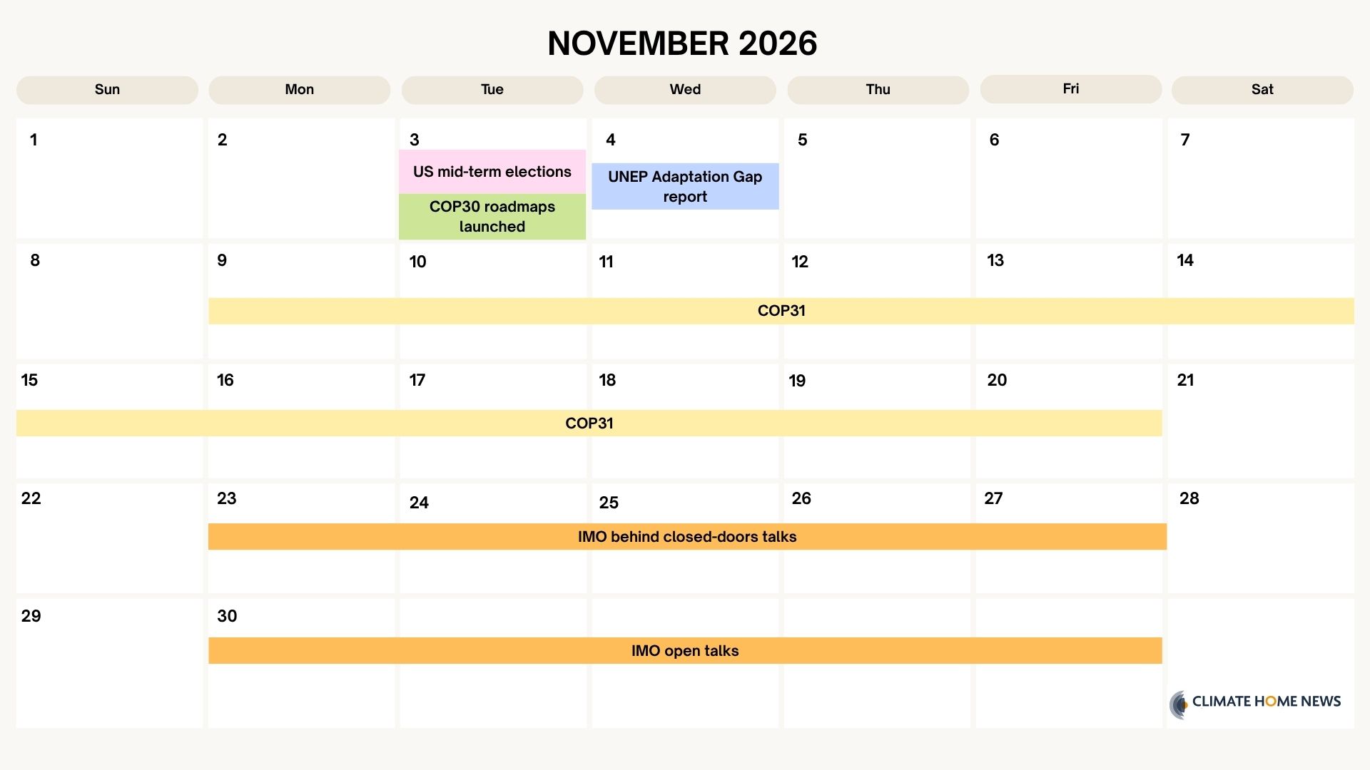
US midterm elections
Tuesday 3 November – United States
The geopolitical highlight for the first week of November is the US midterm elections, which will show whether American voters are in any mood to forgive President Donald Trump for failing to bring down the cost of living. From an energy perspective, his pro-oil and gas stance hasn’t led to cheaper prices for consumers, pushed up by the US-instigated Iran conflict. And his diesel deal with Russia won’t yet have made a difference at the pump.
The key issue for climate and energy policy is whether the Republicans hold onto their governing trifecta. If so, then expect continued dismantling of regulations that protect the environment, as well as strong backing for fossil fuel production. If the Democrats regain control of Congress, which polls suggest is possible, it could trigger a push to restore Biden-era clean energy tax credits, and support states wanting to restart mothballed wind and solar projects.
Data centres have been a hot-wire issue, with growing community opposition to their expansion – partly due to concerns over rising utility bills as the facilities gobble power. Whether Republicans or Democrats win Congress, both are likely to make tech firms pay for the extra electricity production they need, with the latter favouring renewable sources.
Governor races are also taking place in key states for climate issues, including Democrat-run California, which has used the courts to fight Trump’s attacks on clean energy.
Read more: National climate plans now promise half the emission cuts expected by UN
Read more: The more Europe relies on the US for energy, the more it’s vulnerable to pressure by Trump

COP30 Deforestation and Fossil Fuel Transition Roadmaps
Tuesday 3 November – Brazil
Brazil is set to unveil two global roadmaps: one for transitioning away from fossil fuels, the other for ending deforestation.
The COP30 presidency promised them in the dying hours of the Belém summit last November as a last-minute fix to break a political impasse. Since then, it has been consulting with countries, experts and campaigners around the world to gather ideas and sketch out the elements to include in these blueprints.
Don’t expect the roadmaps to offer any new global targets or give direct instructions on what countries must do, either to cut fossil fuel production and consumption or better protect forests. Rather, Brazil has said the documents will identify barriers and priority actions, highlight existing mechanisms and present a range of options that can be adapted to different national contexts.
It remains unclear what will happen with the reports once they are delivered on Tuesday. At the Bonn talks last June, a group of European and small island nations called for the roadmaps to be brought into the official negotiations, warning that a one-off report won’t cut it. But such efforts would undoubtedly face stiff opposition from fossil fuel-producing nations that objected to drafting the energy transition roadmap within the formal UN process last year.
Read more: European, island states seek clear future for global roadmap to cut fossil fuels
Read more: COP30 roadmap to end deforestation will invite countries to draft domestic plans
Read more: What we need to see in the roadmap to transition away from fossil fuels
UNEP Adaptation Gap Report
Wednesday 4 November – Nairobi, Kenya
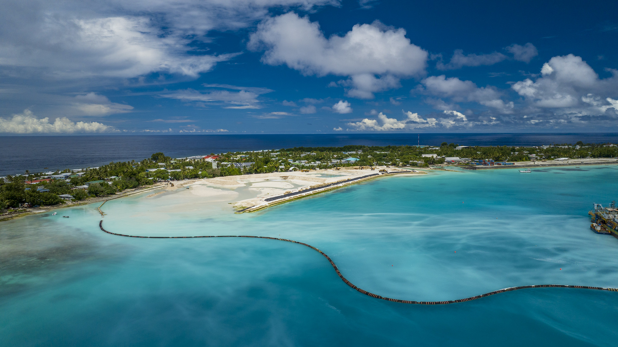
The UN Environment Programme (UNEP) will publish its annual assessment of how well the world is planning, implementing and – crucially – financing measures to cope with worsening climate impacts.
Past editions have made for grim reading. Last year’s report warned of a widening gap between what developing countries need for adaptation and what they can access. It estimated they will need $310–365 billion a year by 2035, which is 12 to 14 times current international flows. The report also found that a goal of doubling international public adaptation finance by 2025 was likely to have been missed.
This year’s edition will be closely watched with adaptation expected to be a big-ticket item at COP31. Governments are likely to discuss the specifics of a commitment to triple adaptation finance for developing nations by 2035, agreed at COP30 last year – particularly what the baseline for that pledge is. Negotiators will be debating how to track progress against the 59 indicators of the Global Goal on Adaptation.
Read more: Editor’s Desk: Nepal’s disaster has laid bare the world’s adaptation accountability gap
Read more: Bonn climate talks end in “gridlock” on adaptation and emissions-cutting
Read more: New data shows rich nations likely missed 2025 goal to double adaptation finance
COP31 Climate Conference
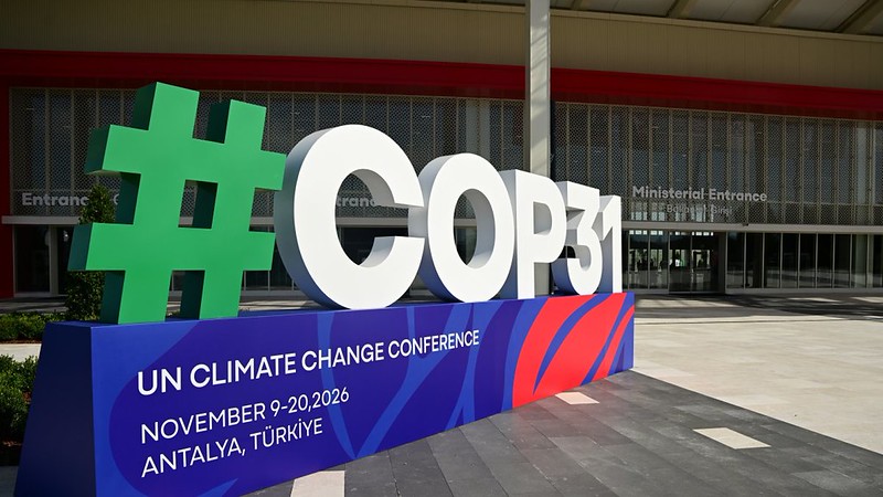
Monday 9 November – Friday 20 November – Antalya, Türkiye
The climate community’s attention turns this month to Antalya for the annual UN climate summit. From the outset, COP31 will have an unprecedented, and potentially explosive, set-up: Türkiye is COP president overseeing the non-negotiated Action Agenda, while Australia runs the negotiations.
Billed, once again, as an “implementation COP”, the talks come amid a global energy crisis largely sparked by the actions of the US government, which is not expected to show up on the Turkish Riviera. It is also the first COP in the era of climate overshoot, coming just weeks after the UN officially confirmed the 1.5C warming limit will be breached and set out a narrow pathway to bring temperatures back down to the most ambitious Paris goal.
Unlike most recent COPs, the formal negotiations lack a clear headline item. Countries are due to establish and define the scope of the Just Transition Mechanism agreed in Belém last year, including its rules, governance and possible funding arrangements. On adaptation, vulnerable countries want a clearer path to delivering last year’s pledge to triple finance by 2035 and to putting the new progress indicators to work on the ground.
Governments are also likely to clash over next steps on the transition away from fossil fuels, and especially over whether the mitigation work programme – the forum dedicated to emission-cutting measures – has any future beyond this year.
Notable events to look out for in Antalya:
Opening session (9 November): The summit kicks off with the customary first-morning plenary. After the usual pageantry from the host nation, negotiating blocs and individual countries will deliver statements setting out their stall for the next two weeks. Watch out for a potential fight over the summit’s agenda – perhaps on issues relating to finance and trade following submissions requesting additional items – also a COP tradition.
Electrification (10 November): On Energy Day, the Turkish presidency is expected to formally launch its flagship electrification pledge, revealing which countries have signed up. Signatories will voluntarily commit to raising electricity’s share of global final energy consumption to 35% by 2035, though the current text does not require that power to come from clean sources. There is also a question mark over whether and how this can be included in the political cover decision the COP co-hosts have said they will aim to produce.
Leaders Summit (11-12 November): Heads of state and governments will jet into town for the traditional high-level segment in the middle of the first week, where world leaders typically talk up their climate record, air their grievances and call for more action.
Relatively few powerful leaders are on the list this time. Brazil’s Lula is set for another star turn this year, fresh from his surprise election win in October. The UK’s Andy Burnham, Spain’s Pedro Sanchez and China’s vice-premier Ding Xuexiang are expected, alongside Türkiye’s Recep Tayyip Erdogan and Australia’s Anthony Albanese. In addition, African and small island nations will feature prominently.
Our COP31 Briefing newsletter will offer a more in-depth preview of the talks later this week.
Read more: Early speakers’ list suggests few powerful leaders will attend COP31
Read more: COP31 electrification pledge leaves out clean power commitment
Read more: From Belém to Antalya – gains, gaps and challenges for a new Just Transition Mechanism
International Maritime Organization (IMO) Shipping Talks
Monday 23 November – Friday 4 December – London, United Kingdom
One year on from explosive talks in which Trump’s officials teamed up with Saudi Arabia to delay a deal to make the shipping industry greener, governments will gather on the banks of the Thames for another attempt to reach agreement.
The Net Zero Framework, provisionally agreed in October 2025, includes a series of emissions reduction targets for the owners of large ships along with penalties for not meeting them, rewards for doing so and measures to make the maritime transition fair.
The framework is likely to be either tweaked or radically rewritten so that it’s more acceptable to the US and Saudis. Brazil and Japan have submitted compromise proposals. Analysts find those will move shipping further away from being able to meet its climate goals.
There will be closed-door talks between November 23-27 and a second week of talks open to accredited media from November 30 to December 4. Agreement on a proposal, perhaps decided through a vote, is expected after long and technical negotiations. The shipping industry’s 3% share of the world’s emissions is at stake.
Read more: London talks raise hopes for green shipping deal
The post What’s on the climate calendar for November 2026? appeared first on Climate Home News.