


Disclaimer: Disseminated for GoldMining Inc.
From the latest press release, we discovered that GoldMining Inc. (GLDG: NYSE) has unveiled promising preliminary results from reprocessing, inversion, and modeling of historic geophysical surveys on its Rea uranium project in the Western Athabasca Basin, Alberta, Canada. The Rea Project, with GoldMining holding a 75% stake and Orano Canada holding the remaining 25%, spans approximately 125,328 hectares around Orano’s high-grade Dragon Lake prospect.
Furthermore, located 60 km southeast of the Rea Project are world-class uranium deposits, including Fission Uranium Corp.’s Triple R deposit and NexGen Energy Inc.’s Arrow deposit. Both these projects are currently in development phase.
Navigating the Athabasca Basin’s Strategic Frontiers
GoldMining’s CEO Alastair Still has expressed his excitement about the Rea project in the following statement:
“We are extremely encouraged by the targets we have generated within the Athabasca Basin, an area that contains some of the world’s largest and highest-grade uranium deposits. This work enhances our activities that have and continue to focus on unlocking value within our portfolio of gold and gold-copper projects located throughout the Americas.”
He further emphasized the impressive, cost-effective work by GoldMining’s technical team, underscoring their strategic approach to significantly enhance shareholder value.
The team also utilized modern reprocessing techniques and inversion modeling of historic geophysical surveys to identify over 70 km of prospective areas for follow-up exploration. These areas, spanning three distinct corridors, exhibit geophysical signatures similar to known Athabasca Basin uranium deposits.
Rea Project: Unlocking Promising Uranium Potential
1. Strategic Location
The Rea Project comprises 16 contiguous exploration permits covering about 125,328 hectares around Orano’s Maybelle River project, featuring the shallow Dragon Lake prospect. Located roughly 175 km north-northwest of Fort McMurray, Alberta, the project is accessible via winter roads and air charter.

2. Geophysical Insights
Reprocessing, inversion modeling, and reinterpretation of historic surveys have mapped over 70 linear kilometers of basement conductive trends. They are interpreted as graphite-bearing shear zones, indicative of potential unconformity-style uranium mineralization.
3. Three Prospective Corridors
Maybelle River Corridor (11 km): Extending northward from Orano’s Maybelle River Project, where shallow, high-grade uranium mineralization is hosted at the Dragon Lake prospect. Dragon Lake, discovered in 1988, has previously reported historic high-grade drill intersections including 17.7% U3O8 over 5 m in MR-39 and 4.7% U3O8 over 1.7 m in MR-34.
-
- Five historic drill holes on the Company’s Rea Project claims tested a portion of the Maybelle River Corridor, intersecting anomalous uranium values in two holes and anomalous pathfinder elements and minerals—including clay alteration and dravite, a distinctive accessory mineral linked to many significant Athabasca uranium occurrences—in three holes.
Net Lake Corridor (20 km): 20 widely spaced drill holes have tested the area, with five intersecting anomalous uranium and associated pathfinder elements such as vanadium, nickel, cobalt, and arsenic, as well as pathfinder minerals like clay alteration and dravite
Keane Lake Corridor (40 km): The area remains largely unexplored, except for two historic drill holes that intersected anomalous uranium values in the south-central area of the Project.
Significant Geological Findings and Future Exploration
Each of the three prospective corridors is interpreted as a potentially significant and deeply rooted basement structure, fundamental to the formation of Athabasca uranium deposits. Drill-proven fault and shear zones have been intersected on both the Maybelle River and Net Lake corridors. Follow-up exploration programs will include additional geophysical surveys to refine targets before drilling.
Exploration Focus: Uranium Deposits in the Athabasca Basin
Geological Context and Deposit Characteristics
In the Athabasca Basin, conductive graphite-bearing shear zones in basement rocks beneath sedimentary layers are intricately associated with unconformity-related uranium deposits. These shear zones, identifiable through electrical geophysical methods, typically underlie extensive hydrothermally altered zones within the overlying sandstone.
Uranium mineralization often occurs near the unconformity within sandstone. Notable deposits, such as Fission’s Triple R and NexGen’s Arrow, specifically occur within graphitic shear zones in the basement rocks.
Geophysical Survey and Interpretation
GoldMining Inc. recently enlisted Fathom Geophysics LLC to process, invert, and model historical airborne and ground geophysical surveys within the Rea Project area. These surveys, conducted between 2005 and 2009, include Versatile Time Domain Electromagnetics (EM), magnetic surveys, Induced Polarization (IP) surveys, and Full Tensor Gradiometry data. These surveys’ resulting structural and lithological interpretation aligns closely with the modeled geophysical data and the regional tectonic framework.

GoldMining Inc. is a public mineral exploration company focused on gold assets in the Americas. It controls a diversified portfolio of resource-stage gold and gold-copper projects across Canada, the U.S., Brazil, Colombia, and Peru.
The company also holds significant shares in Gold Royalty Corp., U.S. GoldMining Inc., and NevGold Corp. Moving forward, the company remains committed to further exploration and development to unlock substantial value within its diversified portfolio of mineral assets across the Americas.
The post Orano’s Unlikely Uranium Partner GoldMining (GLDG) Makes Big Strides at Rea appeared first on Carbon Credits.

Carbon credit providers vs marketplaces is the first comparison many buyers try to make. In this comparison, a carbon credit provider is the project developer: the company that originates credits from its own projects and sells them directly. A carbon credit marketplace is a platform that lists credits from many projects at published prices.

Carbon Footprint
Democrats who call climate change an emergency should not defend a permitting system too slow to build the clean energy that would address it.”
Democrats, Take The Deal. New York Times editorial, Nov. 12.
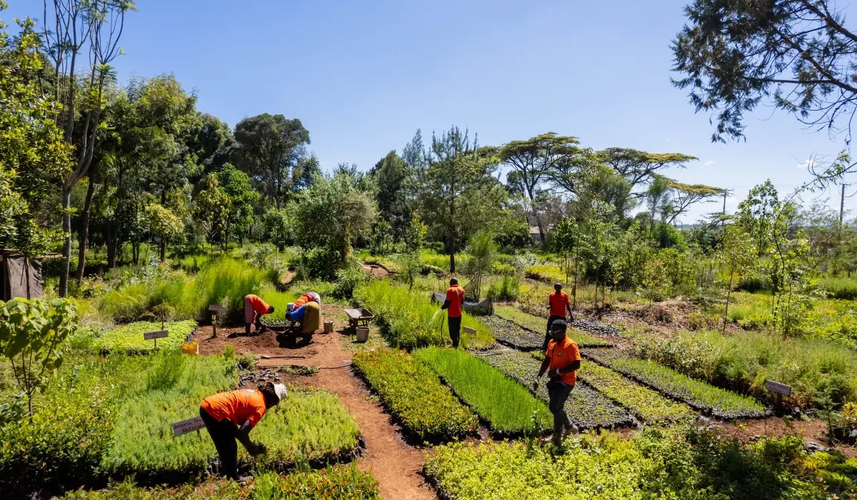
Insetting program design starts with your supplier map. The carbon claim comes much later.
Consider a coffee procurement team that funds a farm intervention before checking its sourcing data. The supplier aggregates coffee lots from several regions. The buyer lacks farm-level traceability. Another purchaser expects to report the same outcome. A more attractive project brochure solves none of these problems.
If the distinction between a value-chain intervention and a purchased credit is still open, read CCC’s Insetting vs Offsetting guide before you set the brief.
Insetting program design begins with the purchasing relationship and works outward. You need to decide 1) where an intervention belongs, 2) what business problem it addresses, 3) who pays for it, 4) how results will be measured, and 5) what the evidence will let you say about them. This five-step playbook turns that sequence into a procurement plan.
Step 1: Insetting program design starts with supplier mapping
Start with the commodities that matter most to your Scope 3 inventory and sourcing continuity. Ask finance for spend by supplier, sustainability for the emissions baseline, and category managers for origin and volume records. Then identify which suppliers can trace material to a jurisdiction, sourcing region, producer group, or individual land-management unit.
The level of traceability affects what you can account for. Under the GHG Protocol Land Sector and Removals Standard, the spatial boundary for purchased land-based products depends on the traceability associated with each volume. Farm-specific factors or removals require physical traceability through an acceptable chain-of-custody model. A contract with a tier-one trader, by itself, does not establish a link to the farms behind its deliveries.[1]
Build a first-pass table with five columns: commodity and annual volume; supplier and origin; current traceability level; land-use and production risks; and the business owner who can change the purchasing terms. Mark missing data plainly. A blank cell is cheaper to fix before a program starts than after a claim is drafted.
If your company sets an SBTi Forest, Land and Agriculture target (FLAG), keep its land-related target boundary separate from energy and industry emissions. The current FLAG guidance also requires relevant companies to assess primary deforestation-linked commodities in their value chains.[2]
Step 2: Choose a commodity and jurisdiction for a pilot
Select one supply corridor where the sourcing connection can be established and procurement has a reason to stay. A useful pilot has repeat purchases, suppliers willing to share records, an intervention matched to a diagnosed problem, and a defined plan to measure the result. Carbon potential alone is a poor selection rule if the supplier cannot deliver the crop your business needs.
Compare candidate regions on land-use risk, supplier concentration, local rights and tenure, the availability of baseline data, and exposure to drought, erosion, or forest conversion. Check the relevant legal requirements separately. A nature project does not satisfy a due-diligence obligation merely because it has a carbon method attached.
Consider a coffee buyer sourcing from two districts. In the first, producer-group records identify the farms, while recent dry seasons have increased rejected green coffee lots. In the second, deliveries pass through several intermediaries and farm origins are unknown. Pilot shade management in the first district, with local agronomic advice and quality checks built into the plan. The buyer can trace purchases there and test the intervention against a defined sourcing problem.
Use a short decision memo to record why the selected corridor beats the alternatives, what remains uncertain, and what would stop the pilot. That memo is the first control against a project drifting toward whatever happens to photograph well.
Step 3: Design the supplier engagement and commercial model
The intervention needs an owner on each side of the contract. Decide who supplies planting material or training, who maintains the practice, who bears the cost if a harvest disappoints, and how long the buyer expects to purchase from participating suppliers. Where smallholders participate, budget cash flow and technical support for practices that offer a later return.
Put these terms in a supplier agreement or pilot addendum. It should cover eligible farms and volumes, consent to data collection, access for monitoring, any land or carbon rights that matter, benefit sharing, and what happens if the purchasing relationship ends. Ask local counsel and producer representatives to review the arrangement. The Accountability Framework is a useful reference for supply-chain work involving forests, ecosystems, and human rights.[3]
Avoid assigning an automatic carbon benefit to the buyer. The contract should say which party has the right to report each outcome, how overlapping claims will be checked, and how any issued credits will be handled. A reduction reported in a buyer’s inventory cannot simply be sold for someone else’s offset claim without an accounting review. SBTi FLAG guidance excludes purchased credits used as offsets from near-term FLAG target achievement.[2]
Set commercial measures beside environmental ones: delivered volume, rejection rate, supplier retention, and procurement cost. They tell you whether the program works as a supply-chain investment, even if carbon accounting takes longer to resolve.
Step 4: Build monitoring, reporting, and verification before rollout
Agree on the baseline and data flow before paying for a full rollout. Identify the land units or sourcing regions in scope, the practices that change, the records suppliers already keep, and the additional measurements the program requires. Decide which data can come from field visits, transaction records, or remote sensing, and who checks each source.
For carbon, separate three questions. Did the practice happen? Did emissions or removals change under an applicable method? Can the buyer attribute a defensible share to its purchased goods without double counting? The GHG Protocol’s 2026 guidance includes dedicated chapters on spatial boundaries, data and methods, evaluating actions, credited outcomes, and assurance.[1] These are distinct jobs. A photograph of a planted tree answers only part of the first.
CCC’s MRV and Additionality article explains the separate evidence questions a project reviewer will ask.
Create an evidence file for every reporting period: dated supplier and farm records, purchase volumes, methods and emission factors, uncertainty, quality checks, and changes from the baseline. Specify who can challenge the data and how corrections are recorded. If a project also seeks credit certification, keep project accounting and corporate inventory accounting separate. The GHG Protocol says its land standard focuses on entity-level inventories and does not set the rules for credit certification.[4]
Start with the minimum viable measurement design that can survive review. Add complexity when the pilot tells you which data actually changes a decision.
Step 5: Decide what can be reported and claimed
Insetting program design needs reporting rules before the marketing copy. Procurement, sustainability, finance, and legal should agree on four distinct outputs: operational performance; observed land or nature outcomes; inventory effects, if the accounting criteria are met; and any separately issued credits. One dashboard can display them, but they should not share a single unqualified headline.
SBTi FLAG guidance allows certain land-based removals within a company’s operations or supply chain to contribute to FLAG pathways, subject to criteria including permanence, traceability, data quality, and allocation. It does not allow purchased offsets to meet near-term FLAG targets.[2] Eligibility therefore depends on evidence and the applicable target rules, not on calling an activity “insetting.”
Draft a claims register. For each proposed sentence, record the period, boundary, data owner, calculation method, reviewer, and whether the result is measured, estimated, or still a goal. If the evidence supports only “we funded a pilot with 200 farms,” say that. Do not turn a funding fact into a verified emissions reduction.
What good looks like by year three
Treat year three as a review point, not a promised payback date. A mature pilot should have mapped participating supply volumes, a stable supplier agreement, a repeatable data collection process, and a comparison of commercial and environmental results against the baseline. It should also have a documented answer for outcomes that cannot be included in the buyer’s inventory.
Scale only where the pilot improves a sourcing decision and the evidence can follow the product. If neither condition holds, redesign the intervention or change the corridor. A disciplined program can conclude that a site is unsuitable. That is useful procurement intelligence.
Discuss your insetting program with CCC
Carbon Credit Capital designs nature-based supply chain investments around sourcing needs and measurable sustainability outcomes. Schedule a consultation with our carbon and sustainability experts to map your tier-one supplier network, FLAG exposure, and first pilot decision.
Sources
[1] GHG Protocol, Land Sector and Removals Standard, version 1.1, and companion Guidance, June 2026: https://ghgprotocol.org/land-sector-and-removals-standard ; https://ghgprotocol.org/land-sector-and-removals-guidance
[2] Science Based Targets initiative, Forest, Land and Agriculture Science-Based Target-Setting Guidance, version 1.2, March 2026, especially pp. 16–17, 37, and 41: https://sciencebasedtargets.org/resources/files/SBTiFLAGGuidance.pdf
[3] Accountability Framework initiative, Accountability Framework and guidance for companies: https://accountability-framework.org/
[4] GHG Protocol, Frequently Asked Questions: Land Sector and Removals Standard, questions 10 and 18: https://ghgprotocol.org/blog/frequently-asked-questions-land-sector-and-removals-lsr-standard

COP31 Bulletin Day 13: New draft retains electrification goal but delays adaptation finance and science decisions

How “Marie Antoinnete” Can We Get?

COP31 Bulletin Day 12: ‘Don’t ignore us,’ Panama warns as COP31 runs into overtime

-
Climate Change1 year ago
Guest post: Why China is still building new coal – and when it might stop
-
Greenhouse Gases1 year ago
Guest post: Why China is still building new coal – and when it might stop
-

 Renewable Energy1 year ago
Sending Progressive Philanthropist George Soros to Prison?
-
Greenhouse Gases1 year ago
嘉宾来稿:探究火山喷发如何影响气候预测
-

 Climate Change2 years ago
Analysis: China’s CO2 falls 1% in Q2 2024 in first quarterly drop since Covid-19
-

 Climate Change1 year ago
嘉宾来稿:探究火山喷发如何影响气候预测
-

 Renewable Energy5 months ago
Send a Bible to a Starving Child
-

 Green Living2 years ago
Our Picks for the Top 2024 Black Friday and Cyber Week Sales From Sustainable Brands