

An Bord der Merian untersuchen wir das gesamte Nahrungsnetz vor Madeira. Dazu gehören alle Wassertiefen und damit auch alle Lebensräume des Ozeans. Die verschiedenen Trophieebenen reichen von winzigen Algen, dem so genannten Phytoplankton, bis zu den großen Raubfischen, die sich vor kaum jemandem in Acht nehmen müssen. Die Vielfalt der Fische im Ostatlantik ist riesig, und das gilt auch für die Methoden diese zu beproben.
Mit Planktonnetzen, wie zum Beispiel dem Multi-Schließnetz, können wir Organismen fangen, die zu groß sind, um durch eine Maschenweite von 335 µm zu schlüpfen. Mit diesem Netz ist es möglich, eine bestimmte Wasserschicht zu beproben und so ein tiefenaufgelöstes Bild der Zooplanktonzusammensetzung zu bekommen. Fischlarven können mit Netzen dieser Art sehr gut gefangen und schonend an die Oberfläche gebracht werden.
Tiefseefische, wie zum Beispiel Laternenfische, Drachenfische oder die berühmten Tiefsee-Anglerfische (s. Bild oben) fangen wir mit einem größeren Netz, welches pelagisch in einer Tiefe von bis zu 1000 m geschleppt wird. Dieses Netz hat eine deutlich größere Netzöffnung, mit der wir ein Vielfaches an Wasser filtern können als mit den Planktonnetzen, allerdings auch eine größere Maschenweite (4 mm). Wenn ein solches Netz an Deck kommt, ist es immer spannend zu sehen welche seltsam anmutenden Fische, Garnelen oder Quallen sich im Steert gesammelt haben. Nicht selten stoßen wir dabei auf Individuen, die wir vorher noch nicht beobachten konnten. Bizarre Schnepfenaale oder seltsam geformte Beilfische sind nur ein paar Beispiele in dieser großen Diversität.

Die letzte Möglichkeit, Fische zu beproben, ist das Angeln. Das ist mal mehr, mal weniger erfolgreich, macht aber allen viel Spaß und ist eine gute Möglichkeit, Fische zu fangen, die wir mit unseren Forschungsnetzen nicht beproben können. Barrakudas oder Stachelmakrelen zum Beispiel stellen eine der höchsten Trophieebenen in dieser Region dar. Daher ist es besonders wichtig, solche Fische in unsere Proben einzubeziehen, um ein möglichst vollständiges Bild des Nahrungsnetzes zu erhalten.
Alle diese Fische werden auf zwei verschiedene Arten beprobt. Zum einen nehmen wir eine genetische Probe in Form eines kleinen Stücks Schwanzflosse, das in Ethanol konserviert wird. Zum anderen entnehmen wir den Organismen ein Stück Muskelfleisch für eine Isotopenprobe. Anhand dieser Probe kann später im Labor die genaue Konzentration bestimmter Kohlenstoff-, Stickstoff- und Schwefelisotope bestimmt werden. Anhand der Konzentrationen und der Verhältnisse dieser Isotope zueinander kann dann die Stellung des beprobten Organismus im Nahrungsnetz bestimmt werden.

Wir versuchen also, durch eine möglichst vielfältige Probenahme ein Bild des Nahrungsnetzes in den Gewässern um Madeira zu bekommen und damit das Ökosystem besser zu verstehen. Daher ist jeder Netz-Hol, der an Bord kommt, spannend und wichtig, um das Bild zu vervollständigen. Wir freuen uns auf die Netz-Hols der letzten Tage an Bord, um unsere Daten zu vervollständigen.
Grüße von der Maria S. Merian,
Anton Höper


If you’ve ever joined a beach cleanup, you’ve almost certainly picked up a plastic bottle. During Ocean Conservancy’s 2025 International Coastal Cleanup® (ICC), plastic beverage bottles were the top item collected by volunteers around the world. Plastic bottles have been among the top 10 items collected throughout the ICC’s entire 41-year history.
But where do those bottles really come from? We know rivers carry plastics of all shapes and sizes from inland communities to coasts and the ocean. What we know far less about is what makes plastic bottles move within rivers, what speeds them up or slows them down and how likely they are to reach the coast and become ocean pollution. Research on river plastics is growing worldwide, but studies in North America lag behind other regions.
Ocean Conservancy scientists, alongside a team of collaborators from 10 research institutions around the United States and Canada, set out to help close some of these pressing knowledge gaps.
How do you track a plastic bottle?
… with a little help from GPS! We modeled our research after a 2021 project in the Toronto Harbor conducted by our University of Toronto colleagues. Like the Toronto project, our research team outfitted floating plastic bottles with GPS tags that reported each bottle’s location at regular intervals. That let us calculate how far and how fast every bottle traveled. Over a two-year period, we released about 300 GPS-tagged bottles into 30 stretches of river in Los Angeles, California; California’s San Francisco Bay Area; Chicago, Illinois; Washington, D.C.; Miami, Florida; Boston, Massachusetts; and Toronto, Canada.
We chose each of these places on purpose.
The locations were selected to represent varied watershed types (ranging from temperate to subtropical climates and mountainous to flat terrain) and development intensity (suburban to densely urban). We followed the bottles for about three months each, through changing seasons, storms and rainfall before locating and retrieving them. And while the plan was always to recover the bottles at the end of the experiment, we also conducted cleanups in each watershed beforehand to make sure we were leaving things a little cleaner than we started.
What did we find?
Our bottles went on quite a journey! On average, each bottle traveled 3.8 miles, but distance traveled actually spanned a huge range depending on the bottle and location. For example, one of our bottles barely budged, moving just 240 feet over the deployment period. Another made it further than the length of a marathon, clocking in at 33 miles traveled.
We found river flow was a major driver of how far bottles went, but it wasn’t the only factor—the landscape around each river mattered too. Patterns in bottle movement revealed:
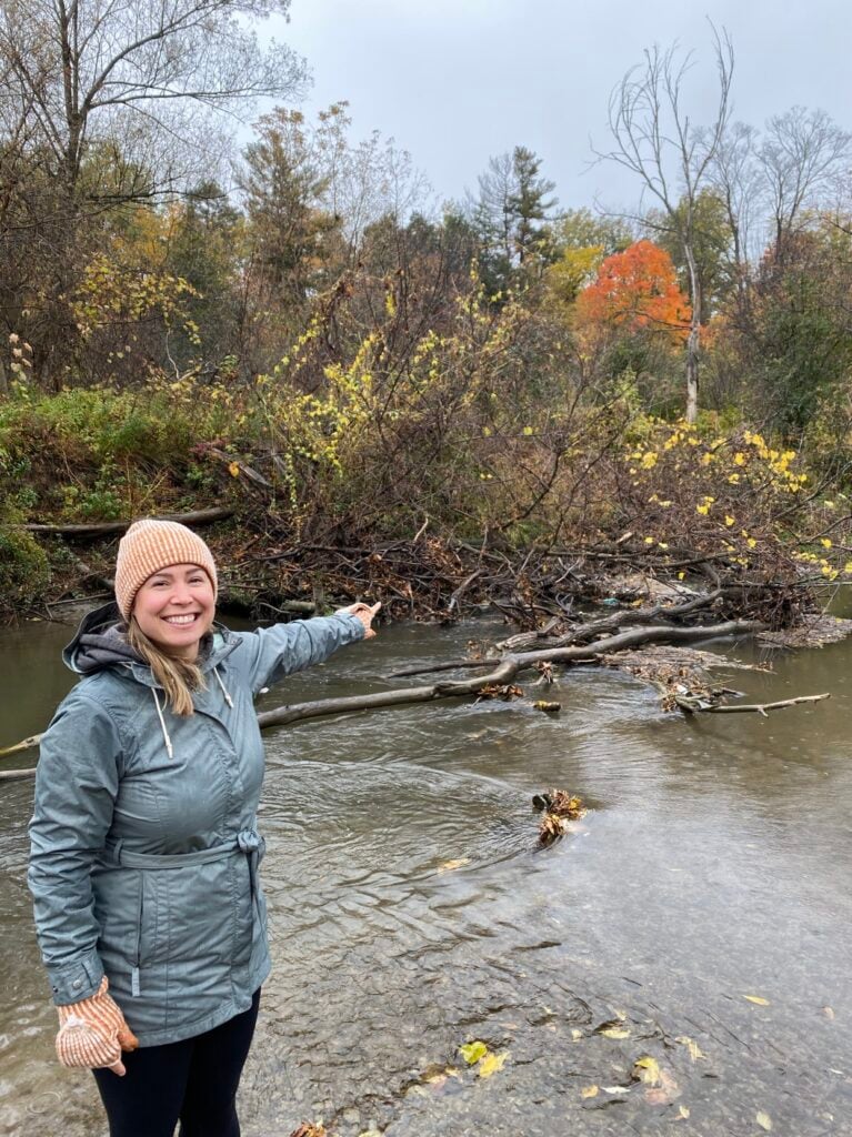
- Forest and vegetation in rivers slowed bottles down. The more forest cover upstream, the less likely a bottle was to reach the coast, because it got snagged in brush, branches and other natural obstructions.
- More urbanized stretches sped them up. Bottles moved farther and faster in more urbanized stretches of river, where there was typically less vegetation to catch them.
Using thousands of GPS points, as well as data about the river systems and watersheds we studied, we built a model to estimate where bottles reaching the coast or the Great Lakes may be coming from. It showed that within a one-year period, about half originate quite close to shore (within seven miles). The other half come from much farther inland, up to 120 miles away!
Why does this matter for our ocean?
Plastic bottles aren’t just unsightly. Ocean Conservancy’s recent, award-winning research found they can be deadly to marine life—either as whole items or after they break up into sharp fragments. There have been documented instances of seabirds like albatross dying after swallowing a plastic bottle whole.
Plastic bottles are among the most prolific plastic pollutants we see out there, and now we understand that many of those we find on beaches or in the ocean may be coming from far upstream.
That has big implications for how we tackle the problem. If half of the bottles reaching the ocean around North America or Great Lakes can start their trip more than 100 miles inland, prevention must happen upstream. Pollution-prevention models, like laws that incentivize the collection and recycling of plastic bottles before they end up in the environment, should be implemented more broadly to prevent plastic from becoming pollution in the first place. Cleanups and other efforts in coastal communities also remain critical. If we want to capture floating plastics like bottles before they reach the coast and eventually our ocean, communities within 120 miles from the ocean or Great Lakes should plan to do those cleanups on an annual basis, or even more frequently.
How can I help keep plastic bottles out of rivers and the ocean?
No matter where you live, the choices you make can help keep plastic out of the ocean:
- Support policies, like those Ocean Conservancy advocates, to stop plastic pollution at the source.
- Join a cleanup along your local river, creek or lakeshore. Every bottle picked up inland is one less that can wash out to sea.
- Choose reusables instead of single-use plastic bottles whenever you can.
We want to extend a huge thank-you to our amazing collaborators on this project at the University of New Hampshire, University of Toronto, Loyola University of Chicago, Smithsonian Environmental Research Center, Florida International University, Moore Institute for Plastic Pollution Research, San Francisco Estuary Institute, University of Waterloo, University of Southern California and University of New Mexico.
Our study, “GPS-Tracked Bottles in North American Rivers Show Marine Plastic Pollution Can Originate from Far Upstream,” was published in the November 13 issue of the scientific journal Environmental Science & Technology-Water. Read the full paper here.
This blog was co-written with Hannah De Frond. Hannah works with Ocean Conservancy and the University of Toronto Trash Team to manage the International Trash Trap Network (ITTN), a global network of local groups using trash traps to increase cleanup efforts, engage communities and inform upstream solutions.
Get Ocean Updates in Your Inbox
Sign up with your email and never miss an update.
The post How Far Does a Plastic Bottle Really Travel in a Year? appeared first on Ocean Conservancy.
If you’ve ever joined a beach cleanup, you’ve almost certainly picked up a plastic bottle. During Ocean Conservancy’s 2025 International Coastal Cleanup® (ICC), plastic beverage bottles were the top item collected by volunteers around the world. Plastic bottles have been among the top 10 items collected throughout the ICC’s entire 41-year history.
But where do those bottles really come from? We know rivers carry plastics of all shapes and sizes from inland communities to coasts and the ocean. What we know far less about is what makes plastic bottles move within rivers, what speeds them up or slows them down and how likely they are to reach the coast and become ocean pollution. Research on river plastics is growing worldwide, but studies in North America lag behind other regions.
Ocean Conservancy scientists, alongside a team of collaborators from 10 research institutions around the United States and Canada, set out to help close some of these pressing knowledge gaps.
How do you track a plastic bottle?
… with a little help from GPS! We modeled our research after a 2021 project in the Toronto Harbor conducted by our University of Toronto colleagues. Like the Toronto project, our research team outfitted floating plastic bottles with GPS tags that reported each bottle’s location at regular intervals. That let us calculate how far and how fast every bottle traveled. Over a two-year period, we released about 300 GPS-tagged bottles into 30 stretches of river in Los Angeles, California; California’s San Francisco Bay Area; Chicago, Illinois; Washington, D.C.; Miami, Florida; Boston, Massachusetts; and Toronto, Canada.
We chose each of these places on purpose.
The locations were selected to represent varied watershed types (ranging from temperate to subtropical climates and mountainous to flat terrain) and development intensity (suburban to densely urban). We followed the bottles for about three months each, through changing seasons, storms and rainfall before locating and retrieving them. And while the plan was always to recover the bottles at the end of the experiment, we also conducted cleanups in each watershed beforehand to make sure we were leaving things a little cleaner than we started.
What did we find?
Our bottles went on quite a journey! On average, each bottle traveled 3.8 miles, but distance traveled actually spanned a huge range depending on the bottle and location. For example, one of our bottles barely budged, moving just 240 feet over the deployment period. Another made it further than the length of a marathon, clocking in at 33 miles traveled.
We found river flow was a major driver of how far bottles went, but it wasn’t the only factor—the landscape around each river mattered too. Patterns in bottle movement revealed:
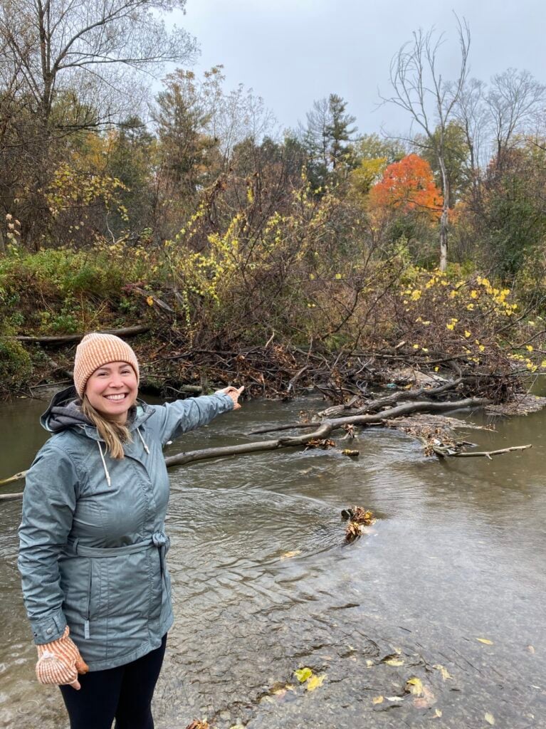
- Forest and vegetation in rivers slowed bottles down. The more forest cover upstream, the less likely a bottle was to reach the coast, because it got snagged in brush, branches and other natural obstructions.
- More urbanized stretches sped them up. Bottles moved farther and faster in more urbanized stretches of river, where there was typically less vegetation to catch them.
Using thousands of GPS points, as well as data about the river systems and watersheds we studied, we built a model to estimate where bottles reaching the coast or the Great Lakes may be coming from. It showed that within a one-year period, about half originate quite close to shore (within seven miles). The other half come from much farther inland, up to 120 miles away!
Why does this matter for our ocean?
Plastic bottles aren’t just unsightly. <