Climate Change
Marine Parks Explained
Australia’s network of marine parks is the largest in the world, covering more than half (52%) of Australia’s Commonwealth waters. You could be forgiven for assuming that a marine park is much like a national park on land: a highly protected place where people can enjoy nature while conservation efforts help habitats recover and wildlife thrive. You wouldn’t expect someone to bulldoze a national park, so why should they be allowed to bottom trawl in a marine park?
The reality is that not all marine parks are equally protected. Australia’s Marine Parks Network is divided into different zoning categories, with each zone determining which activities are permitted and the level of protection provided.
More than half of the Commonwealth Marine Parks Network allows industrial activities like oil and gas mining, and industrial fishing.
Our survival, and the survival of our planet, depends on the ocean. The ocean produces more oxygen than all of our forests combined, sustains communities and regulates the earth’s temperature. It’s home to wondrous wildlife and important ecosystems like coral reefs and kelp forests.
We love our big blue backyard
Australia’s ocean is teeming with life that is found nowhere else on earth. Schools of colourful fish, vibrant coral reefs, endemic shark nurseries, pods of dolphins, families of whales, playful seal pups and threatened Jurassic-era turtles call Australian waters home.
Since time began, from the turquoise waves to the deep blue, the ocean has connected our shorelines and communities, fed us, guided us and grounded us. We are intrinsically connected to our big blue backyard – more than 85% of us live within 50km of the shoreline. For tens of thousands of years, people have lived in harmony with the ocean and the wildlife within it, caring for and being sustained by its rich waters. Australia’s waters are some of the most unique and abundant places on Earth but our Marine Parks Network is falling short to properly protect them.
Australia’s marine parks aren’t living up to their name

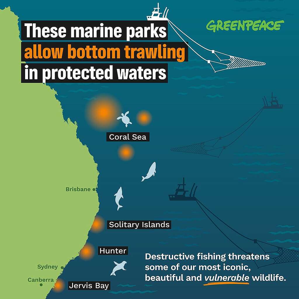
The Australian Commonwealth Marine Parks Network covers commonwealth waters 5.5km from the coast. The network is divided into 7 regional management areas, overall the network contains 60 marine parks. Zoning types determine what activities are allowed in each area. Over half of the network allows industrial activities, risking our most precious and threatened ocean wildlife.
Within many of our marine parks, destructive industries are allowed to fish, trawl, dig and mine using barbaric and cruel methods. Here are some of the zones explained:
- Bottom Trawling: Special Purpose (trawl) zones allow bottom trawling. This covers 10 marine parks totalling almost 13 million hectares. Bottom trawlers bulldoze the seafloor with weighted nets, deforesting our underwater forests; a cruel, indiscriminate and inefficient way to fish.
- Other Industrial Fishing: Includes “Habitat Protection Zones, ““Multi Use Zones” and “Special Purpose Zones.” Fishing methods vary from park to park but many marine parks in these zones allow industrial fishing like longlining. Longlining involves setting lines that can be 100km long, bristling with deadly hooks designed to catch a specific fish species. But longlining is not a selective method of fishing – significant numbers of sharks, rays, turtles, dolphins and seabirds can be harmed or killed as bycatch in the process.
- Oil and Gas Mining: Many “Special Purpose” and “Multi Use” zones allow seismic blasting and oil and gas mining. 30 marine parks or 65 million hectares of Australia’s highest conservation value areas for ocean wildlife are open for mining and exploration of oil and gas.
- Ocean Sanctuaries: National Park and Sanctuary zones are fully and highly protected marine parks designed to conserve wildlife and their habitat, where fishing, mining, and other industrial activities are not allowed.
Industrial fishing is one of the biggest threats to the ocean

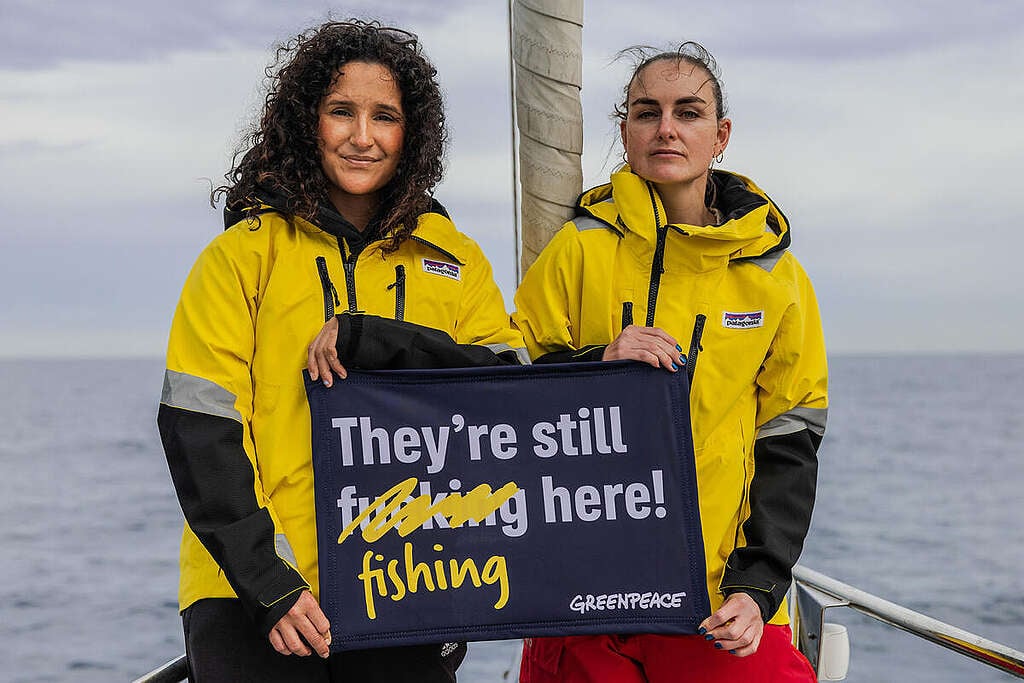
In May, Greenpeace Australia Pacific sailed our campaigning vessel Oceania through some of Australia’s most beautiful and threatened marine parks. Our crew visited Jervis and Hunter marine parks to document their beauty, showcase what’s at risk and aim to expose the industrial fishing activities in these protected waters. Both of these marine parks allow bottom trawling and longlining methods of industrial fishing.
Industrial fishing is ripping the ocean apart across the planet. Longlining, also known as longline fishing, is an industrial fishing method that involves the use of a fishing line with thousands of baited hooks. These fishing lines can stretch over 100 kilometers in length and are set to capture a fish species, often tuna or billfish species. But it is not a selective method of fishing and often results in significant bycatch. This includes a range of non-target species like sharks, rays, sea turtles, marine mammals, and seabirds which are often injured or killed as bycatch.
Bottom trawling involves dragging heavy weighted nets along the ocean floor. This fishing method is popular with commercial fishing companies, because it makes it easy to catch large quantities of fish in one go. But it also damages the seafloor, releasing carbon and can kill or injure non-target ocean life like coral, fur seals, dolphins and seabirds. You may have watched the reality of bottom trawling (and the benefits of ocean sanctuaries) in Ocean with David Attenborough, if not, add it to your watch list!
Fully protected ocean sanctuaries that ban industrial fishing and mining can protect ocean wildlife and underwater wonderlands for generations to come. Vast, robust sanctuaries create blue havens where ocean wildlife are safe from nets and hooks, and can truly rest, recover, thrive and replenish out into the surrounding waters. Ocean sanctuaries ensure a healthy ocean full of life.
A once-in-a-decade chance to fix what’s falling short
We have a unique opportunity to turn the tide.
The Australian Government is asking for your feedback on how our Commonwealth Marine Parks Network is managed. This is our once-in-a-decade chance to protect ocean wildlife, ban industrial fishing and create more ocean sanctuaries.
As part of the review the Government is asking for submissions from the public to hear from you on what improvements are needed to better protect our vast network of marine parks. Writing a submission is a powerful way to influence government decisions and create real change.
This is the moment to ban industrial activities like bottom trawling and oil and gas mining. But only if they hear from YOU. Add your name!
Greenpeace is calling on the Australian government to:
1. Ban industrial activities from Australia’s Marine Parks Network: Ban industrial activities, such as industrial fishing, seismic blasting and oil and gas mining, from Australia’s marine parks.
2. Create more ocean sanctuaries: Increase fully protected sanctuaries in Australia’s marine parks based on science principles.
3. Connect Australia’s Marine Parks Network to the High Seas: mCreate seascape connectivity by linking Australian marine parks to new high seas ocean sanctuaries.
References
Substantiation that more than half of the Marine Parks Network permits industrial activity comes from a peer-reviewed systematic literature review (Phillips et al. 2025, PLOS One, https://doi.org/10.1371/journal.pone.0307324). The study found that within the Commonwealth Marine Parks Network specifically, “all zones are considered partially protected areas, meaning areas where extractive activities are permitted, except ‘Pink zones’ (Preservation Zones; IUCN Ia) and ‘Green Zones’ (IUCN II).” In other words, every Commonwealth marine park zone type other than the network’s strict no-take sanctuary and national park zones (IUCN Ia and II) permits some form of extractive industrial activity. Since no-take zones are the minority zone type across the network by area, this supports the conclusion that the majority of the network’s area is zoned to permit industrial activity.
DCCEEW Australian Marine Parks spatial dataset (https://fed.dcceew.gov.au/datasets/erin::australian-marine-parks/explore), filtered by zone type. This confirms that 38.43% of the network’s area is zoned as Sanctuary or National Park zones (IUCN Ia and II). These are the no-take categories excluded from the peer-reviewed study’s definition of partially protected/industrial-permitting zones. The remaining 61.57% of the network falls within the zone categories the study classifies as permitting industrial activity (per The MPA Guide definition of “industrial” applied in Phillips et al. 2025), directly corroborating the peer-reviewed finding with current Commonwealth-specific spatial data.
For further information on activities permitted within the Marine Parks Network Zoning, you can refer to the Management Plans zoning and rules for each Marine Parks Network area, for example: Temperate East, Coral Sea, North.